This site uses affiliate links, meaning that if you make a purchase through our links, we may earn an affiliate commission.
Welcome to breathtaking national parks in California. In this guide, we will take you through 9 stunning national parks, sharing top experiences and essential tips to make your visit truly remarkable.
Whether you are a hiker, wildlife enthusiast, or simply seeking tranquility in nature’s embrace, these parks have something extraordinary to offer. From hidden gems to iconic landmarks, each park holds its own allure and surprises.
So, lace up your boots, grab your camera, and embark on a memorable exploration of California’s captivating national parks!
Yosemite National Park
Quick Facts About the Park
- Founded – Yosemite National Park was established on October 1, 1890, making it one of the oldest national parks in the United States.
- Annual Visitors – Yosemite attracted 3.7 million visitors in 2022, making it the 6th most visited park that year.
- Size – Encompassing an area of approximately 748,542 acres.
- Location – Yosemite National Park is located in the Sierra Nevada Mountains of California.
- Entrance Fee – The entrance fee for private vehicles entering Yosemite National Park was $35 per vehicle.
- Notable Facts – Yosemite is renowned for its awe-inspiring granite cliffs, particularly El Capitan and Half Dome. Additionally, it is home to the tallest waterfall in North America, Yosemite Falls, which plummets a staggering 2,425 feet from the top of the valley. Yosemite has the honor of being designated a UNESCO World Heritage Site.
3 Essential Tips for Unforgettable Visit to Yosemite
1. Best Ways to Get to Yosemite
- By Car: Yosemite National Park is accessible by car from various directions. The major highways that lead to the park include Highway 120 (Tioga Road). If you’re coming from the east (such as from Nevada), this route takes you through the breathtaking Tioga Pass. Highway 41, this route leads to the park’s South Entrance from Fresno. Highway 140, from the west (such as from Merced).
- By Air: For those traveling from distant locations, the closest major airports to Yosemite National Park are Fresno Yosemite International Airport (FAT) located about 2.5 hours south of Yosemite, and Mammoth Yosemite Airport (MMH) situated about 2.5 hours east of Yosemite.
2. Best Way to Navigate Inside the Park
- Yosemite Valley Shuttle: The Yosemite Valley Shuttle is a free and convenient transportation option within the park. Operating seasonally, this shuttle connects major destinations in Yosemite Valley, including popular viewpoints, trailheads, and visitor centers. Hop on and off at your leisure to explore iconic landmarks like Yosemite Falls, Bridalveil Falls, and El Capitan.
- Private Vehicle: If you prefer the freedom to explore Yosemite at your own pace, you can use your private vehicle to travel within the park. Be prepared for limited parking at popular destinations during peak seasons, and consider using the park’s shuttle services to reduce congestion.
3. Best Time to Explore the Park (Time Your Visit Right)
Yosemite National Park is a year-round destination, each season offering something special for visitors.
- Spring, from late April to early June, blankets the park in vibrant wildflowers and gushing waterfalls, creating a picturesque landscape. The moderate temperatures make it perfect for hiking and exploring the lush meadows.
- Summer, from June to August, is the peak season with longer days and a bustling atmosphere. This is the time for iconic hikes to Half Dome and Glacier Point but be prepared for larger crowds.
- Fall, from September to November, paints the park with warm hues as the leaves change, and the waterfalls slow down. It’s a great time for fewer crowds, pleasant weather, and stunning photography opportunities.
- Winter, from December to February, transforms Yosemite into a magical wonderland with snowy vistas and frozen waterfalls. While some areas may be inaccessible due to snow, it offers a serene and peaceful experience, perfect for cross-country skiing and snowshoeing.
Top 10 Experiences in Yosemite You Can't Miss
- Sunrise at Tunnel View – Catch the first rays of sunlight at Tunnel View, a famous vista point that frames El Capitan, Bridalveil Fall, and Half Dome in one breathtaking panorama.
- Yosemite Falls – Marvel at the tallest waterfall in North America, Yosemite Falls, as it cascades down the valley’s cliffs. Experience its grandeur from various viewpoints along the Yosemite Falls Trail.
- Mirror Lake – Take a leisurely walk to Mirror Lake, a seasonal pool nestled beneath the iconic Half Dome. During the spring, the lake reflects the surrounding scenery like a perfect mirror.
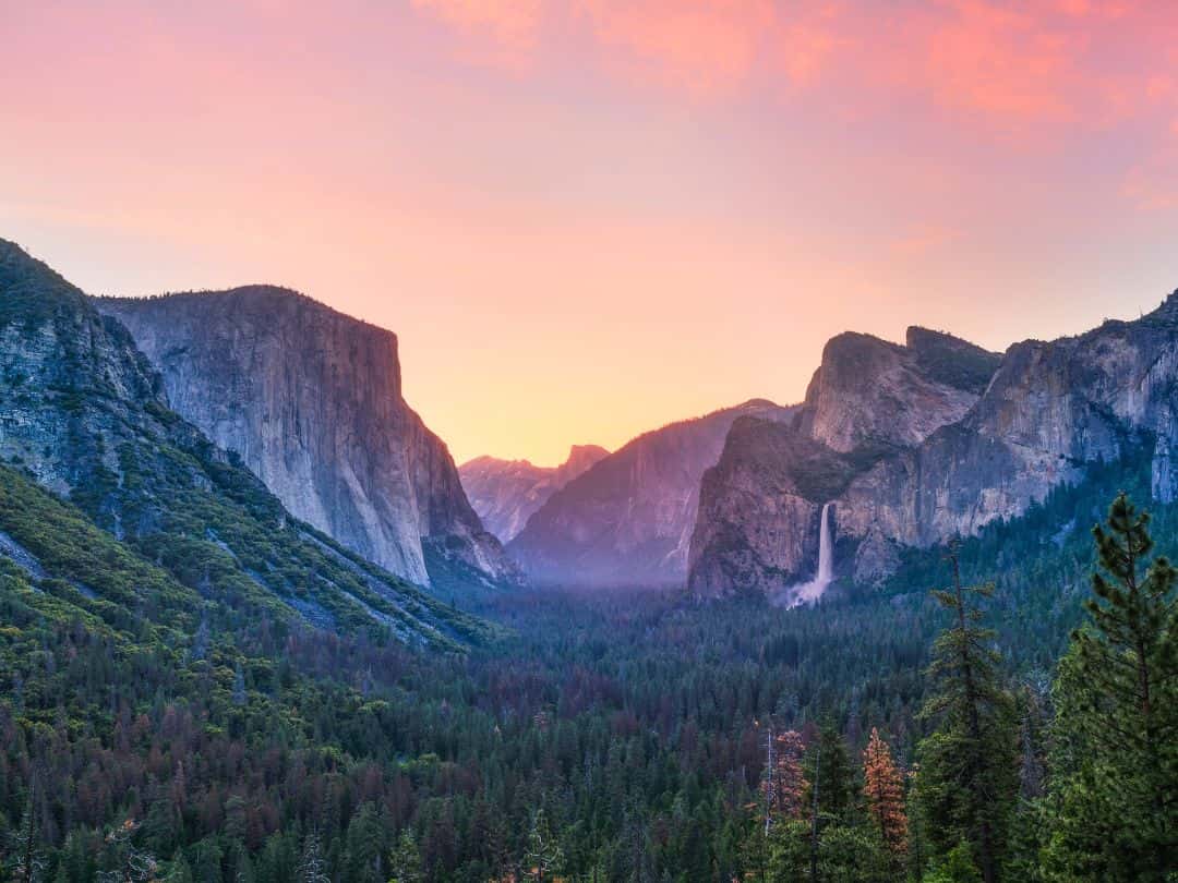
National Parks in California / Yosemite National Park (Tunnel View at Sunrise)
- Mist Trail – Embark on a memorable hike along the Mist Trail, which takes you up close to the thundering Vernal Fall and the misty spray of Nevada Fall. The trail offers a refreshing experience, especially during spring and early summer.
- Tuolumne Meadows – Discover the high-country beauty of Tuolumne Meadows, a vast expanse of sub-alpine meadows surrounded by granite domes and peaks. Enjoy hiking, picnicking, and soaking in the serene alpine environment.
- Yosemite Valley – Marvel at the captivating beauty of Yosemite Valley, home to iconic landmarks like El Capitan, Half Dome, and Bridalveil Fall. Wander along the meandering Merced River and witness the majestic waterfalls that cascade from the valley’s towering cliffs.
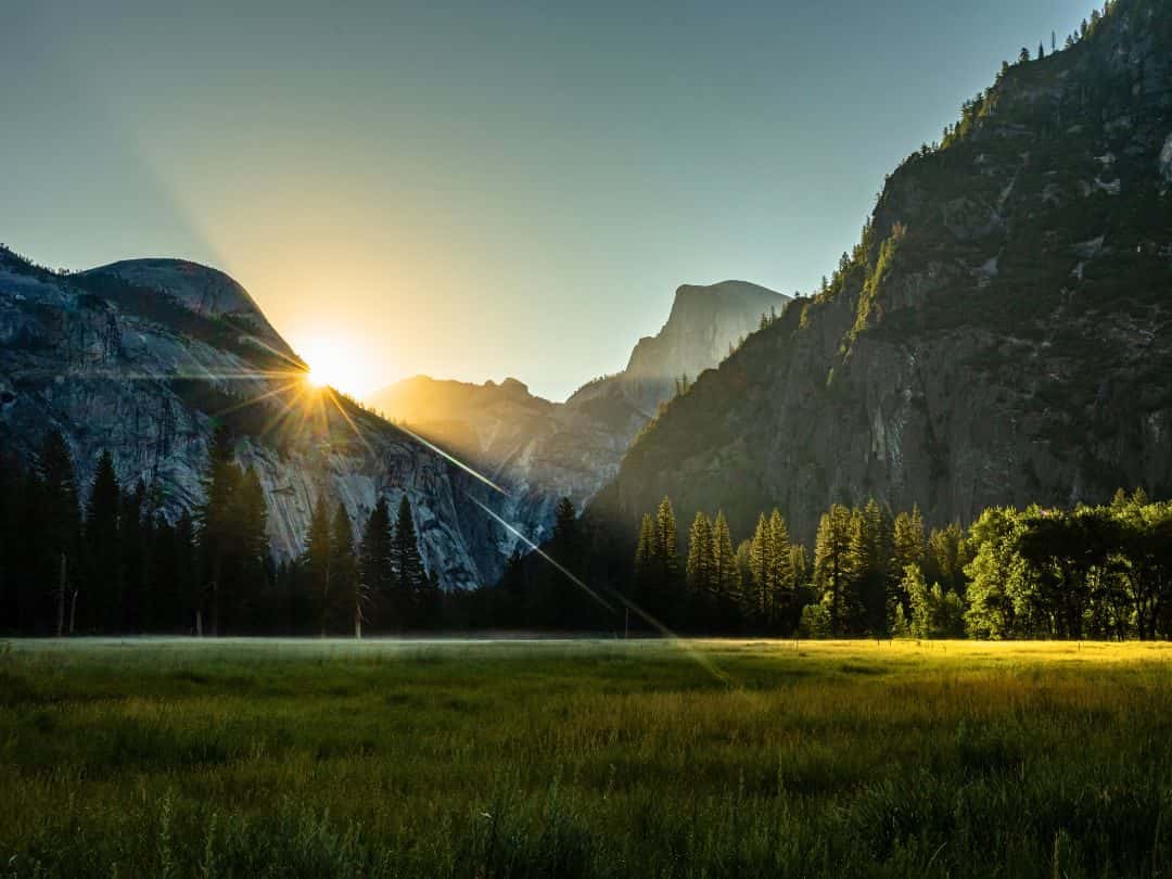
National Parks in California / Yosemite National Park (Yosemite Valley)
- Panorama Trail – Embark on the Panorama Trail, a challenging but rewarding hike that offers stunning views of Half Dome, Illilouette Falls, Nevada Fall, and Vernal Fall, all in one breathtaking panorama.
- Glacier Point – Experience awe-inspiring views from Glacier Point, an elevated vista that offers a breathtaking panoramic outlook of Yosemite Valley and its surrounding peaks. The sunset and starry night views are stunning.
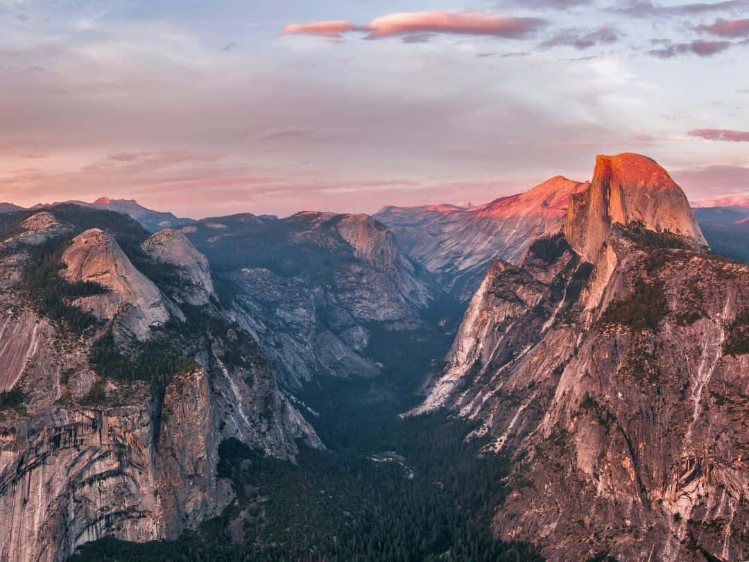
National Parks in California / Yosemite National Park (Glacier Point at Sunset)
- Tuolumne Grove of Giant Sequoia – Explore the lesser-visited Tuolumne Grove, where you can walk amidst giant sequoias and feel humbled by the sheer magnitude of these ancient trees.
- Mariposa Grove of Giant Sequoias – Stand in awe among ancient giants at Mariposa Grove, home to some of the world’s largest and oldest living trees, including the famous Grizzly Giant and the California Tunnel Tree.
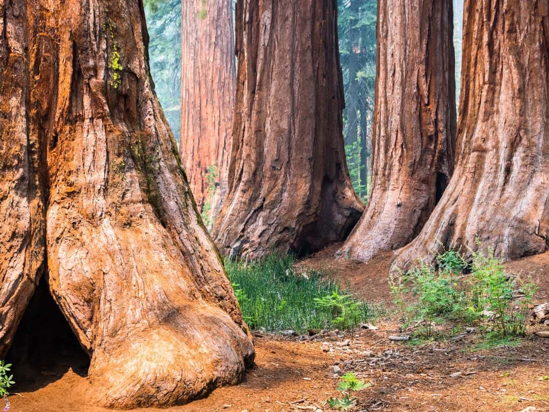
National Parks in California / Yosemite National Park (Mariposa Grove)
Ultimate Adventure in Yosemite
- Conquering the Iconic Half Dome
For daring adventurers seeking the ultimate thrill and accomplishment in Yosemite National Park, conquering the iconic Half Dome stands as an unparalleled challenge.
Rising nearly 5,000 feet above the valley floor, Half Dome is a granite monolith that has captured the hearts of hikers and rock climbers for generations. The journey to its lofty summit involves a rigorous ascent, breathtaking landscapes, and a sense of triumph unlike any other!
PRO TIP: You must have a permit to ascend the subdome steps or Half Dome cables.
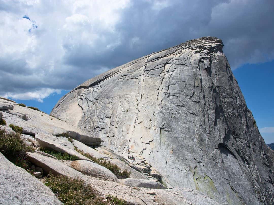
National Parks in California / Yosemite National Park (Half Dome)
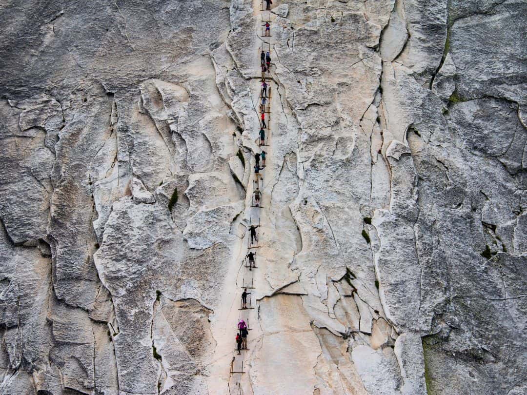
National Parks in California / Yosemite National Park (Half Dome)
FURTHER READING ABOUT YOSEMITE:
5 Amazing Scenic Drives in Yosemite (with Best Stops+Maps)
17 Easy Hikes in Yosemite Perfect for All Ages (Useful Tips+Maps)
15 Best Stops on Tioga Road: Yosemite’s Scenic Highway (Useful Tips and Map)
9 Spectacular Yosemite Sunset Spots (No Hiking Needed)
5 Towns Near Yosemite (with Best Places to Stay and Eat)
Best Yosemite Shuttle Bus Guide (Useful Tips+Maps+Routes)
Ultimate Guide to Airports Near Yosemite (+Pro Tips for Seamless Access)
8 Best Times to Visit Yosemite (Find the Perfect Time for Your Adventure)
Joshua Tree National Park
Quick Facts About the Park
- Founded: Joshua Tree National Park was established on October 31, 1994.
- Annual Visitors: Joshua attracted 3.1 million visitors in 2022.
- Size: Joshua Tree National Park covers an area of approximately 759,200 acres.
- Location: The park is located in Southern California, straddling the Colorado Desert to the east and the Mojave Desert to the west.
- Entrance Fee: The entrance fee to Joshua Tree National Park is $30 per vehicle, valid for 7 days.
- Notable Fact: Joshua Tree National Park is famous for its unique and otherworldly Joshua trees (Yucca brevifolia), which are actually not trees but belong to the yucca plant family.
3 Essential Tips for Unforgettable Visit to Joshua Tree
1. Best Ways to Get to Joshua Tree National Park
- By Car: The most convenient way to reach Joshua Tree is by car. The park has several entrances: West Entrance located in Joshua Tree, Twentynine Palms Entrance situated in the city of Twentynine Palms and it is accessible via Highway 62 and Cottonwood Entrance located near the town of Cottonwood. It is accessible via Interstate 10.
- By Air: If you are traveling from a distant location, you can fly to nearby airports and then rent a car to reach the park. The closest major airports to Joshua Tree are Palm Springs International Airport (PSP) about 1 to 1.5 hours from the park and Ontario International Airport (ONT) about 2 to 2.5 hours from Joshua.
2. Best Navigating Options Inside the Park
- Private Vehicle – Getting around Joshua Tree National Park is primarily done by car. The park has a well-maintained road network that connects its major attractions and trailheads.
3. Best Time to Explore the Park (Time Your Visit Right)
- Spring (March to May): Spring is one of the most popular times to visit Joshua Tree. The temperatures range from the 70s to 80s Fahrenheit. Wildflowers often bloom during this time. Spring is ideal for all outdoor activities.
- Fall (September to November): Fall is another excellent time to visit. Daytime temperatures range from the 70s to 80s Fahrenheit. Fall brings clear skies and beautiful sunsets.
- Winter (December to February): Daytime temperatures typically range from the 50s to 60s Fahrenheit, but nighttime temperatures can drop sometimes below freezing. Winter is perfect for peaceful solitude and comfortable hiking conditions during the day.
- Summer (June to August): Summer can be extremely hot in Joshua Tree, with daytime temperatures often exceeding 100 degrees Fahrenheit or more. If you plan to visit in summer carry plenty of water to stay hydrated.
Top 10 Experiences in Joshua Tree You Can't Miss
- Keys View: Visit this iconic viewpoint for breathtaking panoramic vistas of the Coachella Valley and the Salton Sea.
- Hidden Valley: Explore the unique Hidden Valley, a secluded area surrounded by massive rock formations, perfect for short hikes and bouldering.
- Cholla Cactus Garden: Marvel at the dense concentration of striking cholla cacti, especially during sunrise or sunset for fantastic photo opportunities.
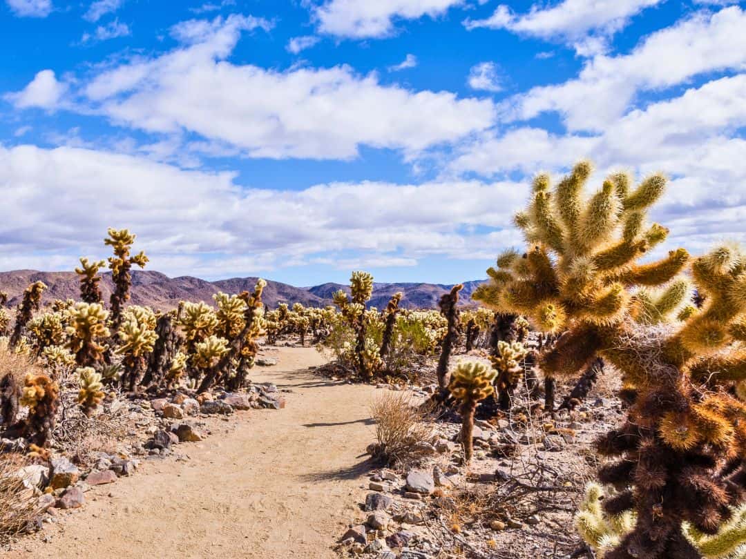
National Parks in California / Joshua Tree (Cholla Cactus Garden)
- Ryan Mountain: Hike to the top of Ryan Mountain for sweeping views of Joshua Tree’s rugged landscapes.
- Stargazing: Witness the mesmerizing night sky free from light pollution. Joshua Tree is renowned for its exceptional stargazing opportunities.
- Skull Rock: Discover this intriguing rock formation resembling a skull along the park’s main road.
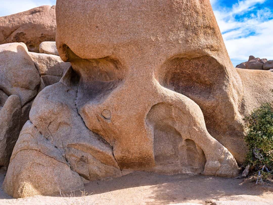
National Parks in California / Joshua Tree (Skull Rock)
- Barker Dam: Take a stroll to Barker Dam, an easy hike leading to a historic water catchment area and scenic vistas.
- Arch Rock: Photograph the unique Arch Rock, an iconic natural arch formed by wind and erosion.
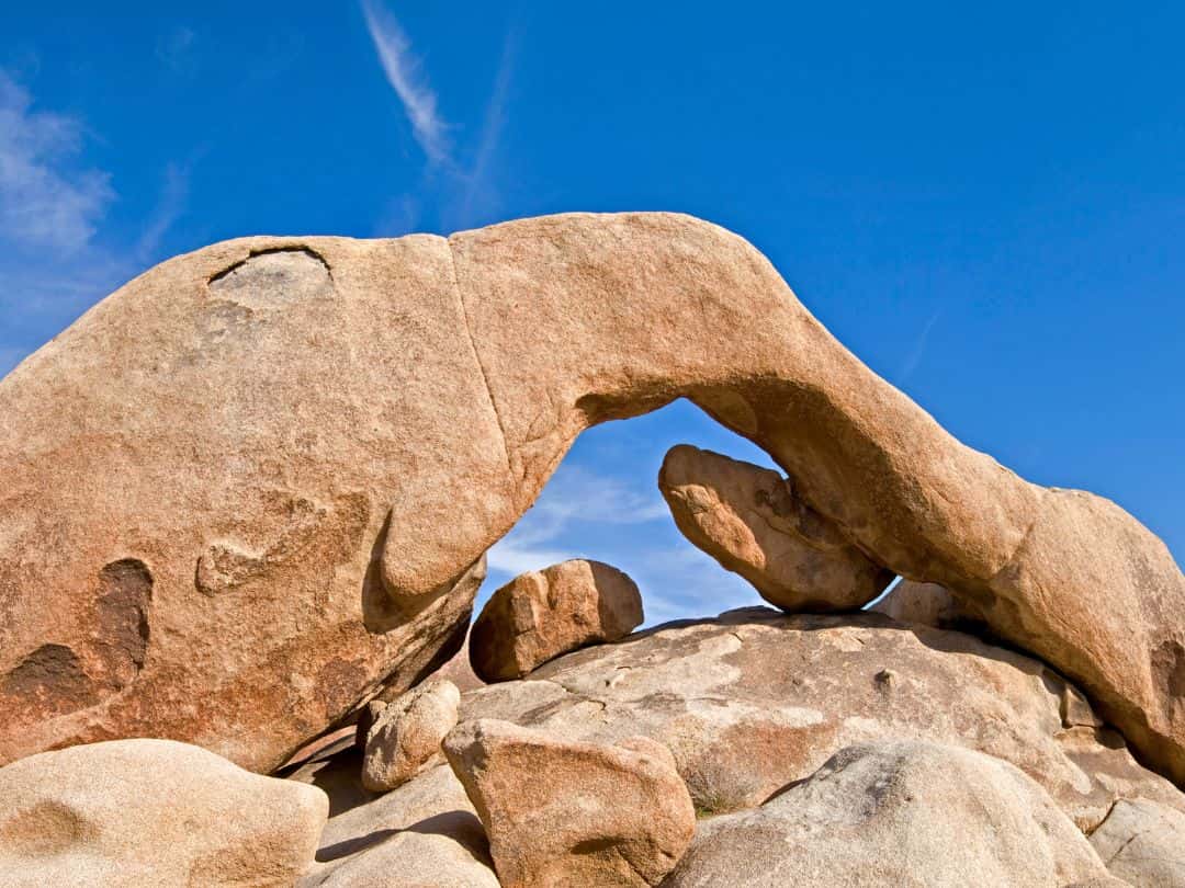
National Parks in California / Joshua Tree (Arch Rock)
- Eureka Peak: Drive to the Eureka Peak trailhead and take a short hike to the summit, where you can enjoy stunning views of the rugged terrain and iconic rock formations.
- Geology Tour Road: Embark on the Geology Tour Road, an engaging and informative 18-mile self-guided driving adventure that unveils the park’s distinctive rock formations and geological processes.
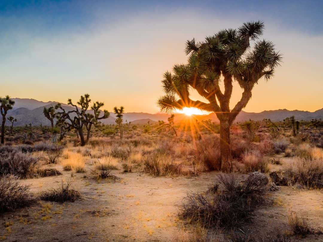
National Parks in California / Joshua Tree National Park at Sunset
Ultimate Adventure in Joshua Tree
- Rock Climbing
The ultimate adventure in Joshua Tree National Park is undoubtedly rock climbing. With its unique and rugged rock formations, Joshua Tree is a world-renowned destination for rock climbers of all levels.
The park offers a wide variety of climbing routes, ranging from beginner-friendly to challenging and technical climbs, making it a playground for climbers to test their skills and push their limits.
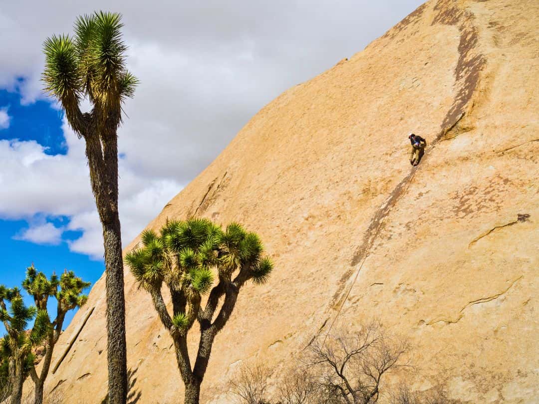
National Parks in California / Rock Climbing in Joshua Tree National Park
FURTHER READING ABOUT JOSHUA TREE:
Death Valley National Park
Quick Facts About the Park
- Founded: Death Valley National Park was established on October 31, 1994.
- Annual Visitors: The park attracted over 1 million visitors in 2022.
- Size: Death Valley National Park covers approximately 3.4 million acres, making it the largest national park in the contiguous United States.
- Location: The park is located in eastern California and stretches into Nevada. It is part of the larger Mojave and Colorado Deserts Biosphere Reserve.
- Entrance Fee: The entrance fee for private vehicles to Death Valley National Park was $30 and was valid for 7 days.
- Notable Facts: Death Valley is known for its extreme temperatures, recording the highest air temperature ever recorded on Earth (134 degrees Fahrenheit). It is home to Badwater Basin, the lowest point in North America, at 282 feet below sea level. The park’s diverse landscapes include salt flats, sand dunes, rugged mountains, colorful badlands, and unique rock formations.
3 Essential Tips for Unforgettable Visit to Death Valley
1. Best Ways to Get to Death Valley National Park
- By Car: The most convenient and flexible way to reach Death Valley is by car. The park is accessible by multiple entrances with Furnace Creek Visitor Center Entrance being the most popular one. It can be reached via California State Route 190 from the east or west.
- By Air: If you’re traveling from a distant location, you can fly to nearby airports and then rent a car to reach the park. The closest major airports to Death Valley are Las Vegas McCarran International Airport (LAS), about 2-3 hours away, and Los Angeles International Airport (LAX) around 4-5 hours away.
2. Best Way to Navigate Inside the Park
- By Car: The best way to navigate inside Death Valley National Park is by car. Having your own vehicle provides the flexibility to explore the park at your own pace and access various points of interest easily.
3. Best Time to Explore the Park (Time Your Visit Right)
- Late Fall (November): November is an excellent time to explore the park. The daytime temperatures are generally comfortable, ranging from the 70s to the low 80s Fahrenheit.
- Winter (December to February): Winter is a popular time to visit with daytime temperatures, ranging from the mid-60s to the low 70s Fahrenheit. The evenings and nights can get cold, so it is essential to bring warm clothing.
- Early Spring (March to April): Spring is another pleasant season to visit, with daytime temperatures ranging from the 70s to 90s Fahrenheit. This is the time when the wildflowers are in full bloom, transforming the desert landscape into a colorful display.
- PRO TIP: Avoid visiting Death Valley during the peak of summer (June to August) as temperatures can soar to extreme levels, often exceeding 100 degrees Fahrenheit. The heat during these months can be dangerous and can lead to heat-related illnesses.
Top 10 Experiences in Death Valley You Can't Miss
- Dante’s View: Climb up to Dante’s View for a panoramic view of Death Valley. At an elevation of 5,476 feet, you can witness an expansive vista of the valley below.
- Ubehebe Crater: Hike to Ubehebe Crater, a massive volcanic crater about half a mile wide and 600 feet deep, offering stunning views and unique geological insights.
- Zabriskie Point: Witness the breathtaking sunrise or sunset at Zabriskie Point. This iconic viewpoint offers stunning vistas of the golden badlands, eroded hills, and colorful rock formations.
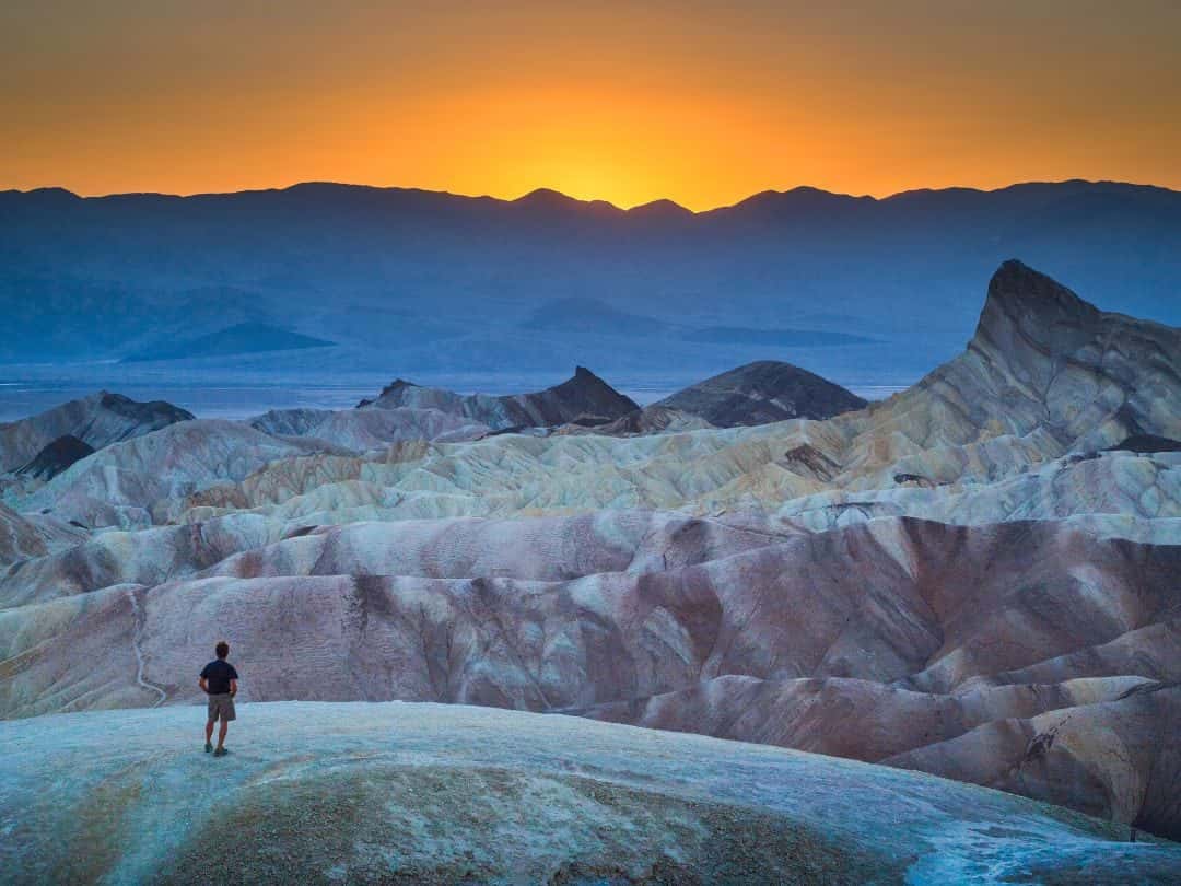
National Parks in California / Death Valley National Park (Zabriskie Point at Sunset)
- Darwin Falls: Hike to a hidden oasis with cascading waterfalls surrounded by lush greenery. The serene pools at the base of the falls invite you to cool off in the crystal-clear waters.
- Stargazing: With its remote location and minimal light pollution, the park offers unparalleled night skies.
- Badwater Basin: Explore the surreal salt flats of Badwater Basin, the lowest point in North America at 282 feet below sea level. The expansive salt flats create mesmerizing patterns, especially during sunrise and sunset.
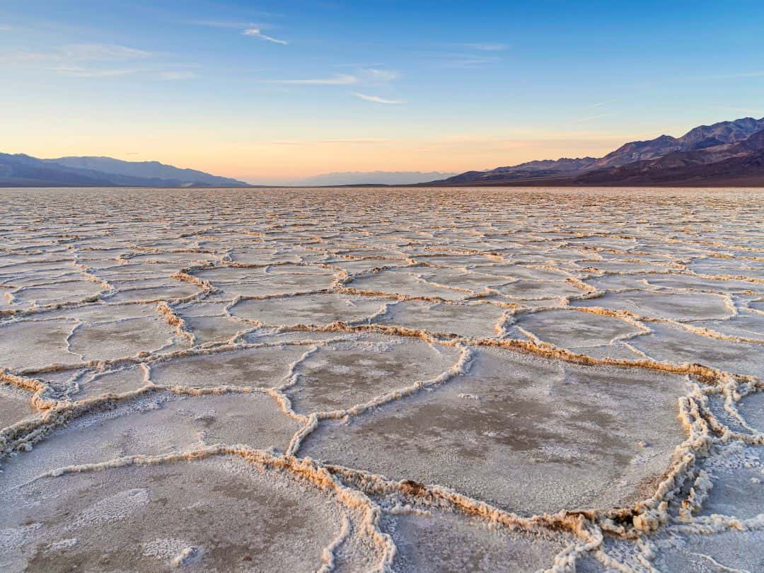
National Parks in California / Death Valley National Park (Badwater Basin at Sunset)
- Artist’s Palette: Drive along Artist’s Drive and witness the vibrant and diverse hues of the Artist’s Palette, where mineral-rich rocks create a beautiful array of colors.
- Devil’s Golf Course: Marvel at the bizarre and otherworldly landscape of Devil’s Golf Course, a vast area of jagged and crystallized salt formations.
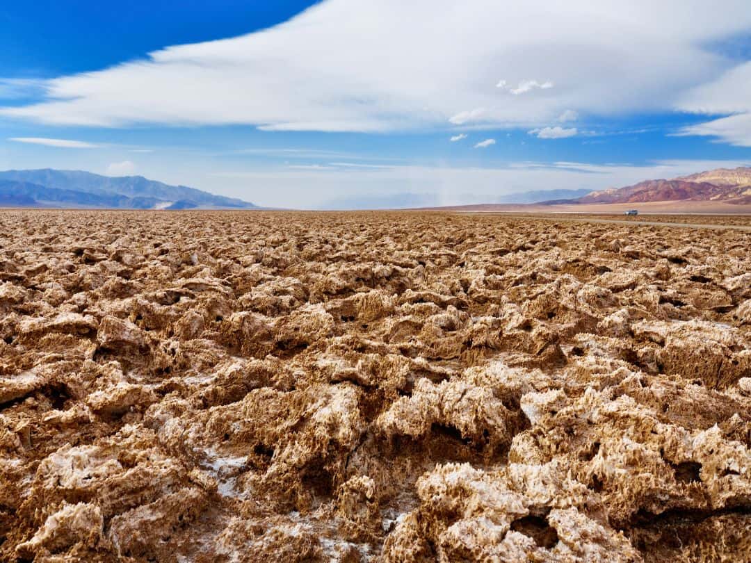
National Parks in California / Death Valley National Park (Devil’s Golf Course)
- Golden Canyon: Hike through Golden Canyon, a scenic and colorful slot canyon with towering walls, providing a glimpse into Death Valley’s geological past.
- Mesquite Flat Sand Dunes: Take a hike on the Mesquite Flat Sand Dunes, a popular spot for photography and capturing the ever-changing patterns formed by the winds.
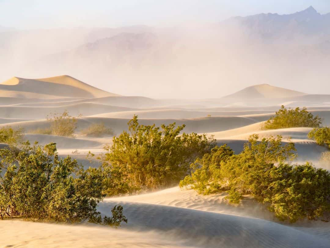
National Parks in California / Death Valley National Park (Mesquite Flat Sand Dunes)
Ultimate Adventure in Death Valley National Park
- Witnessing the Enigmatic “Moving Rocks”
Racetrack Playa is a dry lake bed that stretches for miles, and it is famous for its puzzling phenomenon: rocks that seem to move across the playa’s surface, leaving long tracks behind them.
The mystery was finally solved through careful observation and research, revealing that the rocks move during rare occurrences of winter rain when the playa becomes slightly flooded. During cold nights, the thin layer of water freezes into a thin sheet of ice. As the sun rises and warms the ground, the ice begins to break up, and winds as gentle as 10-15 mph can push the rocks across the slippery mud, creating long tracks.
PRO TIP: To experience Racetrack Playa, you will need to take a rugged and challenging drive on a rough dirt road, so a high-clearance, four-wheel-drive vehicle is recommended.
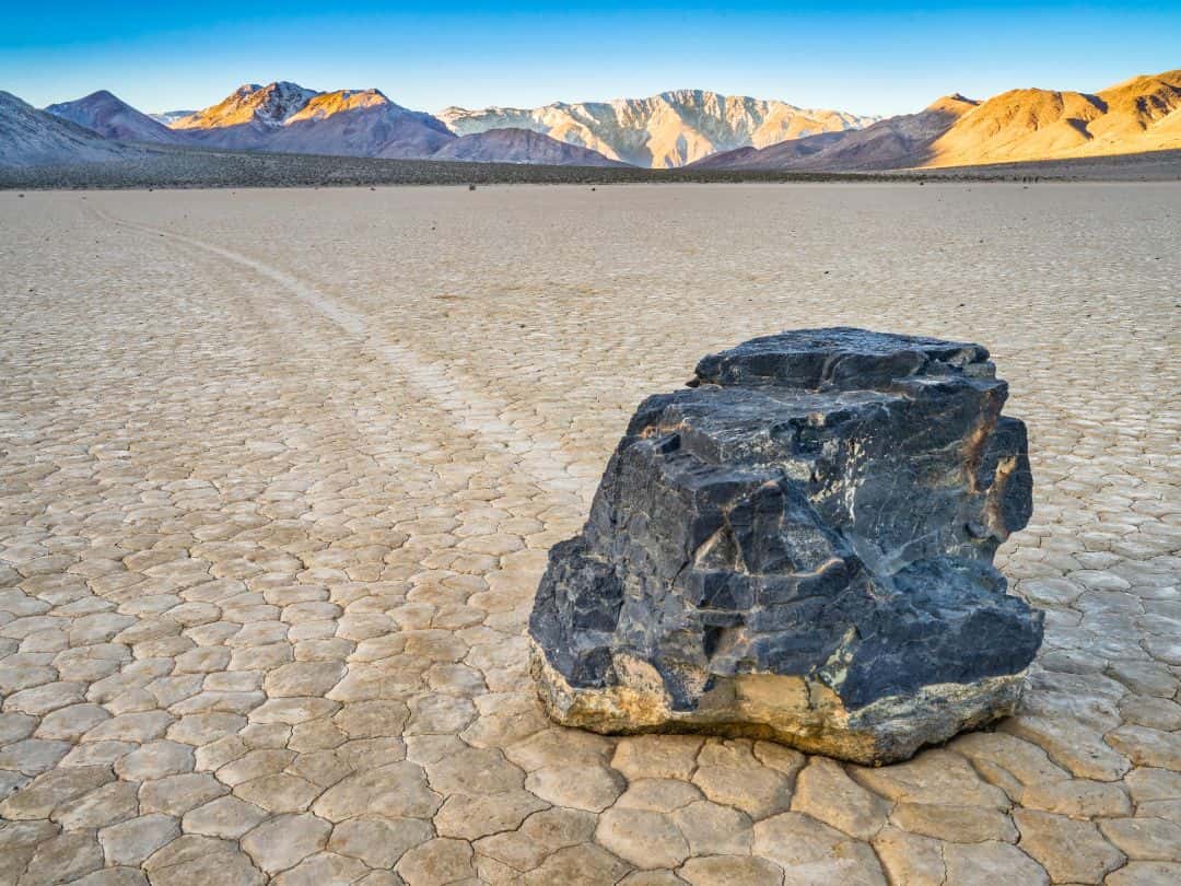
National Parks in California / Death Valley National Park (Racetrack Playa)
Channel Islands National Park
Quick Facts About the Park
- Founded: Channel Islands National Park was established on March 5, 1980.
- Annual Visitors: The park attracted over 323,250 visitors in 2022.
- Size: Channel Islands National Park covers an area of approximately 249,561 acres.
- Location: The park is located off the coast of Southern California, encompassing five rugged and remote islands: Anacapa, Santa Cruz, Santa Rosa, San Miguel, and Santa Barbara Islands.
- Entrance Fee: There was no entrance fee for Channel Islands National Park itself. However, you will need to pay for transportation services, such as ferry rides or boat trips, to access the islands.
- Notable Facts: Channel Islands National Park is often referred to as “The Galapagos of North America” due to its rich biodiversity and unique ecosystems. The park is home to over 2,000 species of plants and animals, of which 145 are found nowhere else on Earth.
3 Essential Tips for Unforgettable Visit to Channel Islands
1. Best Ways to Get to Channel Islands National Park
- Ferry Services: The most common way to access the park is through ferry services offered by authorized concessionaires. These ferries depart from various locations along the coast, including Ventura and Oxnard in southern California. The main ferry companies that operate services to the park are Island Packers and Channel Islands Adventure Company.
- Private Boats: If you have access to a private boat, you can arrange to sail to the park’s islands. Boating to the islands requires proper navigation skills and knowledge of the area’s waters, as conditions can be challenging and subject to strong currents.
2. Best Way to Navigate Inside the Park
- By Foot: Inside Channel Islands National Park, the primary mode of navigation is by foot. Since the park consists of five rugged and undeveloped islands, there are no roads or paved trails.
3. Best Time to Explore the Park (Time Your Visit Right)
- Spring (March to May): Spring is an ideal time to visit the Channel Islands. The weather is mild, with temperatures ranging from the mid-60s to mid-70s Fahrenheit, and the wildflowers are in bloom during this time
- Fall (September to November): Fall is another excellent time to explore the Channel Islands. The temperatures are still comfortable, ranging from the mid-60s to low 70s Fahrenheit.
- Summer (June to August): Summer can also be a popular time to visit, it tends to be warmer, and the islands can get crowded. Additionally, strong winds and fog can occasionally affect boat travel during the summer.
- Winter (December to February): Winter can be colder, and there may be more rain, but it is still possible to visit the islands during this time.
Top 10 Experiences in Channel Islands You Can't Miss
- Santa Barbara Island – Snorkeling and Diving: Dive or snorkel in crystal-clear waters, encountering vibrant marine life, including playful sea lions and colorful fish
- Anacapa Island – Inspiration Point: Hike to Inspiration Point for panoramic views of the rugged coastline and the iconic Anacapa Arch.
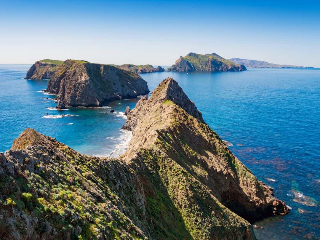
National Parks in California / Channel Island National Park (Anacapa Island – Inspiration Point)
- Wildlife Watching – Scorpion Rocks: Observe seabirds, including pelicans and gulls, nesting on the impressive sea stacks known as Scorpion Rocks.
- Anacapa Island Lighthouse: Visit the Anacapa Island Lighthouse, offering insight into the island’s maritime history and spectacular views from its perch.
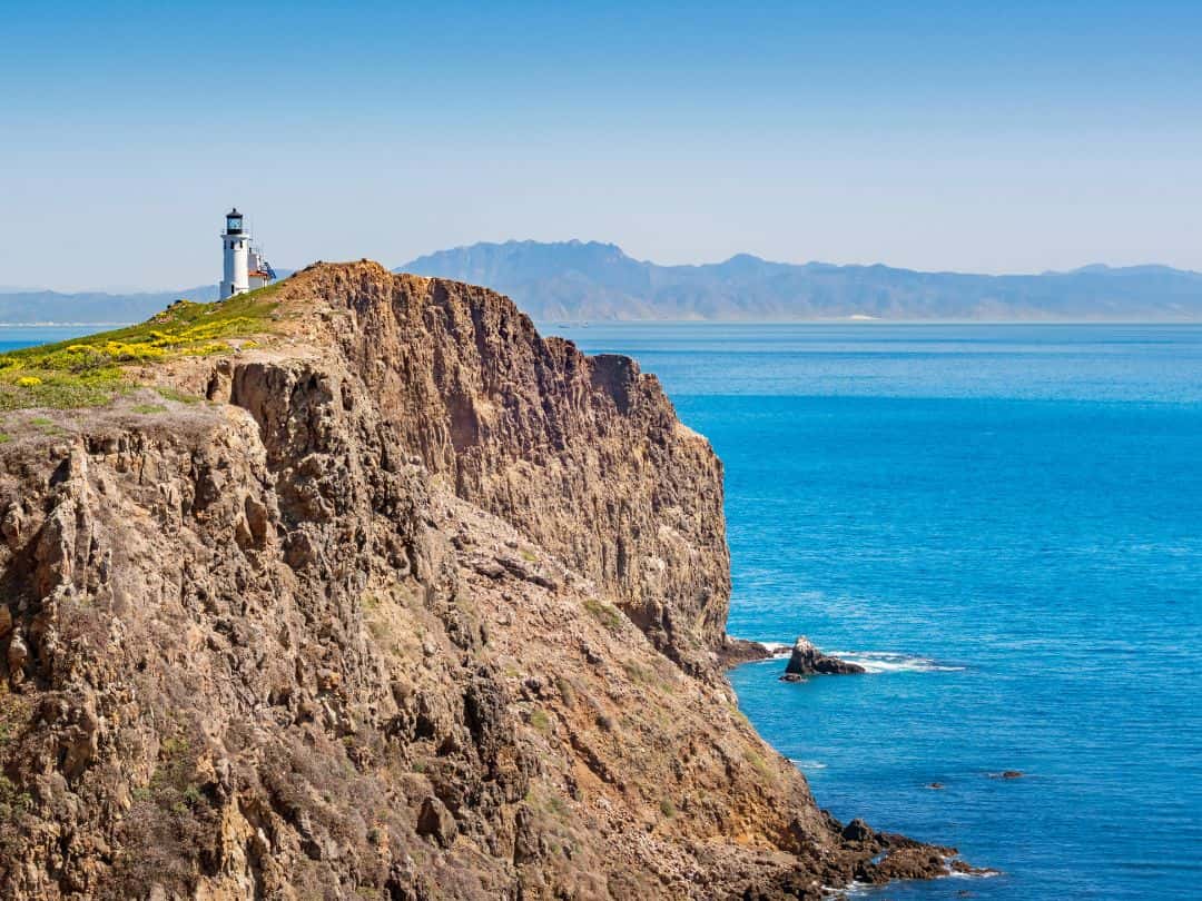
National Parks in California / Channel Island National Park (Anacapa Island – Lighthouse)
- Santa Cruz Island – Smuggler’s Cove: Hike to Smuggler’s Cove, a secluded beach with sea caves and opportunities for spotting marine wildlife.
- Santa Cruz Island – Scorpion Anchorage: Hike the Scorpion Canyon Loop Trail, a moderate hike offering stunning coastal views and a chance to spot island foxes.
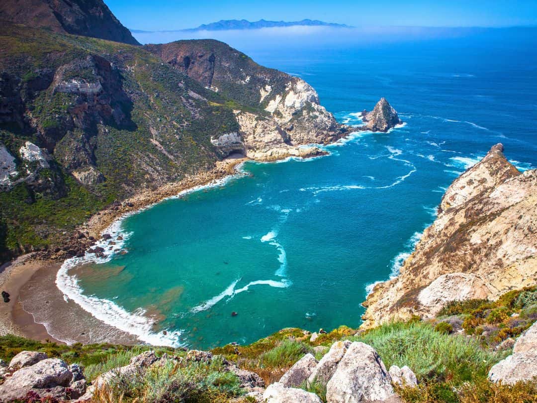
National Parks in California / Channel Island National Park (Santa Cruz Island, Potatoe Harbor View from the Scorpion Canyon Loop Trail)
- Prisoner’s Harbor – Santa Cruz Island: Take a boat tour to Prisoner’s Harbor, a historic site where you can learn about the island’s fascinating human history.
- Kayak Sea Cave Exploration: Join a guided kayak tour to paddle through the sea caves of Santa Cruz Island.
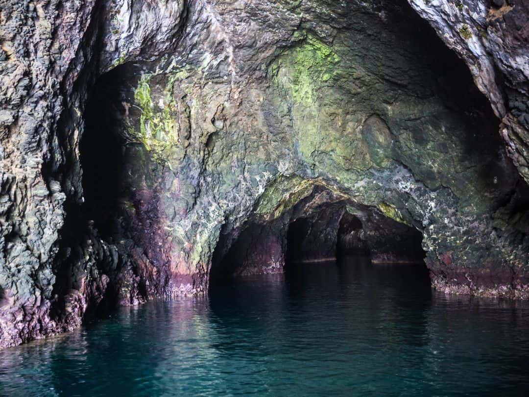
National Parks in California / Channel Island National Park (Santa Cruz Island – Painted Cave)
- Santa Rosa Island – Water Canyon Beach: Explore Water Canyon Beach, known for its beautiful white sand dunes and excellent beachcombing opportunities.
- Santa Rosa Island – Torrey Pines: Discover the unique Torrey Pines, one of the world’s rarest pine species, on a hike through Becher’s Bay area.

National Parks in California / Channel Island National Park (Santa Rosa Island – Torrey Pines)
Ultimate Adventure in Channel Islands
- Multi-Day Sea Kayaking And Camping Expedition
Embark on a guided kayak tour, paddling through crystal-clear waters, gliding past sea caves, and witnessing playful sea lions and dolphins.
As the day winds down, set up camp on secluded beaches, falling asleep to the soothing sound of gentle waves under a sky illuminated by countless stars.
This extraordinary journey allows you to disconnect from the outside world, and immerse yourself in the raw wilderness.
Sequoia and Kings Canyon National Parks
Quick Facts About the Parks
- Founded: Sequoia National Park was established on September 25, 1890, and Kings Canyon National Park was established on March 4, 1940.
- Annual Visitors: Together, the parks attracted over 1.9 million visitors in 2022.
- Size: Sequoia National Park covers an area of approximately 404,064 acres, and Kings Canyon National Park covers approximately 461,901 acres.
- Location: The parks are adjacent to each other in the southern Sierra Nevada mountain range in California.
- Entrance Fee: The entrance fee for private vehicles to either Sequoia or Kings Canyon National Park was $35 and was valid for 7 days.
- Notable Facts: Sequoia National Park is renowned for its giant sequoia trees, including the General Sherman Tree, which is the largest tree on Earth by volume. Kings Canyon features the deepest canyon in the United States, reaching depths of over 8,000 feet.
3 Essential Tips for Unforgettable Visit to Sequoia and Kings Canyon
1. Best Ways to Get to Sequoia and Kings Canyon
- By Car: If you have access to a car, driving is the most convenient way to reach both parks. From Los Angeles 4-5 hours, San Francisco 5-6 hours and Las Vegas 6-7 hours.
- By Air and Car Rental: If you’re traveling from a distant location, you can fly to nearby airports and then rent a car to reach the parks. The closest major airports are Fresno Yosemite International Airport (FAT) and Bakersfield Meadows Field Airport (BFL).
2. Best Way to Navigate Inside the Parks
- Car: Having your own vehicle is the most convenient and flexible way to explore the parks.
- Shuttle Service: During the peak season (typically from late spring to early fall), both parks offer a free shuttle service known as the “Sequoia Shuttle” that operates along designated routes.
3. Best Time to Explore the Parks (Time Your Visit Right)
- Late spring (May to June) and early fall (September to October) are particularly pleasant times to visit. During these months, temperatures are moderate, with daytime highs ranging from the 60s to 80s Fahrenheit, and nights are cool but not excessively cold.
- Summer (July to August) is the peak season for these parks, with warmer temperatures and longer daylight hours. However, be prepared for crowded trails.
- Winter (November to April) can be a beautiful time to experience the parks’ snow-covered landscapes and enjoy peaceful solitude
Top 10 Experiences in Sequoia and Kings Canyon National Parks
- Grant Grove: Explore the Grant Grove area in Kings Canyon National Park, home to the General Grant Tree and other impressive sequoia groves. The easy trails in this section offer a great introduction to the park’s natural wonders.
- General Sherman Tree: Witness the world’s largest tree by volume, the General Sherman Tree, in Sequoia National Park. Standing tall at over 275 feet and estimated to be around 2,200 years old, this iconic giant sequoia is a must-see attraction.
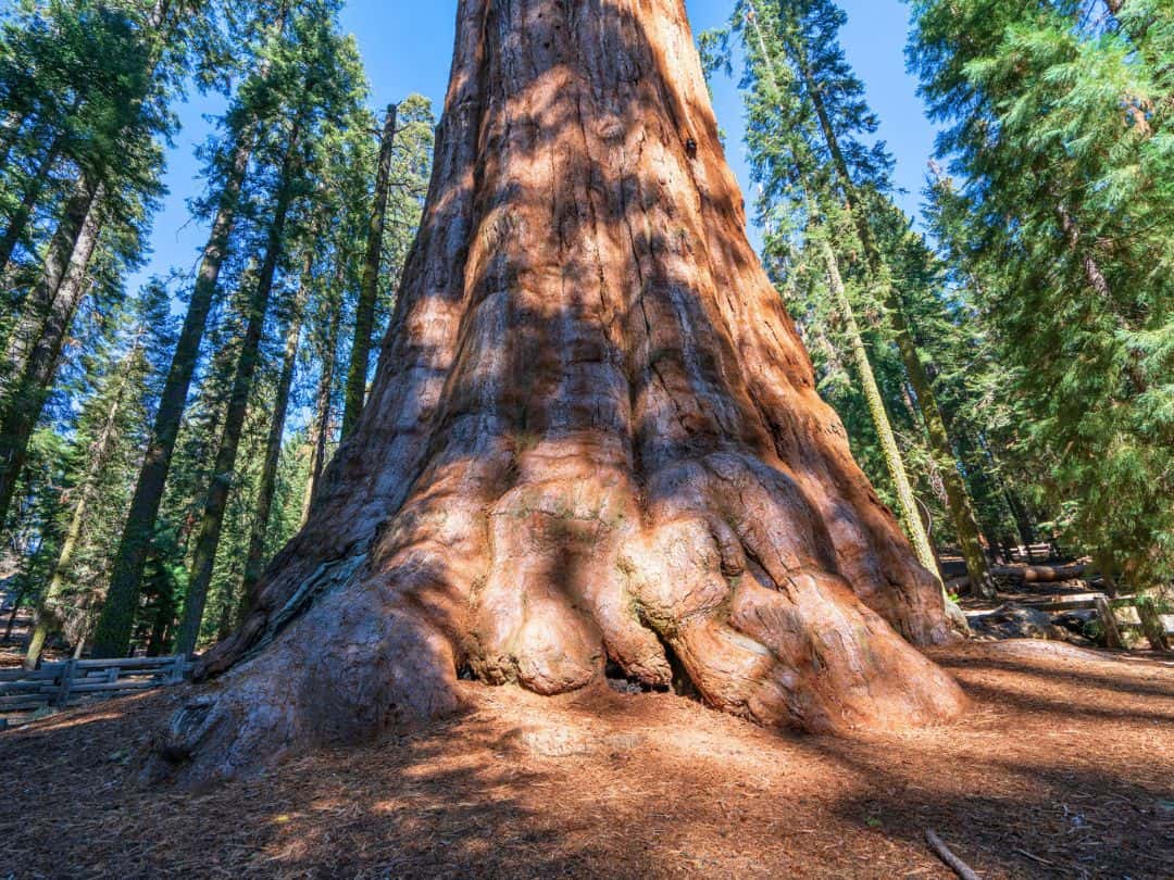
National Parks in California / Sequoia National Park (General Sherman)
- Tokopah Falls: Hike the Tokopah Falls Trail in Sequoia National Park to reach the stunning 1,200-foot cascading waterfall surrounded by lush greenery.
- Crystal Cave: Embark on a guided tour of Crystal Cave in Sequoia National Park to explore the mesmerizing underground world, adorned with spectacular formations of stalactites and stalagmites.
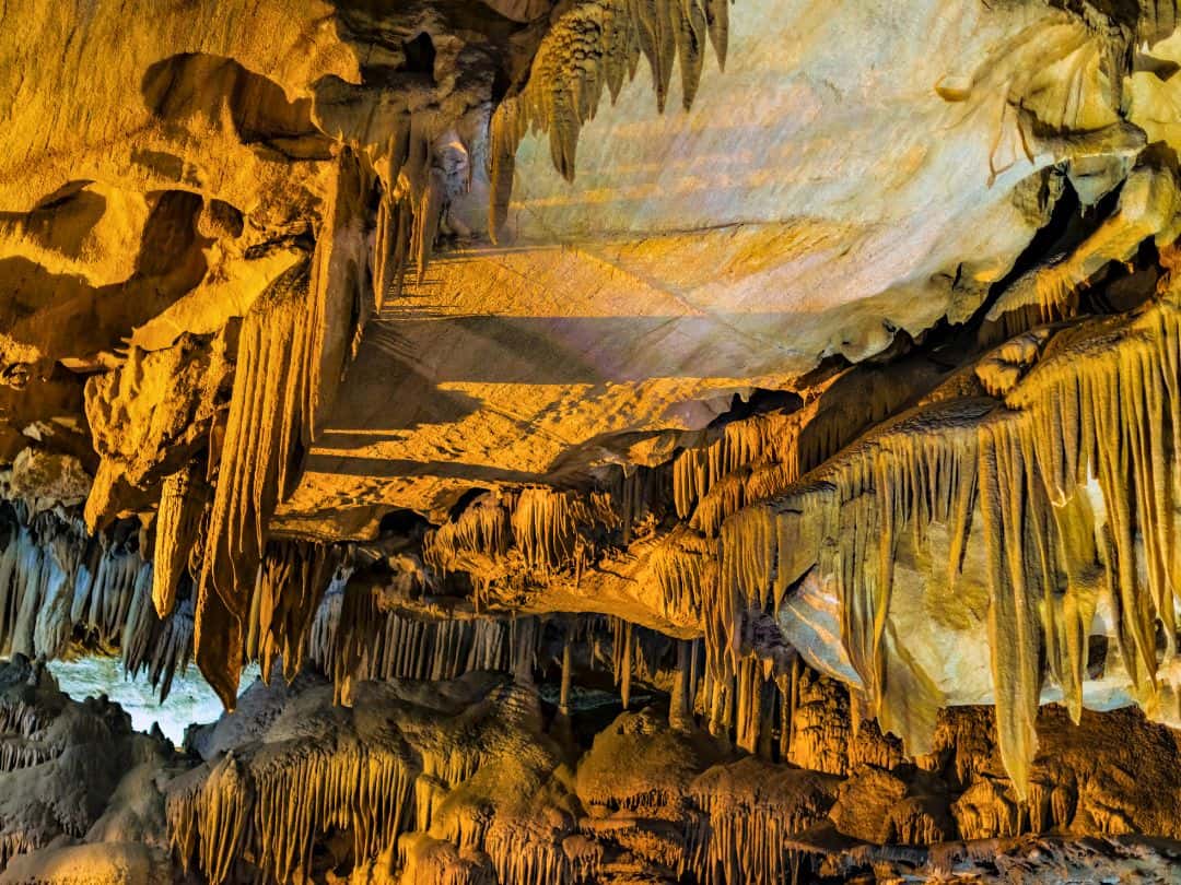
National Parks in California / Sequoia National Park (Crystal Cave)
- Roaring River Falls: Take a short walk to Roaring River Falls in Kings Canyon National Park, where you can witness the powerful rush of water as it tumbles down the rocky steps.
- Crescent Meadow: Stroll along the Crescent Meadow Loop Trail in Sequoia National Park, a serene and picturesque meadow surrounded by towering sequoia trees.
- Kings Canyon Scenic Byway: Drive along the Kings Canyon Scenic Byway, also known as Highway 180, to marvel at the deep canyon walls, waterfalls, and diverse scenery in Kings Canyon National Park.
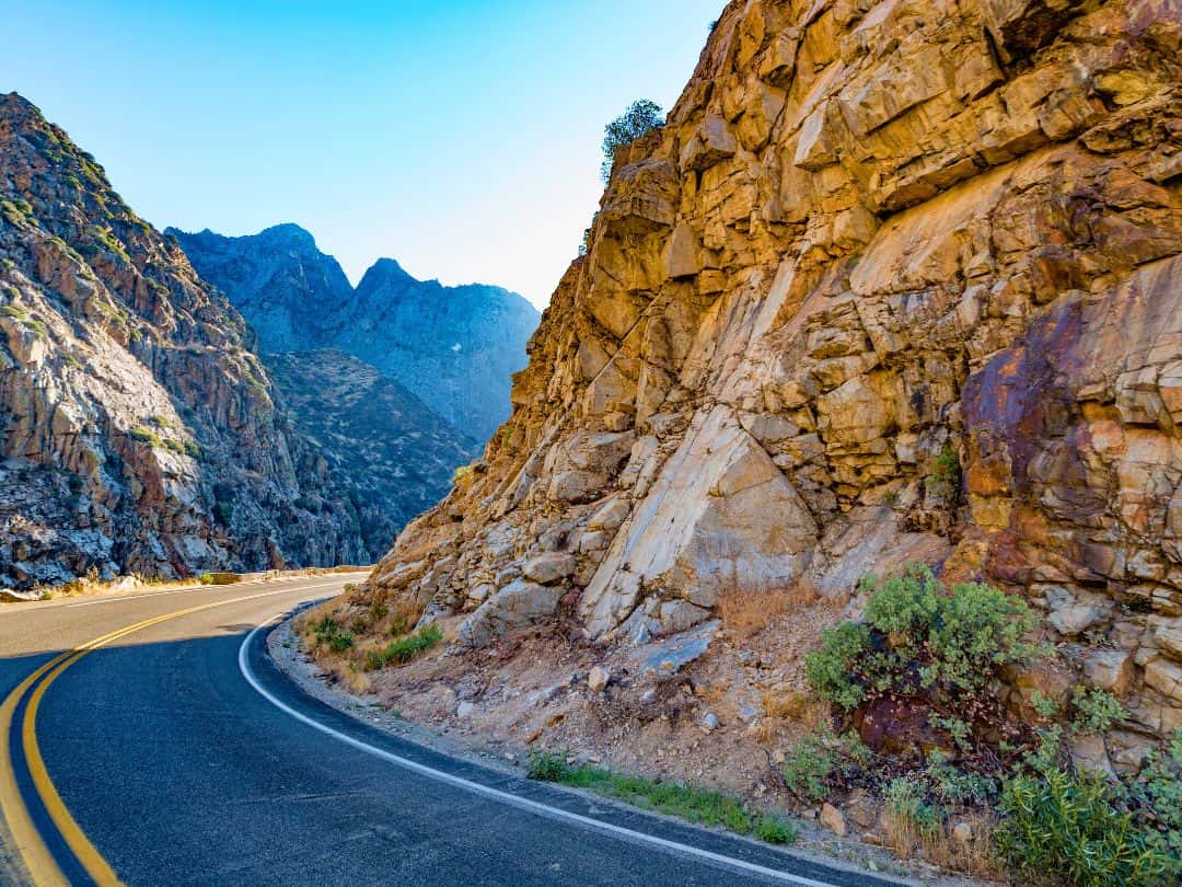
National Parks in California / Kings Canyon Scenic Byway
- Big Stump Trail: Wander through the Big Stump Trail in Kings Canyon National Park, where you can see massive sequoia tree stumps that were left behind by historic logging activities.
- Sunset at Beetle Rock: Experience a breathtaking sunset at Beetle Rock in Sequoia National Park, offering panoramic views of the surrounding landscape and a perfect spot for stargazing.
- Mist Falls: Embark on a rewarding hike to Mist Falls in Kings Canyon National Park, a stunning 100-foot (30 meters) waterfall along the South Fork Kings River.
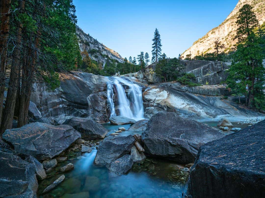
National Parks in California / Kings Canyon National Park (Mist Falls)
Ultimate Adventure in Death Valley National Park
- Climbing Moro Rock
For an adrenaline-pumping experience, climb the steep 400-step stairway to the top of Moro Rock in Sequoia National Park. The reward is awe-inspiring panoramic views of the Sierra Nevada and the Great Western Divide.
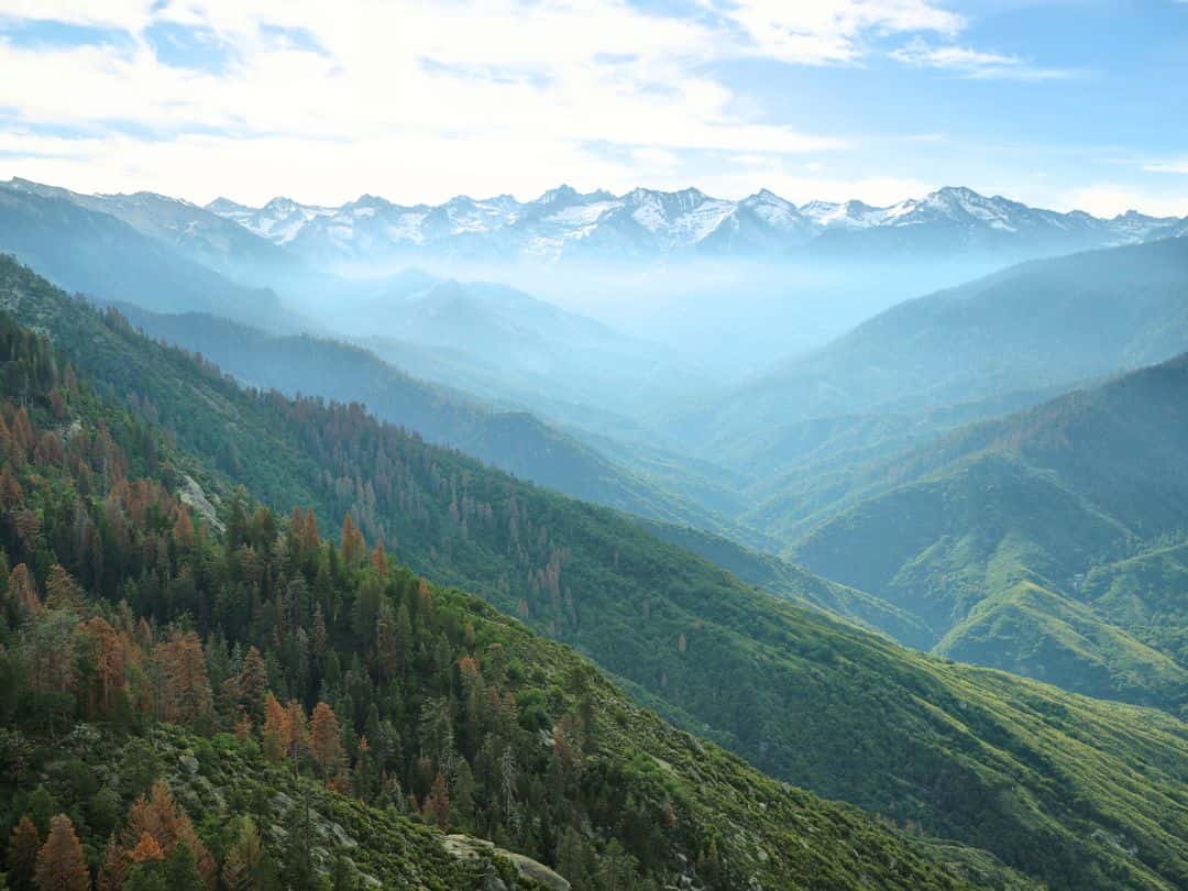
National Parks in California / Sequoia National Park (View from Moro Rock)
Pinnacles National Park
Quick Facts About the Park
- Founded: Pinnacles National Park was established as Pinnacles National Monument on January 16, 1908, and redesignated as a national park on January 10, 2013.
- Annual Visitors: The park attracted over 275,000 visitors in 2022.
- Size: Pinnacles National Park covers an area of approximately 26,606 acres.
- Location: The park is located in central California, near the town of Soledad. It is about 80 miles (about 129 kilometers) southeast of San Jose and about 70 miles (about 113 kilometers) west of the city of Fresno.
- Entrance Fee: The entrance fee for private vehicles to Pinnacles National Park was $30 and was valid for 7 days.
- Notable Facts: Pinnacles National Park is famous for its unique rock formations, spires, and volcanic formations created by ancient volcanic activity. It offers opportunities for hiking, rock climbing, and exploring talus caves formed by massive boulders wedged into narrow canyons. The park is divided into two sections, the East and West sides, which are not directly connected by roads but can be accessed by separate entrances.
3 Essential Tips for Unforgettable Visit to Pinnacles
1. Best Ways to Get to Pinnacles National Park
- By Car: If you have access to a car, driving is the most convenient and flexible way to reach Pinnacles National Park. The park has two main entrances, the east entrance near Paicines, CA, and the west entrance near Soledad, CA.
- By Air: If you are traveling from a distant location, you can fly to nearby airports and then rent a car to reach Pinnacles National Park. The closest major airports are San Jose International Airport (SJC) located about a 1.5 to 2-hour drive from the park and Monterey Regional Airport (MRY) located about a 1.5 to 2.5-hour drive depending on the traffic.
2. Best Way to Navigate Inside the Park
- Car: If you have a car, you can drive through the park on the Pinnacles Highway (CA-146), which connects the east and west entrances. The drive offers beautiful vistas of the surrounding landscapes, and there are parking areas at various trailheads and viewpoints.
- Shuttle Service (Seasonal): Pinnacles National Park operates a shuttle service called the Pinnacles Shuttle during peak seasons (usually spring and fall). The shuttle runs between the east and west entrances.
3. Best Time to Explore the Park (Time Your Visit Right)
- Spring (March to May): Spring brings colorful wildflowers in bloom, making the landscape vibrant and picturesque. The temperatures are generally comfortable, ranging from mild to warm, making hiking and outdoor activities enjoyable.
- Fall (September to November): Fall is another excellent time to visit Pinnacles National Park. The weather remains pleasant with mild temperatures. Fall is an ideal time for hiking and wildlife viewing.
- Summer (June to August): Summer can be quite hot, especially in the lower elevations. Keep in mind that summer is the busiest season, and some areas may get crowded, especially on weekends and holidays.
- Winter (December to February): Winter can be cold, especially at night, and some areas of the park may experience freezing temperatures. While snow is rare in the lower elevations, the higher elevations may receive snowfall.
Top 10 Experiences in Pinnacles National Park You Can't Miss
- Chalone Creek Trail: Discover the beauty of Chalone Creek Trail, which leads you alongside a picturesque creek surrounded by lush vegetation and diverse wildlife.
- Moses Spring Trail: Hike the Moses Spring Trail to witness the enchanting Moses Spring waterfall and enjoy the tranquility of the scenic surroundings.
- Bear Gulch Cave and Reservoir: Explore the fascinating Bear Gulch Cave, a talus cave formed by massive boulders, and the serene Bear Gulch Reservoir.
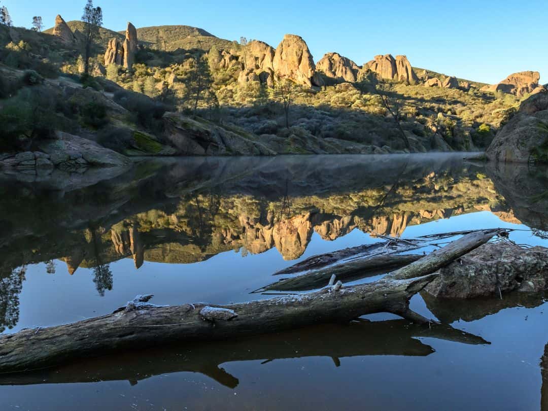
National Parks in California / Pinnacles National Park (Bear Gulch Reservoir)
- Condor Gulch Trail: Take the Condor Gulch Trail for a scenic hike offering sweeping views of the park’s rugged terrain and a chance to spot the majestic California condors soaring in the sky.
- High Peaks Trail: Hike the High Peaks Trail to reach the park’s iconic rock formations and stunning viewpoints. Enjoy panoramic vistas of the surrounding landscapes, including the unique rocky spires known as the High Peaks.
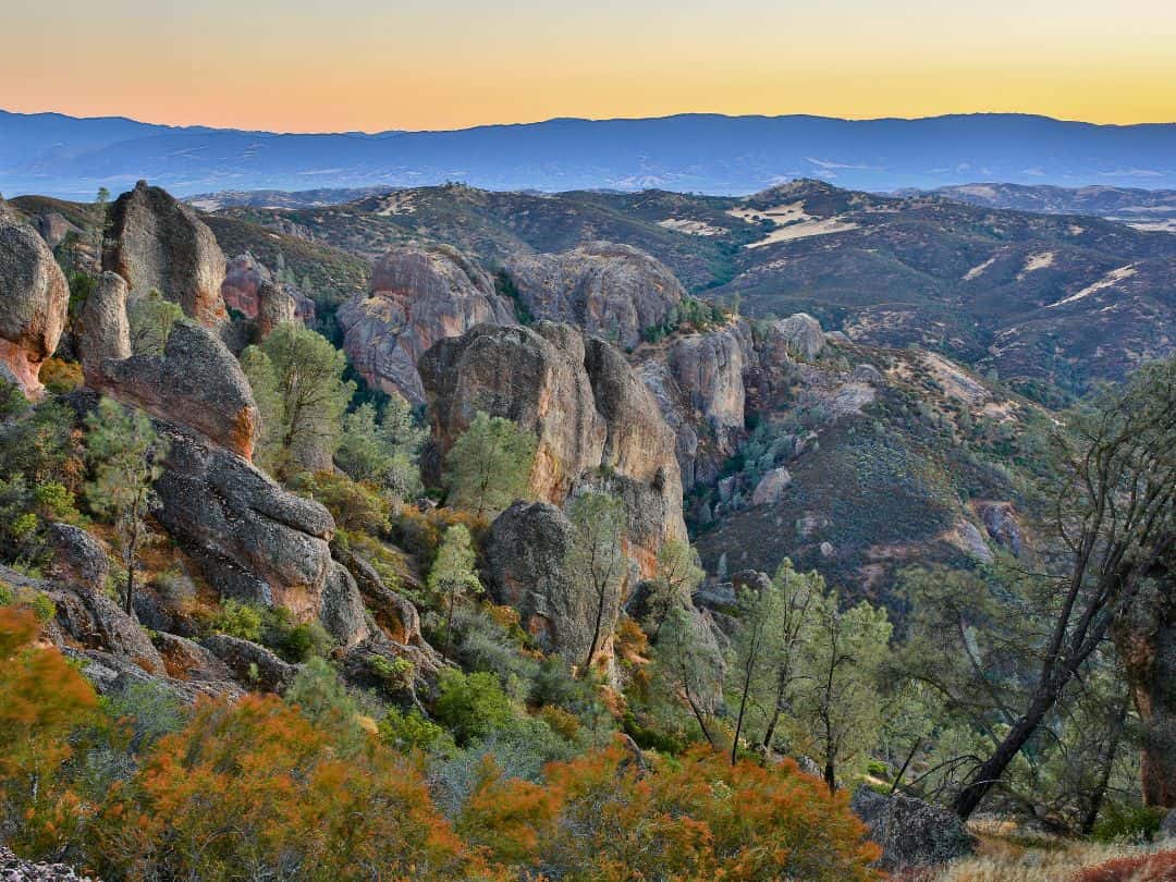
National Parks in California / View of Pinnacles National Park at Dusk
- Stargazing: Experience the park’s dark skies and stellar nightscapes for an unforgettable stargazing adventure. Pinnacles is designated as an International Dark Sky Park, offering incredible views of stars, planets, and the Milky Way.
- Pinnacles Balconies Cave Trail: Wander through the Balconies Cave Trail, an exhilarating trek through dark caves and narrow passages, leading to breathtaking balconies overlooking the canyons below.
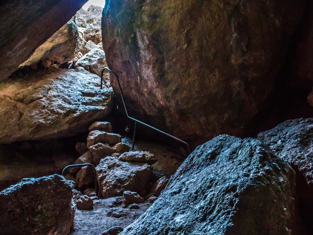
National Parks in California / Pinnacles National Park (Pinnacles Balconies Cave Trail)
- Machete Ridge Overlook: Reach the Machete Ridge Overlook for awe-inspiring views of the rugged cliffs and canyons, offering stunning photo opportunities.
- Wildlife Watching: Keep an eye out for a diverse array of wildlife, including California condors, wild turkeys, deer, coyotes, and a variety of bird species.
- Talus Caves Trail: Explore the Talus Caves Trail to encounter unique rock formations and meandering passages through talus caves.
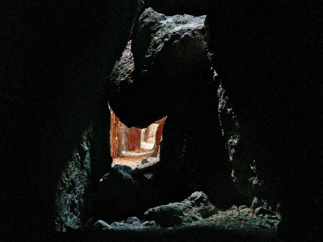
National Parks in California / Cave System at Pinnacles National Park
Ultimate Adventure in Pinnacles National Park
- Backcountry Camping and High Peaks Ascent:
Hike through the wilderness, ascending the High Peaks Trail to witness the park’s iconic rock formations and breathtaking vistas. Spend the night under the stars in a designated backcountry campsite, fully immersing yourself in the wilderness and connecting with the park’s raw beauty.
This ultimate adventure combines challenging hikes, stunning viewpoints, and the serenity of the backcountry for a truly unforgettable experience in Pinnacles National Park.
Lassen Volcanic National Park
Quick Facts About the Park
- Founded: Lassen Volcanic National Park was established on August 9, 1916, making it one of the oldest national parks in the United States.
- Annual Visitors: The park attracted over 500,000 visitors in 2022.
- Size: Lassen Volcanic National Park covers an area of approximately 106,589 acres.
- Location: The park is located in northeastern California, in the southern Cascade Range. It is about 50 miles east of Redding, California.
- Entrance Fee: The entrance fee for private vehicles to Lassen Volcanic National Park was $30 and was valid for 7 days.
- Notable Facts: Lassen Volcanic National Park is home to an array of active geothermal features, including hot springs, fumaroles, and boiling pools. Lassen Peak, the largest plug dome volcano in the world, is one of the park’s major attractions and offers spectacular views from its summit.
3 Essential Tips for Unforgettable Visit to Lassen Volcanic
1. Best Ways to Get to Lassen Volcanic
- By Car: If you have access to a car, driving is the most convenient and flexible way to reach Lassen Volcanic National Park. The park has several entrances and it can be accessed via major highways like California State Route 89 and California State Route 44.
- By Air: If you are traveling from a distant location, you can fly to nearby airports and then rent a car to reach Lassen Volcanic National Park. The closest major airports are Redding Municipal Airport (RDD) about a 1.5 to 2-hour drive and Reno-Tahoe International Airport (RNO) about a 2.5 to 3-hour drive.
2. Best Way to Navigate Inside the Park
- Car: Having a car is the most convenient and practical way to get around the park. Lassen Volcanic National Park has a loop road known as the Lassen Volcanic National Park Highway (CA-89) that connects the main areas and attractions.
- Shuttle Service (Seasonal): During the peak summer months, Lassen Volcanic National Park operates a free shuttle service known as the Lassen Transit Shuttle. The shuttle runs between various key points in the park.
3. Best Time to Explore the Park (Time Your Visit Right)
- Summer (June to August): Summer is the most popular time to visit Lassen Volcanic National Park. The weather is generally pleasant, with daytime temperatures ranging from 60°F to 80°F in the lower elevations.
- Early Fall (September to October): Early fall is also an excellent time to visit. The weather remains pleasant ranging from 50°F to 70°F.
- Late Spring (May to early June): Late spring can be a great time to visit, especially for wildflower enthusiasts. As the snow starts to melt, the park’s meadows come alive with colorful wildflowers. Weather can also be unpredictable during this time, with occasional snowfall and colder temperatures.
- Winter (November to April): Winter is a challenging time to visit Lassen Volcanic National Park due to heavy snowfall and road closures.
Top 10 Experiences in Lassen Volcanic You Can't Miss
- Sulphur Works: Visit the Sulphur Works area, where you can see mud pots and steam vents created by volcanic activity.
- Bumpass Hell: Explore the Bumpass Hell hydrothermal area, famous for its boiling springs, fumaroles, and vibrant colors. Take the Bumpass Hell Trail to witness this geothermal wonder.
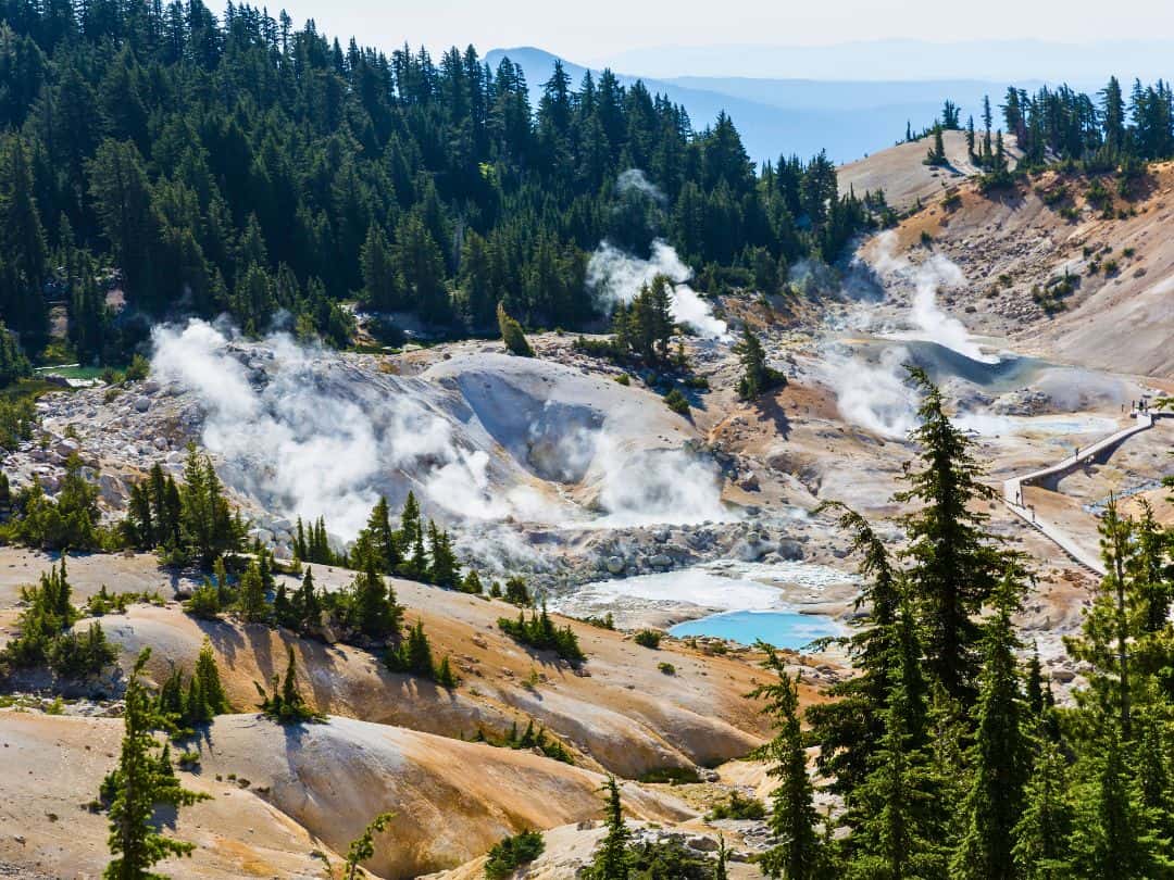
National Parks in California / Lassen Volcanic National Park (Bumpass Hell)
- Kings Creek Falls: Hike to Kings Creek Falls, a beautiful waterfall cascading over volcanic rock formations.
- Lassen Volcanic National Park Highway: Take a scenic drive along the Lassen Volcanic National Park Highway (CA-89), passing through diverse landscapes and providing access to various attractions.
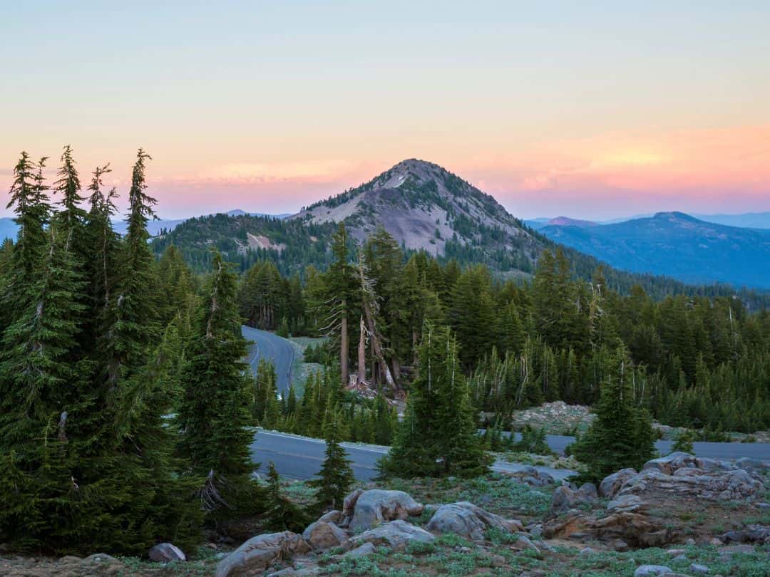
National Parks in California / Lassen Volcanic National Park Highway at Sunset
- Devil’s Kitchen: Explore Devil’s Kitchen, a hydrothermal area with mud pots and hot springs, accessible via a short hike.
- Manzanita Lake: Relax by the picturesque Manzanita Lake, offering reflections of Lassen Peak and opportunities for picnicking and canoeing.
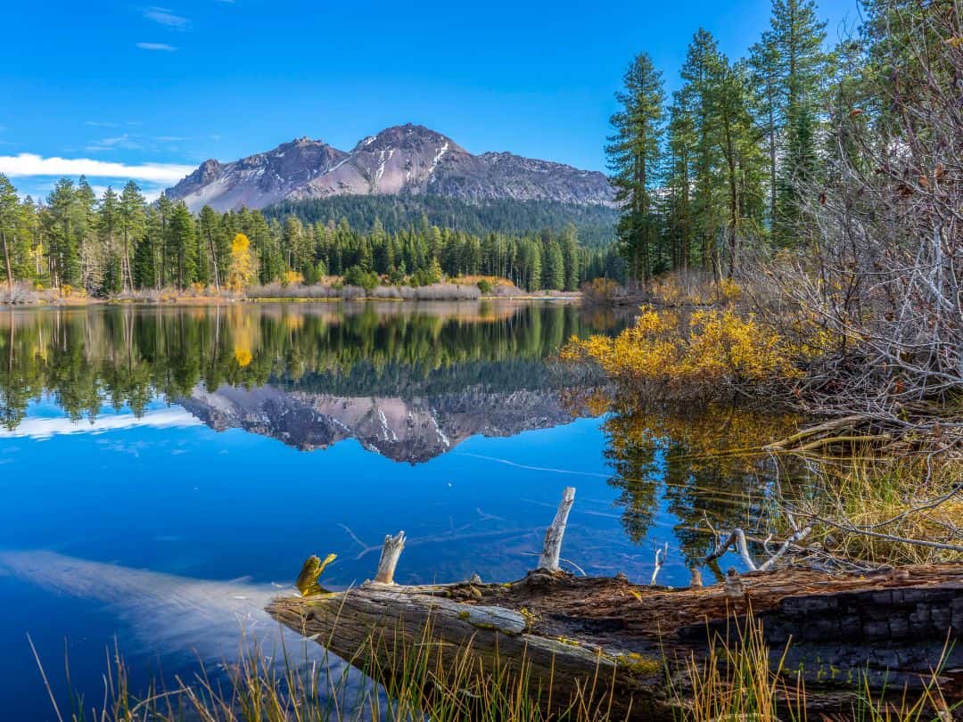
National Parks in California / Lassen Volcanic National Park (Manzanita Lake)
- Mill Creek Falls: Hike to Mill Creek Falls, a picturesque waterfall plunging into a lush canyon.
- Cinder Cone: Climb Cinder Cone, a volcanic cone featuring a vibrant red cinder slope and stunning views of the surrounding landscape.
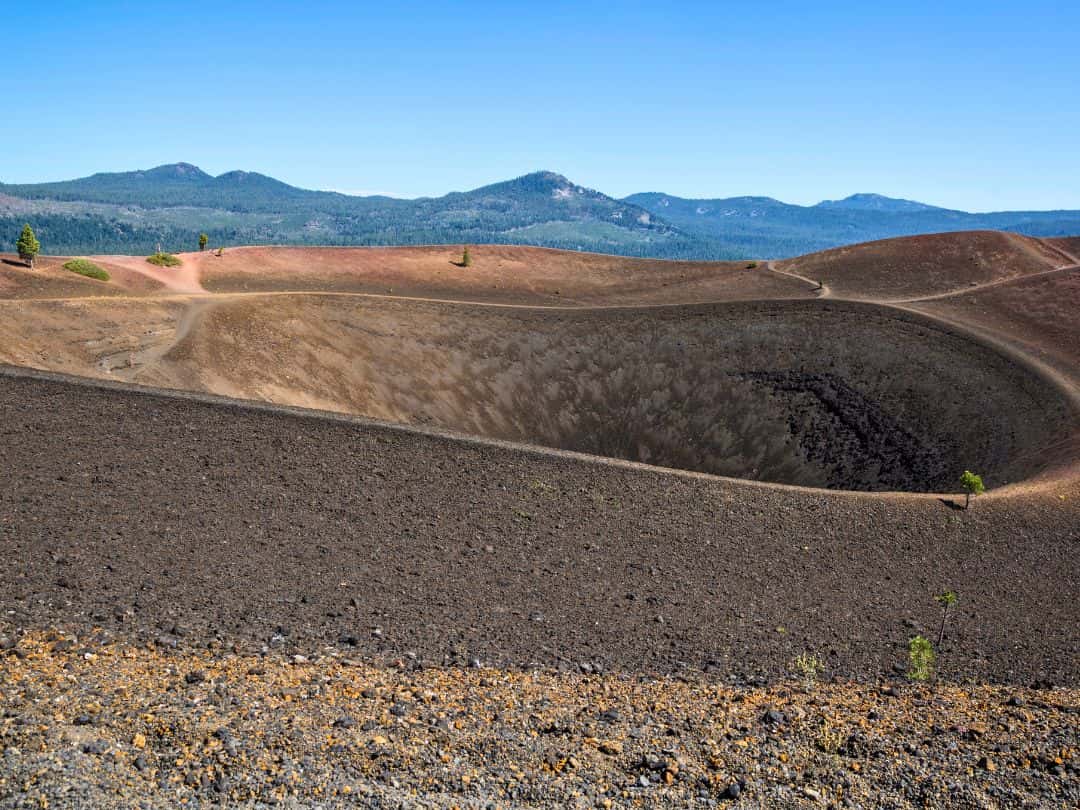
National Parks in California / Lassen Volcanic National Park (Cinder Cone)
- Lava Beds National Monument: located adjacent to Lassen Volcanic National Park, is a remarkable area filled with over 700 lava tube caves formed by volcanic eruptions.
- Stargazing: Enjoy incredible opportunities for stargazing in Lassen Volcanic National Park.
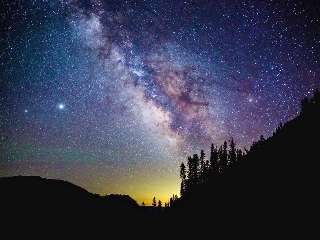
National Parks in California / Milky Way in Lassen Volcanic National Park
Ultimate Adventure in Lassen Volcanic National Park
- Summiting Lassen Peak: The ultimate adventure in Lassen Volcanic National Park is the exhilarating journey to summit Lassen Peak, the park’s iconic volcano.
This challenging yet rewarding hike offers breathtaking views as it takes you through diverse landscapes, from lush forests to volcanic rock formations, as you ascend to the summit.
At the top, you will be greeted with panoramic vistas of the surrounding Cascade Range, including the park’s other volcanic peaks and distant mountain ranges.
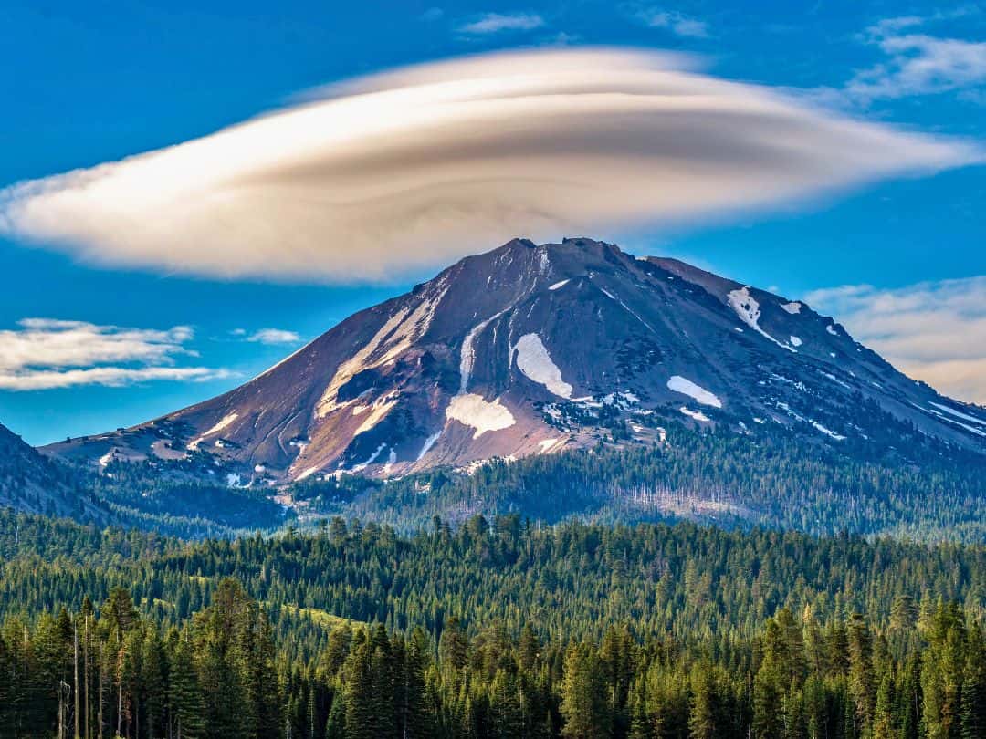
National Parks in California / Lassen Volcanic National Park (Lenticular Cloud Over Lassen Peak)
The Redwood National and State Parks (RNSP)
Quick Facts About the Parks
- Founded: Redwood National Park was established on October 2, 1968, and the other three state parks: Prairie Creek Redwoods State Park, Del Norte Coast Redwoods State Park, and Jedediah Smith Redwoods State Park joined the collective to create Redwood National and State Parks.
- Annual Visitors: The parks collectively attracted about 500,000 visitors in 2022.
- Size: Redwood National and State Parks cover a combined area of approximately 139,000 acres.
- Location: The parks are located along the northern California coast, extending from Crescent City in the north to Orick in the south.
- Entrance Fee: There was no entrance fee to access the Redwood National and State Parks.
- Notable Facts: Redwood National and State Parks are home to some of the world’s tallest trees, including the iconic coastal redwoods (Sequoia sempervirens), some of which reach heights exceeding 300 feet (about 91 meters). The parks’ coastal areas offer stunning views of rugged coastline, sea stacks, and pristine beaches. Redwood National and State Parks are designated as a UNESCO World Heritage Site and an International Biosphere Reserve, recognizing their exceptional natural and cultural significance.
3 Essential Tips for Unforgettable Visit to the Redwood National and State Parks
1. Best Ways to Get to the Redwood National and State Parks
- By Car: If you have access to a car, driving is the most convenient and flexible way to reach Redwood National and State Parks. The parks are located along the Northern California coast, and you can access them via major highways like US-101 and CA-199.
- By Air: If you are traveling from a distant location, you can fly to nearby airports and then rent a car to reach the parks. The closest major airports are Arcata-Eureka Airport (ACV) and Rogue Valley International-Medford Airport (MFR).
2. Best Way to Navigate Inside the Parks
- By Car: The most convenient way to get around Redwood National and State Parks is by car. The park has a well-developed road network that provides access to various scenic drives and points of interest.
3. Best Time to Explore the Parks (Time Your Visit Right)
- Late Spring (May to June): Late spring is an excellent time to visit the parks. The weather is mild and comfortable, with daytime temperatures ranging from 60°F to 70°F. The lush greenery is at its peak, and the wildflowers are in bloom.
- Summer (July to August): Summer is the most popular time to visit. The weather is generally warm, with daytime temperatures ranging from 65°F to 75°F. Be prepared for more crowds.
- Early Fall (September to October): Early fall is another great time to visit the parks. The weather remains pleasant, with daytime temperatures ranging from 60°F to 70°F. Fall foliage starts to appear in late September.
- Winter (November to April): While winter can be a quiet and peaceful time to visit, it is also the wettest season in the area. The parks receive significant rainfall during these months.
Top 10 Experiences in Redwoods You Can't Miss
- Redwood Creek Overlook: Visit the Redwood Creek Overlook, a viewpoint that provides sweeping vistas of the redwood forest and surrounding landscape.
- Avenue of the Giants: Drive or stroll along the Avenue of the Giants, a scenic route lined with towering ancient redwood trees, creating a mesmerizing canopy.
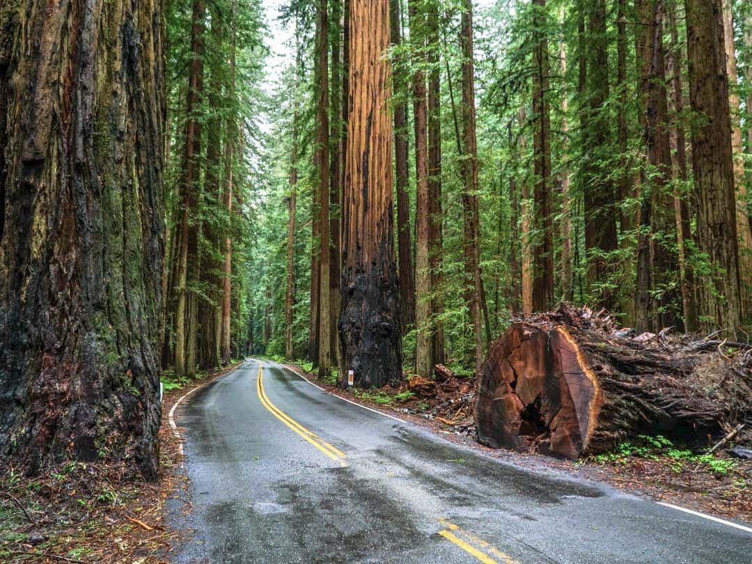
National Parks in California / Redwood National and State Parks (Avenue of the Giants)
- Klamath River Jet Boat Tours: Take a thrilling jet boat tour along the Klamath River, offering a unique perspective of the park’s natural beauty and abundant wildlife.
- Campfire Programs: Attend evening campfire programs led by park rangers to learn about the area’s natural and cultural history.
- Fern Canyon: Hike through the enchanting Fern Canyon, a lush gorge adorned with fern-covered walls, often featured in movies and TV shows.
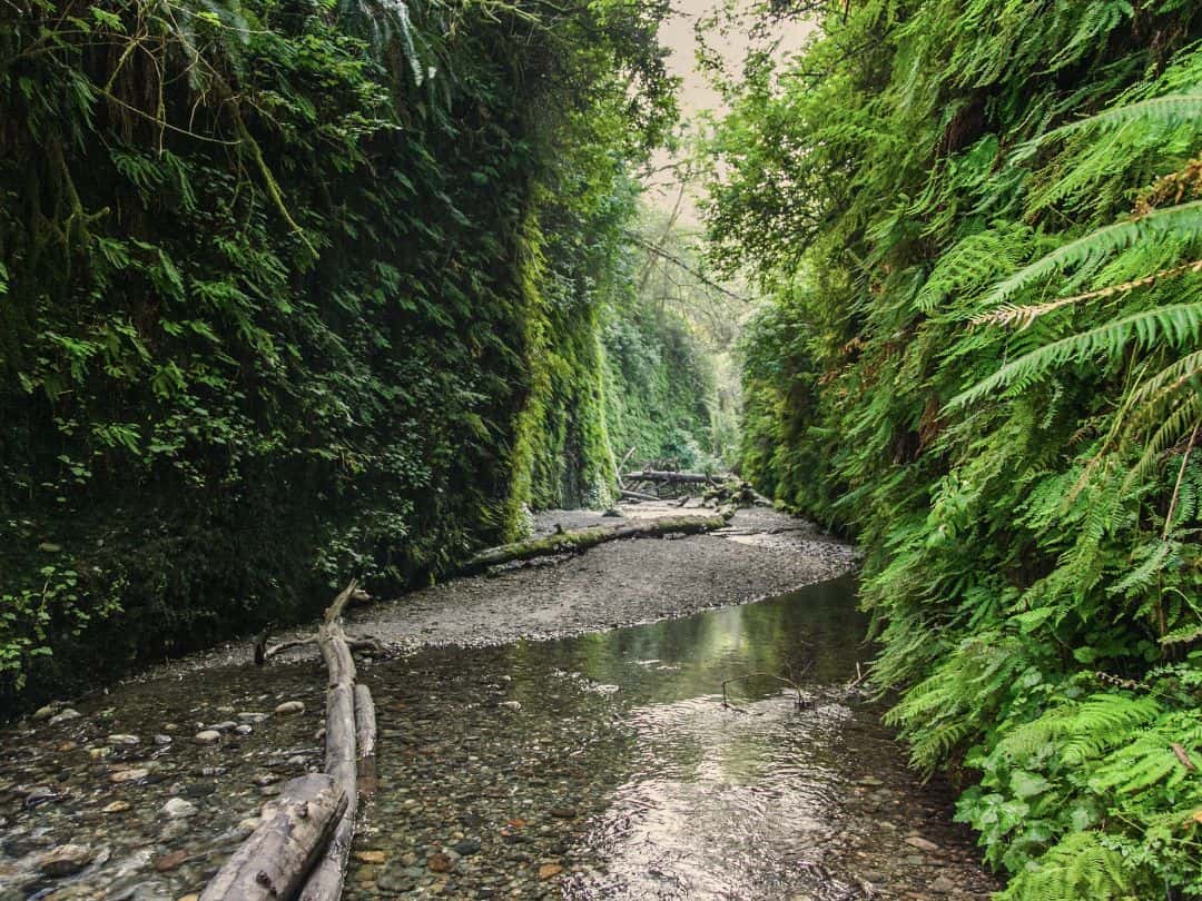
National Parks in California / Redwood National and State Parks (Fern Canyon)
- Tall Trees Grove: Hike to the secluded Tall Trees Grove, accessible by permit only, to witness some of the world’s tallest trees in a serene setting.
- Lady Bird Johnson Grove: Take a peaceful walk through the Lady Bird Johnson Grove Trail, named after the former First Lady, and marvel at the majestic redwoods.
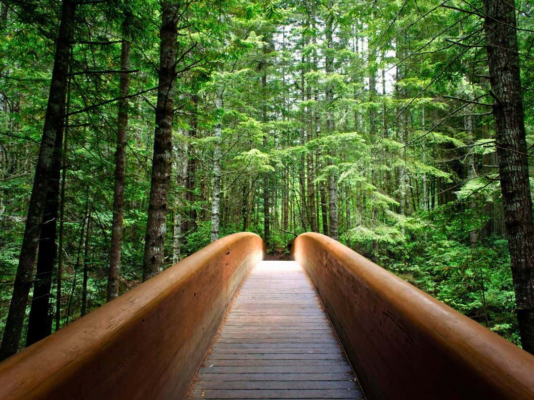
National Parks in California / Redwood National and State Parks (Lady Bird Johnson Grove)
- Wildlife Viewing: Look for wildlife such as Roosevelt elk, river otters, and various bird species while exploring the parks’ diverse ecosystems.
- Trillium Falls Trail: Enjoy a moderate hike on the Trillium Falls Trail, passing through a lush forest and culminating in a picturesque waterfall.
- Coastal Exploration: Visit the scenic coastal areas, such as Crescent Beach Overlook and Klamath River Overlook, for stunning views of the rugged coastline and the Pacific Ocean.
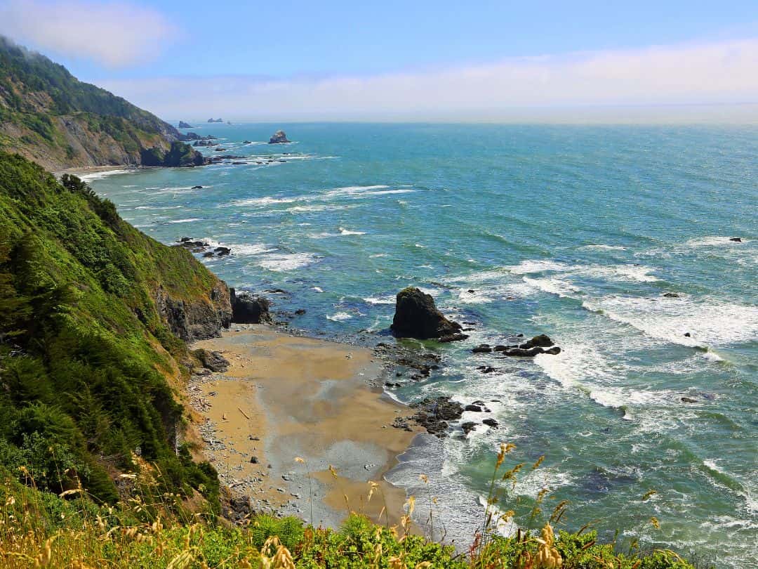
National Parks in California / Redwood National and State Parks (Crescent Beach Overlook)
Ultimate Adventure in Redwoods
Kayaking or Canoeing through Redwood Creek: Embark on an extraordinary adventure by kayaking or canoeing along Redwood Creek, which meanders through the heart of the redwood forest. Paddle gently through the tranquil waters, surrounded by towering redwoods that reflect on the surface, creating a magical and surreal experience.
Choose between a guided tour or a self-guided excursion, both of which provide an opportunity to immerse yourself in the serene beauty of the redwood forest. Whether you’re a seasoned paddler or a first-time kayaker, this ultimate adventure promises a sense of wonder and serenity, making it an unforgettable experience in Redwood National and State Parks.
Did You Find This Useful?
Why Not Save National Parks in California to Your Pinterest Board!
Now, It Is Your Turn, I Would Like to Hear Back from You!
Are you planning a trip to California?
Please let me know! Drop me a quick comment right below!
Click on any of the images below to get inspired and to help you with the planning process for your trip to California!
