This site uses affiliate links, meaning that if you make a purchase through our links, we may earn an affiliate commission.
Moab to Capitol Reef National Park is a classic Utah road trip! Within about 200-mile distance between Moab and Capitol Reef on the Capitol Reef Country Scenic Byway (UT-24), you can hike in Little Wild Horse Canyon, explore Goblin Valley, stop at Factory Butte, be awed by Waterpocket Fold, and finish off your drive with a stunning sunset at Panorama Point in Capitol Reef.
In this post, I cover all the best stops and things to do on a drive from Moab to Capitol Reef that will tick off all the major attractions on Capitol Reef Country Scenic Byway (UT-24). However, make sure to pick the ones that interest you the most. If you are an avid hiker then check out some of the hikes along the way, if you prefer to look at the scenery from the comfort of your car, then read about the best viewpoints and overlooks.
Since you are starting this road trip from Moab, UT, did you know that Moab is a perfect location to stay while visiting Arches and Canyonlands National Parks? Have you visited any of these parks yet?
Also, right in-between Arches and Canyonlands, you will find Dead Horse Point State Park with incredible views of Green and Colorado Rivers 2,000 feet below the cliffs (don’t miss it!)
So, check out 16 Best Stops on Scenic Drive in Arches National Park. However, if you only have one day in Arches, then read 8 Things You Can’t Miss on First Visit to Arches National Park which covers all the major viewpoints and hikes.
With only one day at Canyonlands, head to Island in the Sky District One Day in Island in the Sky at Canyonlands National Park. If you have more time, then make sure to check out The Needles District One Day in The Needles at Canyonlands National Park
And now, with no further delay, let’s dive into Moab to Capitol Reef National Park and cover all 9 excellent stops you can’t miss!
What You Need to Know About Moab to Capitol Reef Drive on Scenic Byway (UT-24)
Moab to Capitol Reef road trip starts on US-191 North, then follows on I-70 West, and finally merges onto UT-24 West (map is right below).
The total driving distance, including short side visits to Little Wild Horse Canyon, Goblin Valley, and Factory Butte, is over 200 miles. It takes about 4 hours and 30 minutes just to drive this distance without any stops. If you plan on stopping at a few of my recommended places, then you should plan to reserve an entire day.
Map of Moab to Capitol Reef with 9 Best Stops
Map of Moab to Capitol Reef with 9 best stops on Capitol Reef Country Scenic Byway (UT-24)
9 Best Stops Between Moab and Capitol Reef
There are so many great places to stop and things to do along the drive from Moab to Capitol Reef, that you will have a hard time deciding what to do. My recommendation is to go through my list and see what sounds the best and interests you the most.
At the end of this post, in the section Intrepid Scout’s Tips, I narrowed down all the stops and listed my favorite must-do things on this scenic drive.
Little Wild Horse Canyon
The first stop on this drive from Moab to Capitol Reef is Little Wild Horse Canyon. It is a stunning canyon that you simply cannot miss!
From UT-24 turn right into Temple Mountain Road and follow it until you reach a junction with Goblin Valley Road. At Goblin Valley Road turn left and continue until you reach a parking lot.
The trailhead to Little Wild Horse Canyon will be on your right.
The first part of the trail is pretty flat and open. At about 0.5 miles from the trailhead, you will reach a junction between Little Wild Horse Canyon Trail and Bell Canyon Trail. Turn right at the junction and continue your hike through Little Wild Horse Canyon.
Little Wild Horse Canyon Trail is 3.6 miles long starting at the junction with Bell Canyon and ending at Behind the Reef Road. However, you do not need to hike through the entire canyon and you can turn around at any point.
Little Wild Horse Canyon starts fairly wide, but soon it narrows and the walls grow taller.
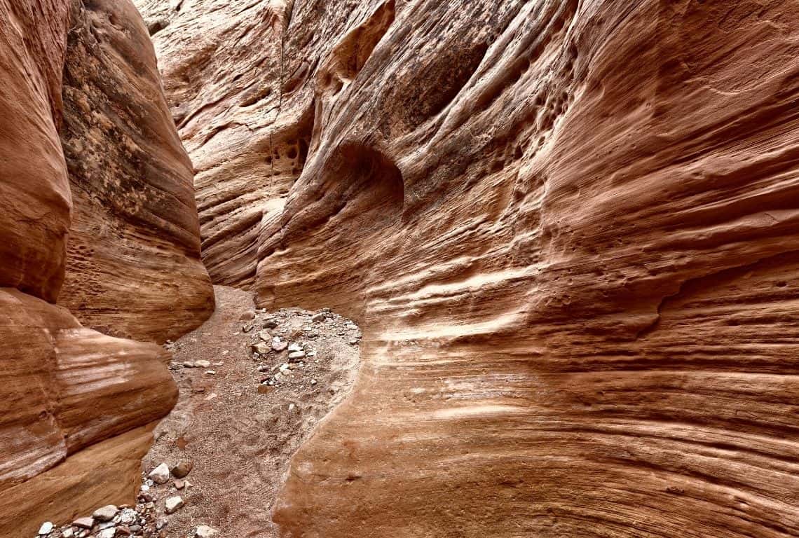
Little Wild Horse Canyon Trail is 3.6 miles long starting at the junction with Bell Canyon and ending at Behind the Reef Road / Moab to Capitol Reef
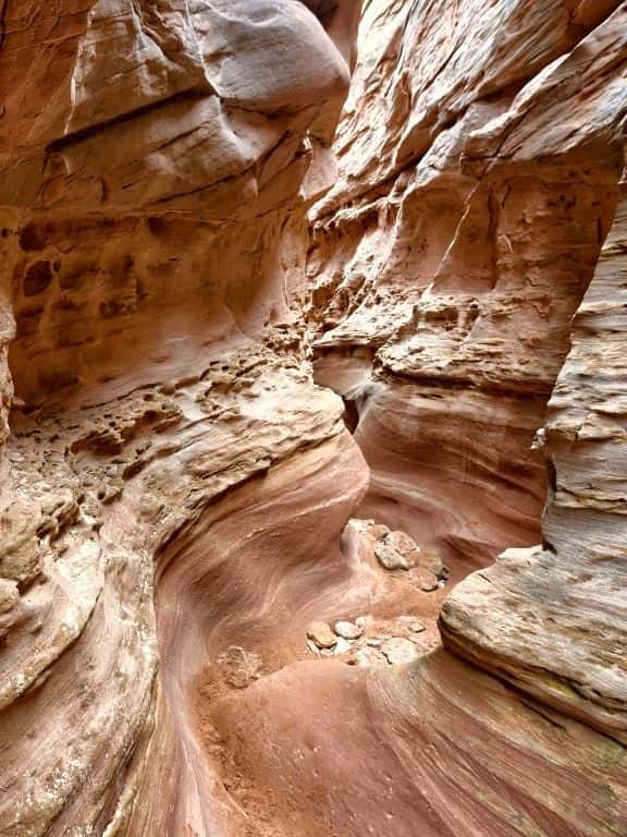
Little Wild Horse Canyon is absolutely stunning. It starts fairly wide, but soon it narrows and the walls grow taller / Moab to Capitol Reef
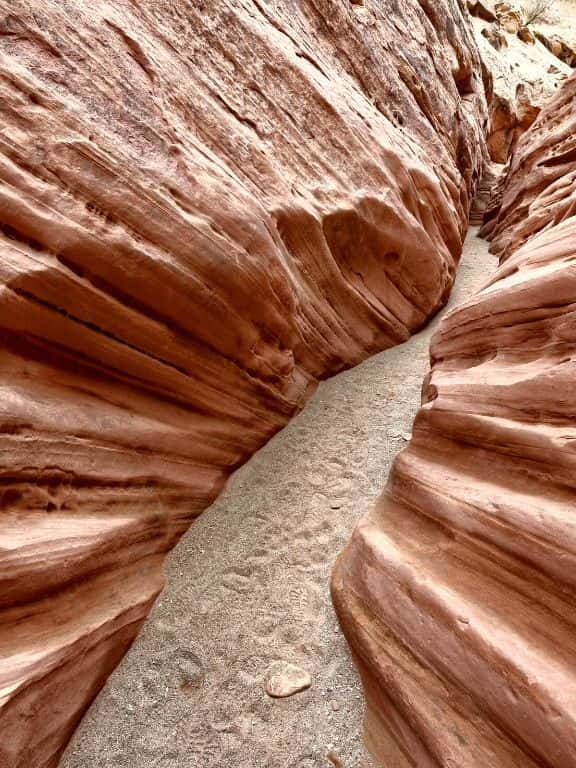
As you continue hiking in Little Wild Horse Canyon, you will be surrounded by tall walls with interesting patterns / Moab to Capitol Reef
Little Wild Horse Canyon Trail can be combined with Bell Canyon Trail to form a loop. Bell Canyon is different than Little Wild Horse Canyon. It is wider and as a result, more light can enter the canyon and it is easier to photograph. The colors are more vibrant as well.
Hands down! This loop is one of my favorite hikes on this Moab to Capitol Reef drive and I am recommending it. However, the entire loop is 8.1 miles long and it takes at least 4 hours to complete. So, doing the entire loop does not fit into this itinerary. However, you might want to save it for another time! I wrote a post about how to hike the loop, check it out (pictures are great): Little Wild Horse and Bell Canyon Loop Trail.
Goblin Valley State Park
Goblin Valley State Park is the next stop on Moab to Capitol Reef National Park road trip.
You will absolutely amazed by this place!
The park is situated in several valleys that were formed by seasonal washes. The valleys contain thousands of mushroom-shaped rock formations that resemble goblins.
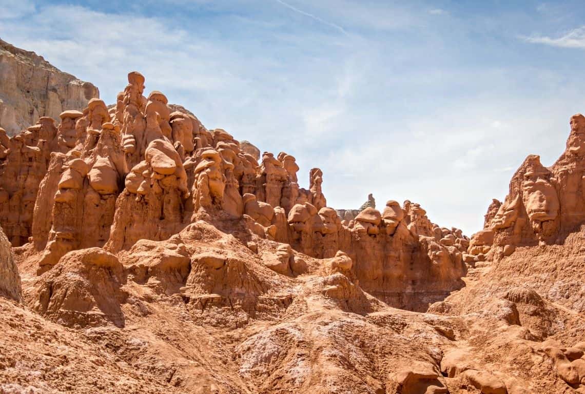
Goblin Valley State Park contains thousands of mushroom-shaped rock formations a few high that (yes!) resemble goblins / Moab to Capitol Reef
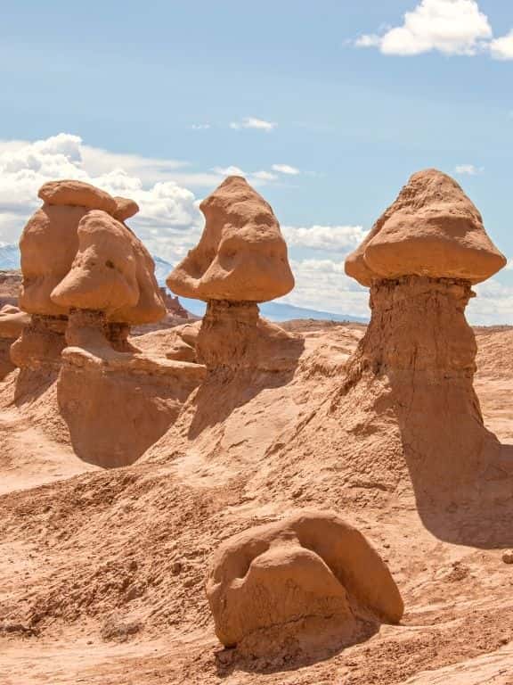
Goblin Valley State Park is absolutely stunning. You will have so much fun exploring the area / Moab to Capitol Reef
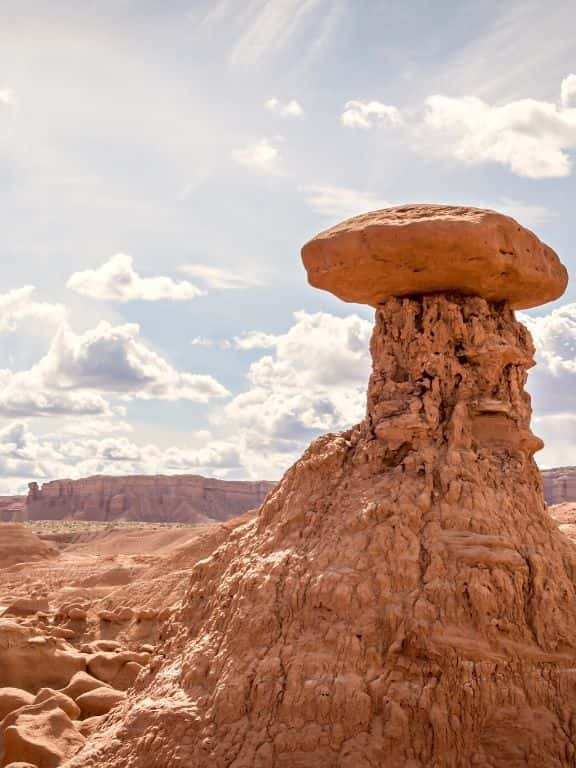
The different shapes and sizes of the rock formations will have you taking hundreds of photos / Moab to Capitol Reef
Goblin Valley State Park is easy to get to. After you finish exploring Little Wild Horse Canyon, hop back into your car and head back to Goblin Valley Road at the junction with Goblin Valley State Park. At the junction turn right and follow the road until you reach a large parking lot.
Goblin Valley State Park is fun to explore. There are no designated trails in the valleys and you can just wander around. Don’t worry, you will not get lost. You will be able to see the parking lot from almost any location in the valleys and you will easily find your way back.
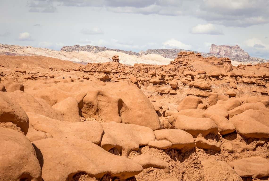
Goblin Valley State Park is fun to explore. There are no designated trails in the valleys and you can just wander around / Moab to Capitol Reef
You can spend an hour or 3 hours at the park, or if you want to stay longer, then there are 3 trails that will take you to different observation points. If this is something you would like to do then bookmark my post: How to Spend One Day in Goblin Valley State Park, Utah (3 Things You Can’t-Miss) for later.
Factory Butte and Skyline Rim Overlook
Next, hop back into your vehicle and continue to the next stop which is Factory Butte and Skyline Rim Overlook
Hands down, Factory Butte and Skyline Rim Overlook area is something that you can’t miss on Moab to Capitol Reef drive. The landscape is simply out of this world!
Factory Butte comes as close to a lunar formation as you can get on earth.
Skyline Rim Overlook will give you an awesome view of the landscape around Factory Butte with the ground of peculiar grey color with purple, pale yellow, and blue streaks running through.
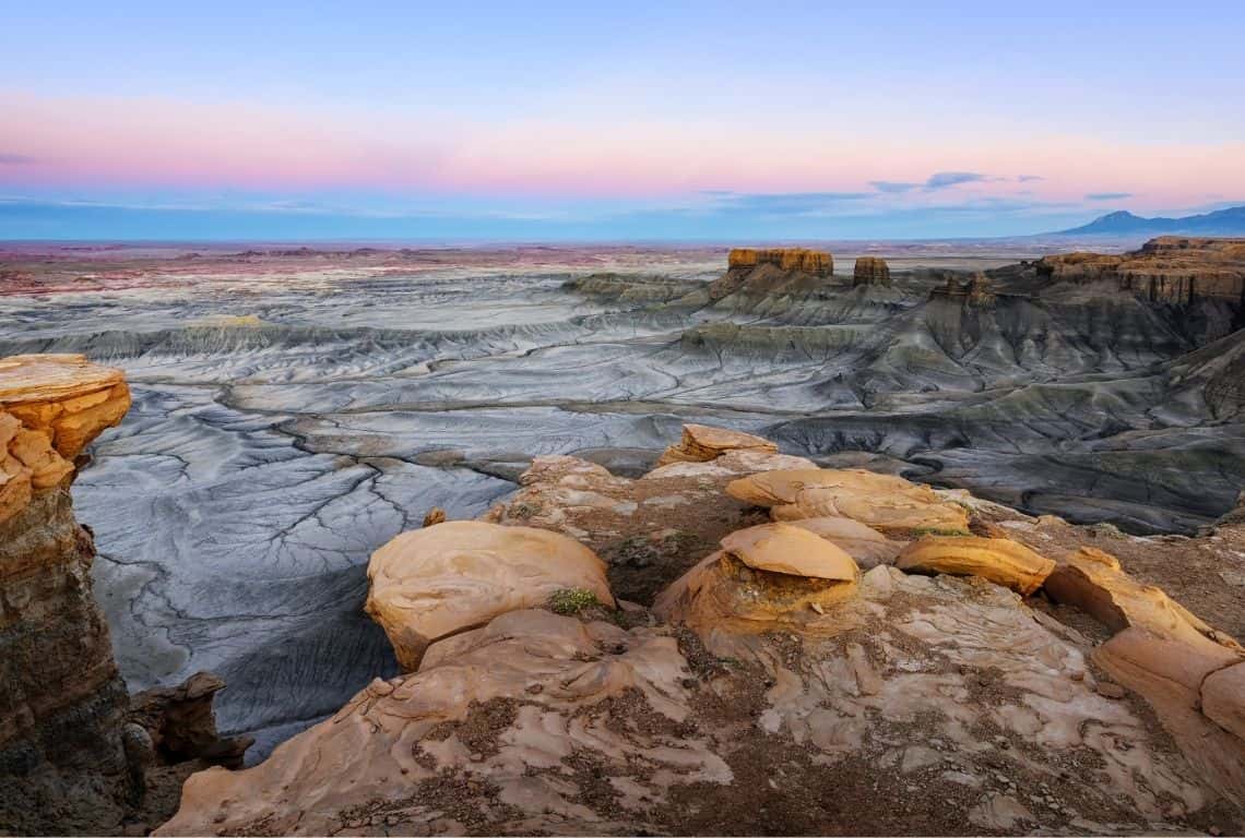
Skyline Rim Overlook will give you an awesome view of the landscape around Factory Butte / Moab to Capitol Reef
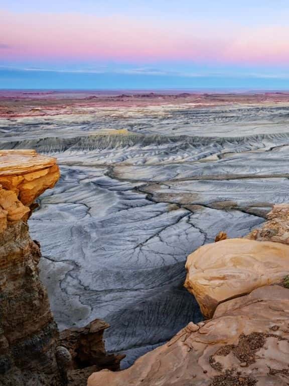
The colors are awesome, especially at sunrise or sunset, with peculiar grey colors, purple, pale yellow, and blue streaks running through / Moab to Capitol Reef
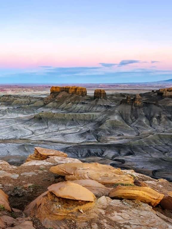
The view from Skyline Rim Overlook is the best at sunrise or sunset / Moab to Capitol Reef
Factory Butte and Skyline Rim Overlook are located right between Caineville and Hanksville, UT. Specifically, traveling from Moab to Capitol Reef, you will turn right (north) on Factory Butte Road which is located exactly 10.7 miles from Hansville.
Following is the detailed map and right below it, are specific instructions on how to get there:
Map of Factory Butte and Skyline Rim Overlook, UT / Moab to Capitol Reef
How to get to Factory Butte and Skyline Rim Overlook:
- Turn north on Factory Butte Road and stay on it for 6.05 miles until it reaches Skyline View Road. Skyline View Road will be on your right.
- Turn on Skyline View Road and continue on it (you will be going east) for 2.7 miles until you reach the end of the road and the overlook.
Once you get to Skyline Rim Overlook take a look to the south. You will see the Henry Mountains with its highest peak, Mount Ellen, standing at 11,552 feet. To the east, are the La Sal Mountains, and to the north San Rafael Swell.
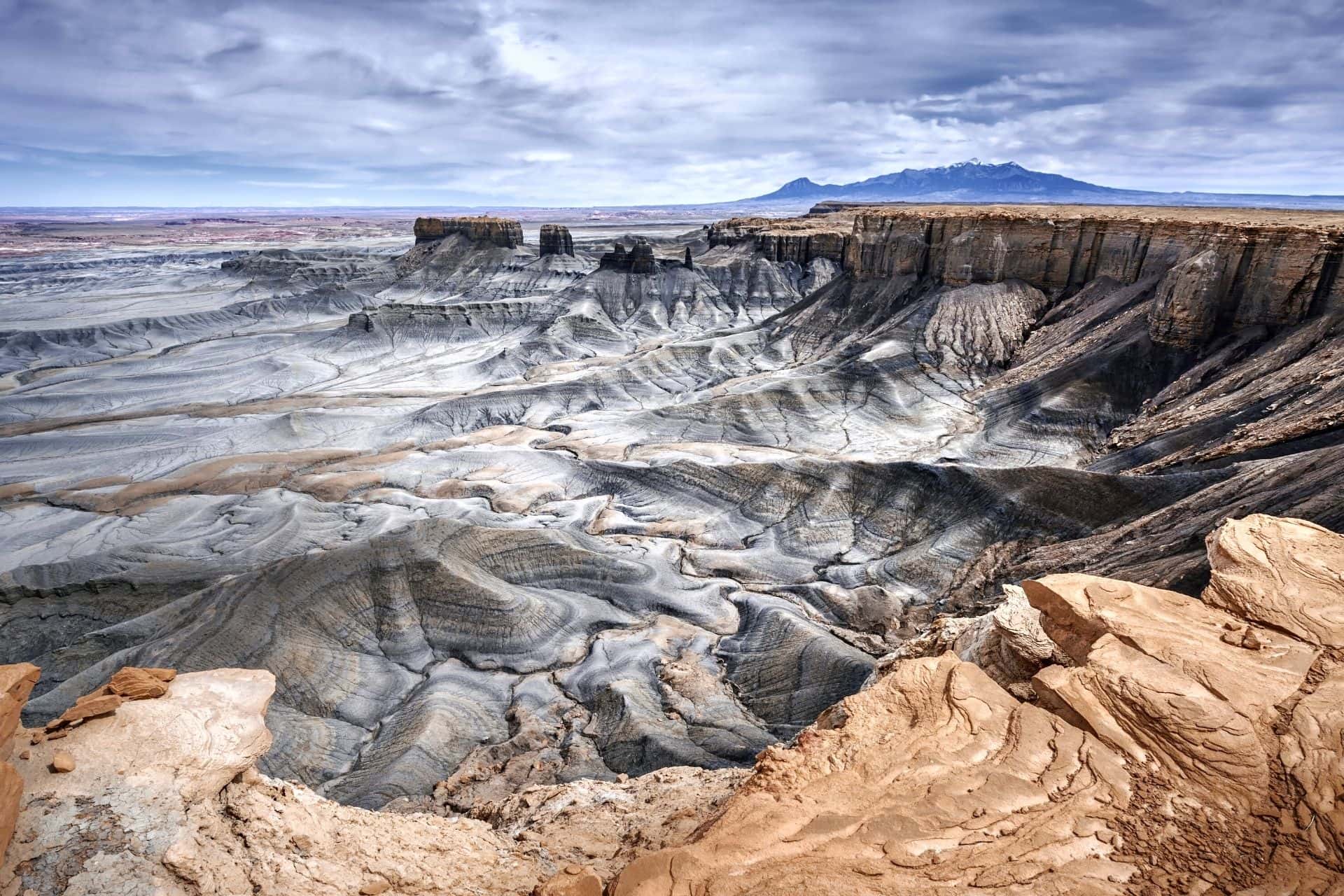
Once you get to Skyline Rim Overlook take a look to the south. You will see the Henry Mountains with its highest peak, Mount Ellen, standing at 11,552 feet / Moab to Capitol Reef
Actually a few tips!
- Factory Butte Road and Skyline View Roads are dirt roads, however, they are well-maintained and suitable for 2wd vehicles, if the weather conditions are dry (do not attempt to travel through this area after heavy rains).
- The best time of the day to visit Factory Butte and Skyline View Overlook is at about sunset time. The colors are stunning!
- Did you know that Skyline Rim is home to NASA’s Mars Research Station? Yup! It is pretty cool. Also, the Burpee Dinosaur Quarry is located in the Skyline Rim area.
- Finally, to clarify, Skyline Rim Overlook is sometimes called Moonscape Overlook. You might see both names being used.
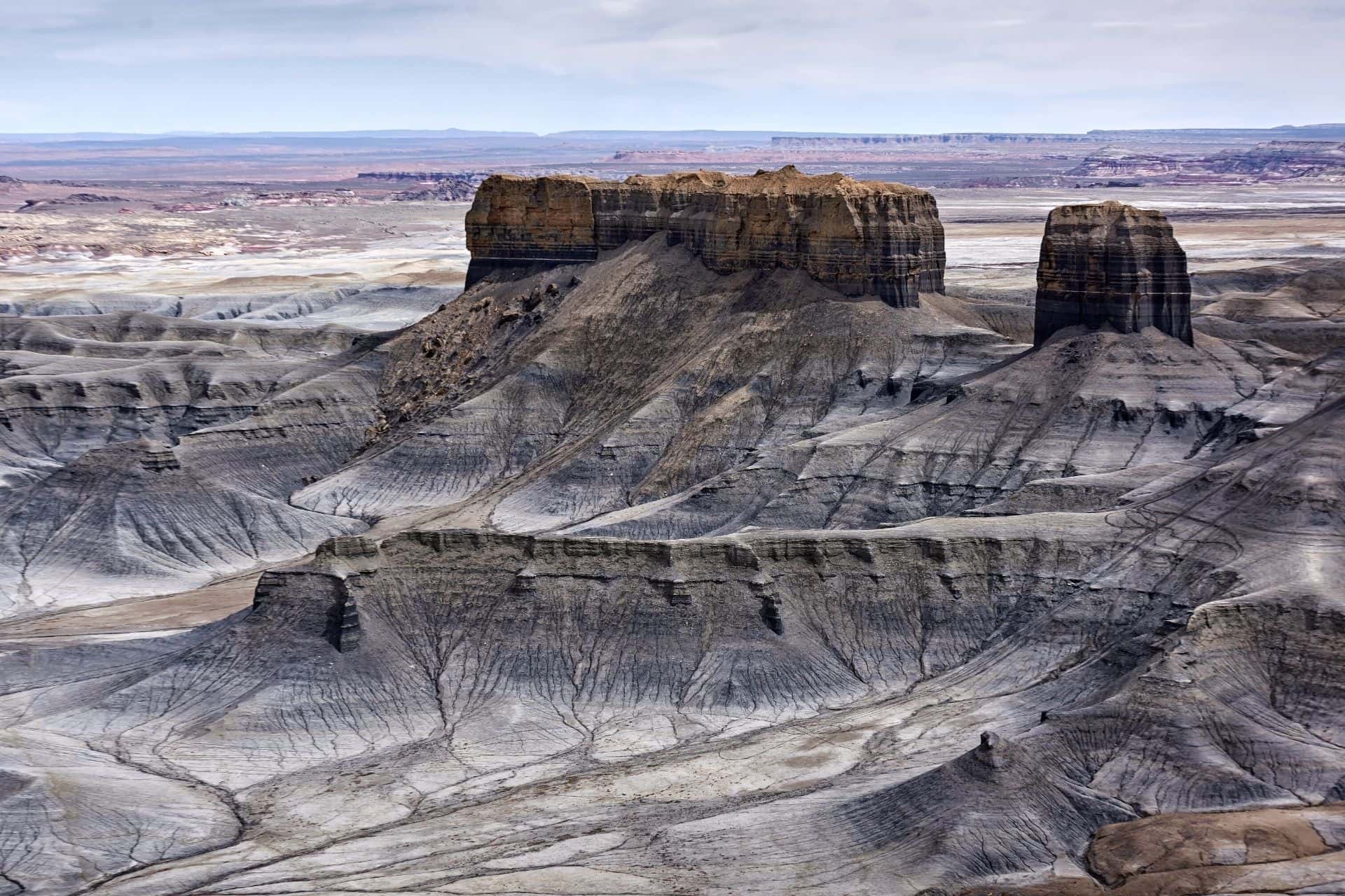
The best time of the day to visit Factory Butte and Skyline View Overlook is at about sunset time. The colors are stunning! / Moab to Capitol Reef
Waterpocket Fold
Next, you will be passing through Waterpocket Fold. It is the defining geologic feature of Capitol Reef National Park. And, needless to say, the views are absolutely stunning!
Many call the Waterpocket Fold a wrinkle on the earth’s surface. This wrinkle extends for nearly 100 miles, creating a dramatic landscape of rugged cliffs and canyons.
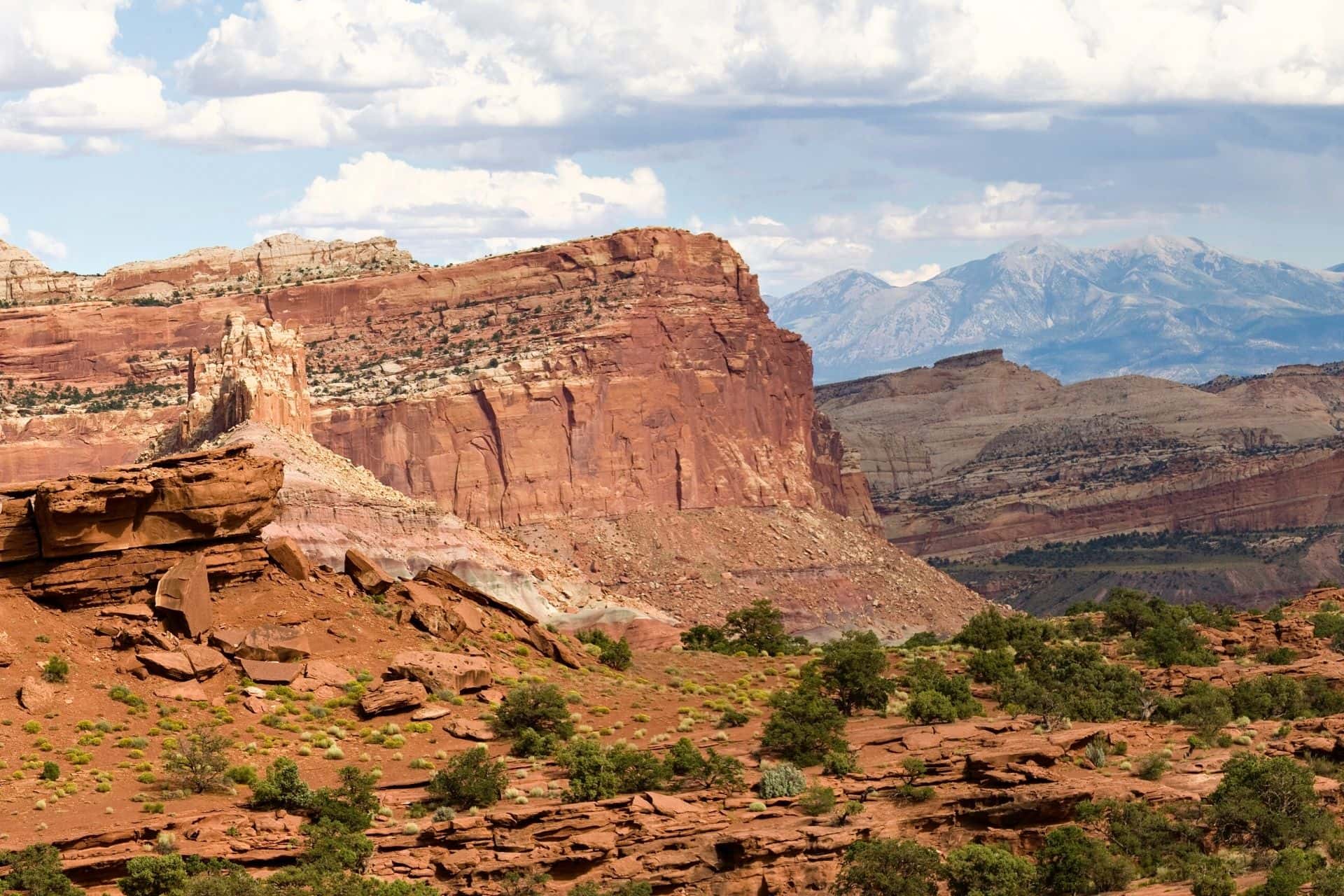
Waterpocket Fold is the defining geologic feature of Capitol Reef National Park / Moab to Capitol Reef
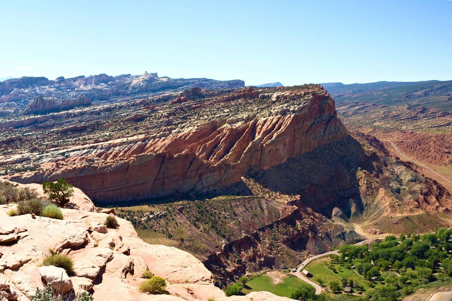
Many call it a wrinkle on the earth’s surface. This wrinkle extends for nearly 100 miles, creating a dramatic landscape of rugged cliffs and canyons / Moab to Capitol Reef
Capital Dome Viewpoint
Your next stop is Capitol Dome Viewpoint and you will get the best view of this famous rock formation right from the Hickman Bridge Trailhead.
Capitol Dome was named for the white domes of Navajo Sandstone that resemble capitol building domes.
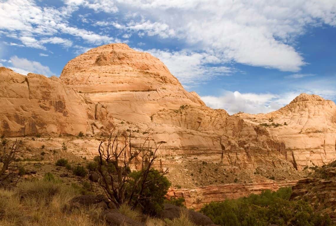
Capitol Dome is best viewed from the Hickman Bridge Trailhead, on Utah State Route 24, two miles (3.2 km) east of the Visitor Center / Moab to Capitol Reef
Hickman Bridge Trail
Next is Hickman Bridge Trail and hands down, Hickman Bridge Trail is the highlight of Capitol Reef National Park!
The trail will take you to a 133-foot natural arch on an incredibly scenic side of the canyon above the Fremont River surrounded by the great white domes of Navajo sandstone.
- Distance. – 1.8 miles round trip
- Elevation – 400 feet
- Time – 1-1.5 hours
- Difficulty – Moderate
Now, what you need to know is that you can continue up to Rim Overlook/NavajoKnobs Trail. Rim Overlook is 4.6 miles round trip with an elevation change of 1,110 feet. Navajo Knobs is 9.4 miles with an elevation change of 1,620 feet.
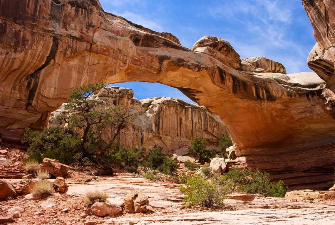
Hands down, Hickman Bridge Trail is the highlight of Capitol Reef National Park! The trail will take you to a 133-foot natural arch on an incredibly scenic side of the canyon above the Fremont River / Moab to Capitol Reef
Petroglyphs Panels
The next stop is Petroglyphs Panels.
What you need to know is that the Fremont Culture lived in what is now Utah for about one thousand years, from 300 to 1300 Common Era (CE). Petroglyphs (images carved or pecked into stone) are one of the most visible aspects of their culture that remains.
Archeologists named these people the Fremont Culture, for the Fremont River canyon where they were first defined as a distinct culture.
The Fremont Culture petroglyphs along Utah State Route 24 are accessible by two wooden boardwalks. Make sure to bring a pair of binoculars to get a closer view of human-like petroglyphs, as well as bighorn sheep petroglyphs, and other animals and geometric designs.
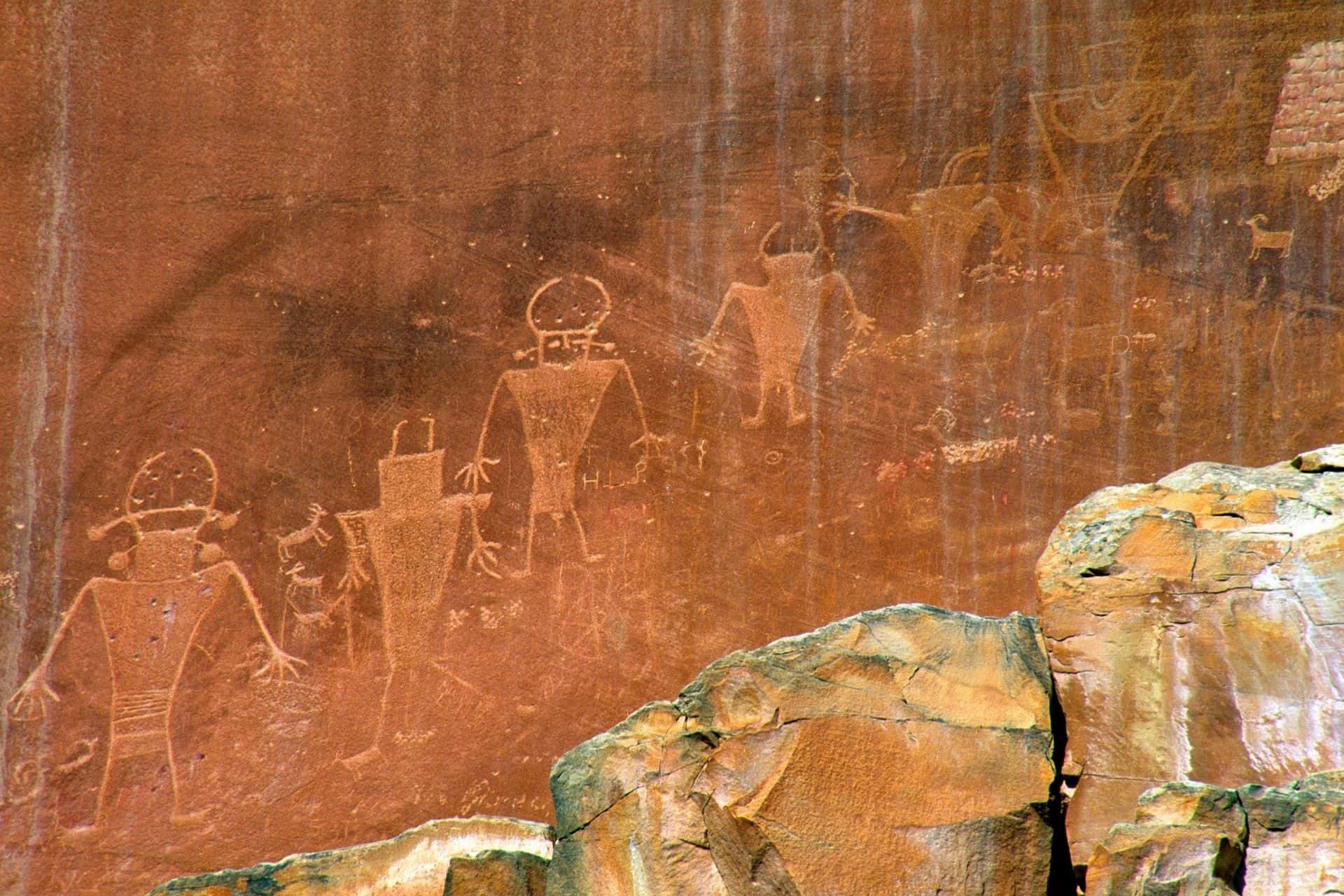
Fremont Culture lived in what is now Utah for about one thousand years, from 300 to 1300 Common Era (CE) / Moab to Capitol Reef
Sunset Point Trail, Panorama Point, Goosenecks Overlook
So, originally, I was going to list all these places separately, but they are all together along Goosenecks Road. So here we go!
Take Goosenecks Road, right off UT-24, and follow it for no more than 0.1 miles to Panorama Point with great views of Chimney Rock which sits right on the border of UT-24. You will love the views from this vantage point!
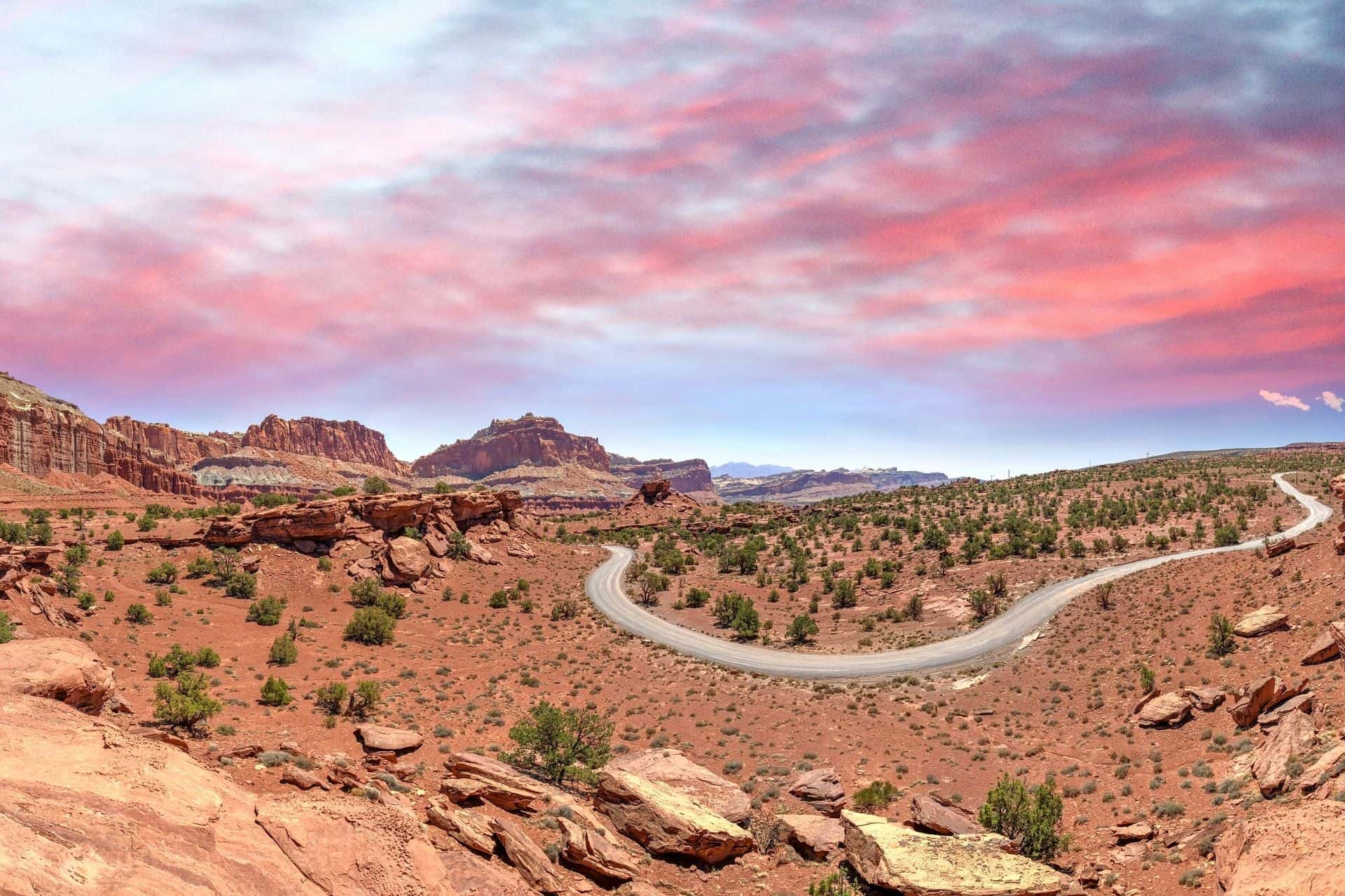
Take Goosenecks Road, right off UT-24, and follow it for no more than 0.1 miles to Panorama Point with great views of Chimney Rock which sits right on the border of UT-24 / Moab to Capitol Reef
Next, follow the road to the very end. There will be a small parking lot.
First of all, from the parking lot take a footpath to Sunset Point (the path will be on your left):
- Distance – 0.8 round trip
- Time – 30 minutes
- Difficulty – easy
The path follows the rim of the canyon of Sulphur Creek to an awesome viewpoint atop a red rock ridge. The views are off the charts here! And, in my opinion, it is the best place to watch the sunset in Capitol Reef National Park.
Next, retrace your steps and get back to the parking lot. After you reach the parking lot, take another path located on your left and follow it to Goosenecks Overlook.
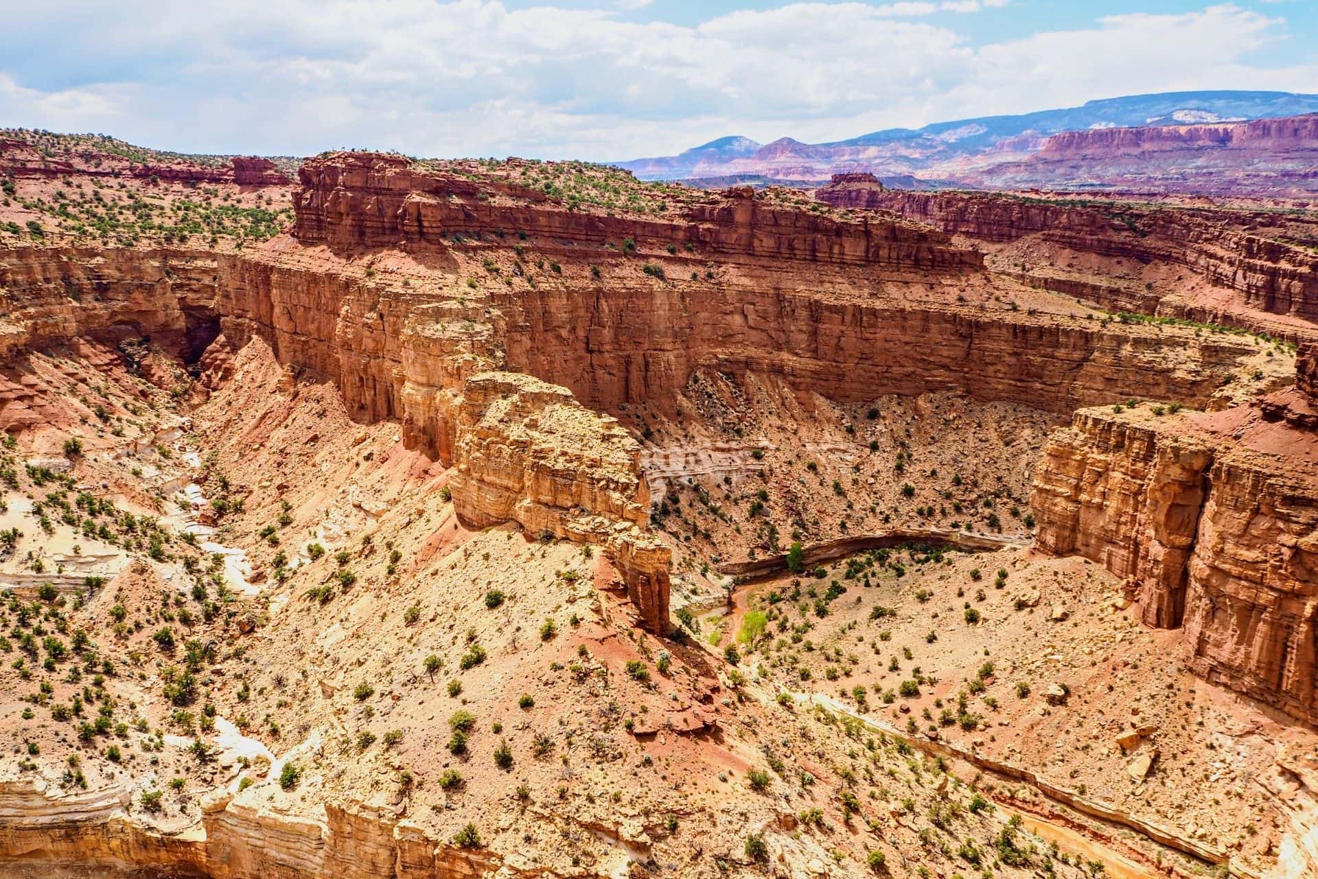
The views are off the charts here! And, in my opinion, it is the best place to watch the sunset in Capitol Reef National Park / Moab to Capitol Reef
Chimney Rock Trail
The last stop is Chimney Rock Trail is a short but pretty strenuous trail that will take you to a high elevation point with some incredible panoramas of Waterpocket Fold’s cliffs.
Chimney Rock Trail gets its name from the famous Chimney Rock standing tall alongside UT 24, a rock formation of eroded red sandstone resembling a pillar.
If you are up to this hike, then set aside at least 2 hours to get it done. The panoramas of the Waterpocket Fold are the best at sunset, so if your time allows, schedule this hike in the late afternoon.
- Distance – 3.6 miles (loop)
- Elevation – 590 feet
- Time – 2-3 hours
- Difficulty – Strenuous
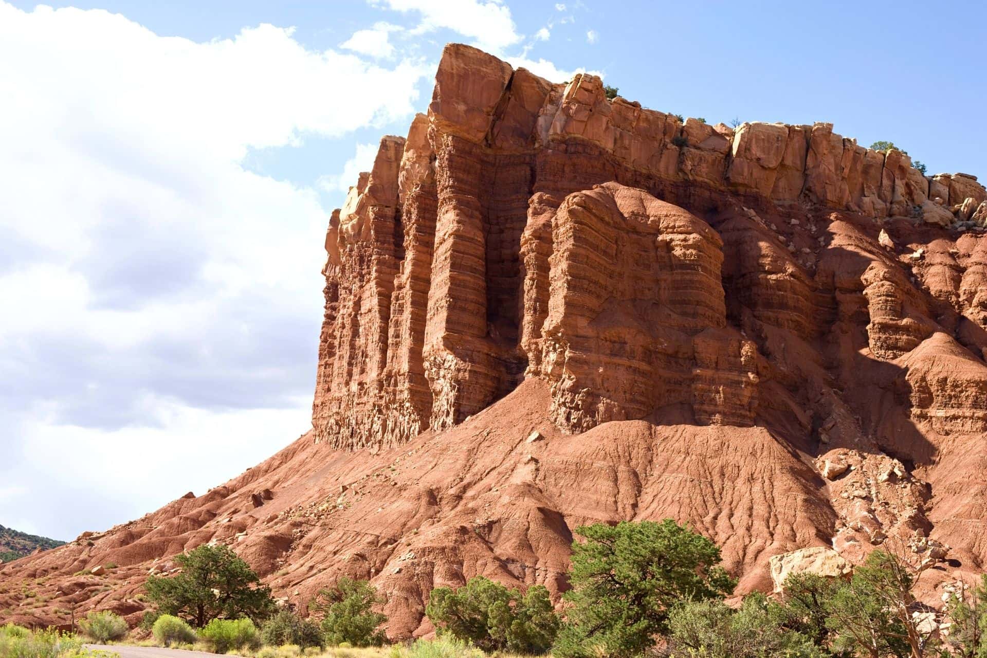
Chimney Rock Trail gets its name from the famous Chimney Rock standing tall alongside UT 24, a rock formation of eroded red sandstone resembling a pillar / Moab to Capitol Reef
Intrepid Scout's 3 Favorite Stops from Moab to Capitol Reef
So, this is a lot of stops and places to see, and things to do between Moab and Capitol Reef. What if you only have time to do a few things? Here are my favorite 5 stops between Moab and Capitol Reef:
- Little Wild Horse Canyon – if you can only do one thing on this drive from Moab to Capitol Reef, then, my recommendation is to do the hike in Little Wild Horse Canyon. It is a fun hike with awesome scenery.
- Goblin Valley State Park – it is an amazing place and the rock formations are out of this world.
- Factory Butte and Skyline Rim Viewpoint – the lunar landscape of Factory Butte with the views from Skyline Rim will have you absolutely mesmerized! Don’t miss this place!
- Hickman Bridge Trail – it is the highlight of Capitol Reef National Park. Make sure to hike to this incredible rock formation.
- Goosenecks Overlook – the views from Goosenecks Overlook are off the charts. It is a perfect spot to watch the sunset in Capitol Reef National Park.
So to sum up: so, the drive from Moab to Capitol Reef is about 4 hours. Then my recommendation is to spend about 1 hour at Little Wild Horse Canyon. Next, spend no more than 1 hour at Little Goblin Valley State Park and no more than 1 hour at Factory Butte. If you are doing ok with time, then hike to Hickman Bridge. If it is getting late, then head straight for sunset to Goosenecks Overlook.
More Information About Capitol Reef National Park
8 Best Stops on SCENIC DRIVE in CAPITOL REEF National Park (Map+ Practical Tips)
You Might Also Like:
8 Things You Can’t Miss on FIRST VISIT to ARCHES National Park
ONE DAY in THE NEEDLES at Canyonlands National Park (8 Things You Can’t Miss)
One Day in ISLAND in the SKY at CANYONLANDS (11 Things You Can’t Miss)
2 DAYS in MESA VERDE National Park (Perfect Itinerary for First Visit)
Did You Find Moab to Capitol Reef: 9 Best Stops on Capitol Reef Country Scenic Byway (UT-24) Useful?
Why Not Save It to Your Pinterest Board!
Now, It Is Your Turn, I Would Like to Hear Back from You!
Are you planning your trip to Utah? Please let me know! Drop me a quick comment right below!
Click on any of the images below to get inspired and to help you with the planning process for your trip to Utah!
