This site uses affiliate links, meaning that if you make a purchase through our links, we may earn an affiliate commission.
Black Canyon of the Gunnison is one of those parks that stays with you. The dramatic cliffs, narrow canyon walls, and the roaring Gunnison River far below are like nothing else.
If you’re wondering how to visit Black Canyon of the Gunnison, this guide will help you plan—from getting there and what to know, to the can’t-miss overlooks and trails. Whether it’s your first visit or you’re returning for more, there’s always something incredible to discover.
- 1. Where Is Black Canyon of the Gunnison and How to Get There
- 2. Hours, Fees, Best Time to Visit, and How to Get Around
- 3. Key Info and Handy Tips
- 4. Map of Black Canyon of the Gunnison
- 5. Things You Can't Miss When Visiting Black Canyon of the Gunnison
-
- 5.1. South Rim Drive
- 5.2. The Warner Point Nature Trail
- 5.3. East Portal Road
- 5.4. North Rim Overlooks
- 5.5. Stargazing
Where Is Black Canyon of the Gunnison and How to Get There
Black Canyon of the Gunnison National Park is in western Colorado, about 15 miles east of Montrose and roughly 63 miles southwest of Gunnison.
- The park is divided into two main areas:
South Rim Entrance is the most popular side, with a visitor center, a main scenic drive, and several trailheads. North Rim Entrance is quieter and more rugged, ideal for escaping crowds.
- Getting to the South Rim:
If you are coming from Montrose, head east on US-50 for about 7 miles, then turn left onto CO-347. It’s another 6 miles to the park entrance. If you are traveling from Gunnison, take US-50 west for approximately 60 miles, then turn right onto CO-347.
- Getting to the North Rim:
If you are coming from Crawford, drive along CO-92 and turn onto Black Canyon Road. Follow it for 11 miles to the entrance. Keep in mind this road is unpaved in parts.
PRO TIP: If you’re coming from farther away, Montrose is the best base. It’s a 20-minute drive to the South Rim and has lodging, restaurants, and amenities.
Hours, Fees, Best Time to Visit, and How to Get Around
Here’s the scoop on the practical stuff:
- Hours:
The South Rim is open year-round, but the North Rim is seasonal—usually open mid-April to mid-November. If you’re visiting in winter, the South Rim Drive is partially closed to vehicles but open for snowshoeing and cross-country skiing.
- Fees:
It costs $30 per car to get in, $25 for motorcycles, and $15 if you’re on foot or biking. Got an America the Beautiful Pass? You’re covered.
- Best Time to Visit:
Spring to early fall is the best time. The weather is mild, all the trails and overlooks are accessible, and the scenery is stunning. Fall (late September and October) brings gorgeous autumn colors to the Gunnison Valley. Winter is perfect for a quiet visit, but South Rim Drive is only open to snowshoers and skiers past Gunnison Point.
- Getting Around:
The South Rim Drive is a 7-mile paved road with 12 overlooks. It’s perfect for a half-day visit or a slow-paced drive with plenty of stops.
East Portal Road: A steep, narrow road (16% grade!) that winds down to the Gunnison River. It’s seasonal and not suitable for vehicles over 22 feet.
The North Rim Drive offers fewer stops but equally jaw-dropping views.
Key Info and Handy Tips
- Altitude: The park sits between 5,000 and 8,000 feet above sea level. Take it slow, drink water, and watch for altitude sickness if you’re not used to higher elevations.
- Cell Service: Don’t count on it! Coverage is extremely limited, especially on the North Rim. Download maps and details before you go.
- Pets: Pets are allowed in parking areas, campgrounds, and some paved paths, but not on trails or overlooks.
- Weather: Mornings can be chilly, even in summer. Pack layers and don’t forget sunscreen—it’s easy to get sunburned at higher altitudes.
- Safety: The canyon edges are sharp and steep. Always stay on marked trails and keep an eye on kids near the overlooks.
Map of Black Canyon of the Gunnison

Map Credit: NPS
Things You Can't Miss When Visiting Black Canyon of the Gunnison
South Rim Drive
South Rim Drive is the heart of Black Canyon of the Gunnison National Park, offering a stunning 7-mile scenic route packed with 12 overlooks.
Each stop reveals a unique perspective of the dramatic canyon, carved by the Gunnison River over millions of years.
PRO TIP: Plan to spend 2–3 hours exploring all the overlooks.
Here’s a detailed guide to every stop along the drive:
- Tomichi Point (Mile 1.2): This is your first introduction to the canyon’s grandeur. It’s conveniently located near the entrance and provides breathtaking views with minimal effort. Rim Rock Trail passes through here, making it a great spot to start exploring.
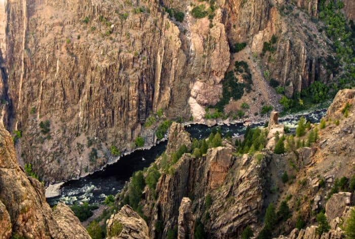
- Visitor Center (Mile 1.5): Stop by the Visitor Center for exhibits, a short film about the park, and information about permits for exploring deeper into the canyon. The Gunnison Point overlook behind the center offers incredible views of the canyon’s dramatic drops.
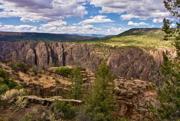
Gunnison Point / How to Visit Black Canyon of the Gunnison
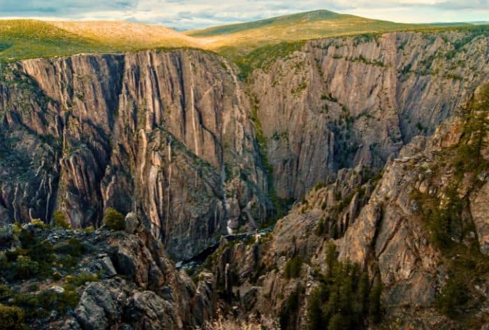
Gunnison Point / How to Visit Black Canyon of the Gunnison
Gunnison Point / How to Visit Black Canyon of the Gunnison
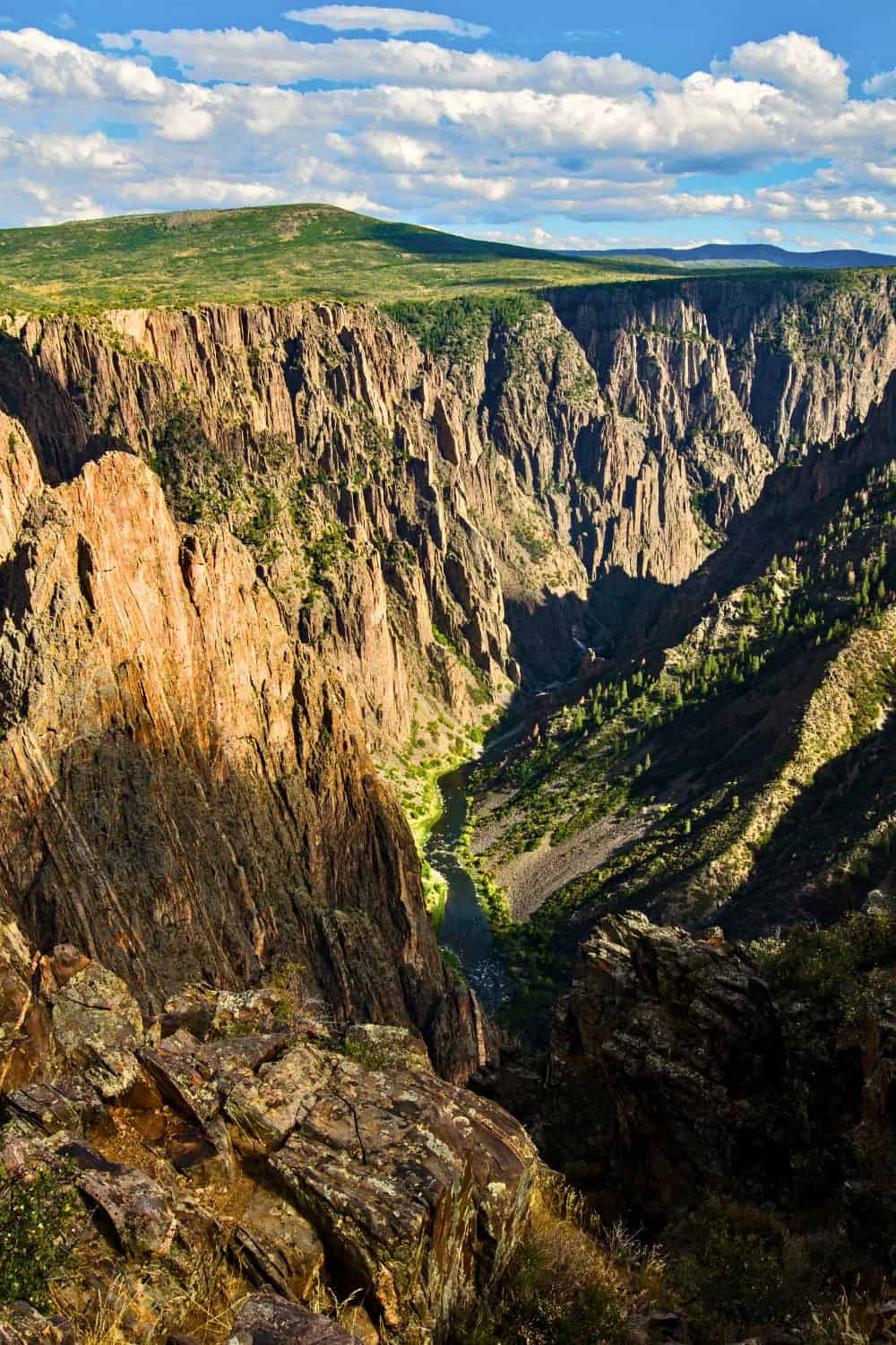
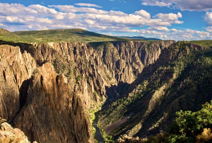
- Pulpit Rock Overlook (Mile 3.3): A short walk brings you to this viewpoint, where a rocky promontory juts out over the canyon, offering striking views of the rugged walls.
Pulpit Rock Overlook / How to Visit Black Canyon of the Gunnison
Pulpit Rock Overlook / How to Visit Black Canyon of the Gunnison
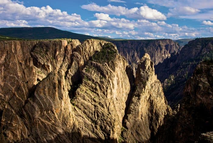
- Cross Fissures (Mile 4.0): Here, you can observe deep cracks in the canyon’s walls. The fissures show the immense forces that shaped the terrain.
Cross Fissures / How to Visit Black Canyon of the Gunnison
- Rock Point (Mile 4.1): This overlook offers more awe-inspiring views of the canyon. A short trail leads to the viewpoint.
- Devil’s Overlook (Mile 4.2): With a name like this, you can expect dramatic views! This stop showcases the canyon’s depth and the relentless power of the Gunnison River below.
- Chasm View (Mile 5.2): This overlook features one of the narrowest points in the canyon, with sheer walls that are only 1,100 feet apart. The scale and steepness here are jaw-dropping.
- Painted Wall Overlook (Mile 5.3): The Painted Wall is the tallest vertical cliff in Colorado, standing at 2,250 feet. Streaks of lighter-colored pegmatite rock cause its striking patterns.
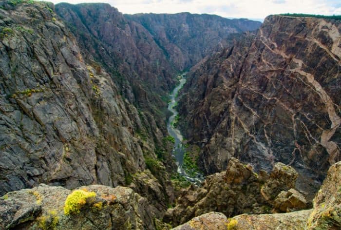
Painted Wall / How to Visit Black Canyon of the Gunnison
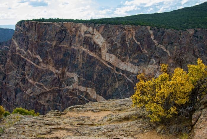
Painted Wall / How to Visit Black Canyon of the Gunnison
- Cedar Point (Mile 5.7): A short nature trail leads to Cedar Point, where you can enjoy expansive views of the canyon, including another perspective of the Painted Wall.
- Sunset View (Mile 6.7): As the name suggests, this spot is perfect for catching the sunset. It also features a picnic area, making it an ideal place to relax and soak in the scenery.
- High Point (Mile 7.6): The road ends here at the deepest point of the canyon, 2,660 feet. You’ll find a picnic area and the trailhead for the Warner Point Nature Trail, which offers more incredible views and a chance to explore the surrounding pinyon-juniper forest.
The Warner Point Nature Trail
The Warner Point Nature Trail is a great hike located at the westernmost point of the South Rim Drive in Black Canyon of the Gunnison.
At just 1.5 miles round trip, it is a relatively easy trail. It gains about 80 feet in elevation, which might feel slightly challenging due to the altitude—over 8,000 feet above sea level.
The trail leads to a stunning overlook where you’ll get panoramic views of the Gunnison Valley, the San Juan Mountains, and parts of the Black Canyon itself.
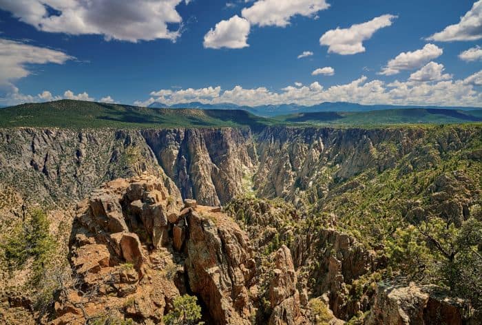
Warner Trail / How to Visit Black Canyon of the Gunnison
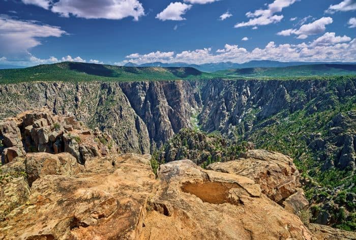
Warner Trail / How to Visit Black Canyon of the Gunnison
There are interpretive signs along the way that share details about the area’s unique geology, plant life, and history. You’ll also notice the pinyon pines and juniper trees typical of the region’s semi-arid ecosystem.
One of the most interesting aspects of this trail is its historical connection—it’s named after Mark Warner, who played an integral role in preserving the canyon as a national park.
Because this trail is at the end of South Rim Drive, it’s a great way to wrap up your visit to the South Rim area of the park!
East Portal Road
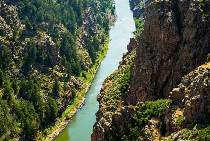
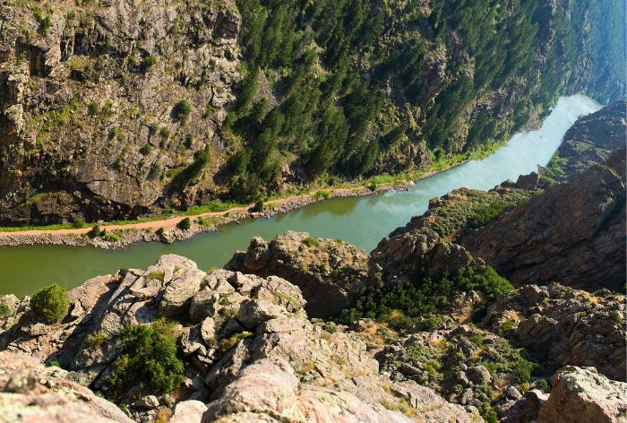
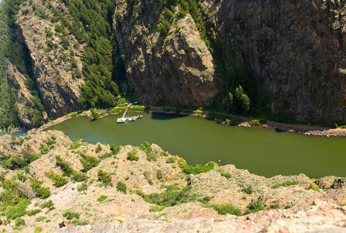
East Portal Road offers one of the most exciting ways to experience the Black Canyon—by heading straight to its depths!
The 5.2-mile drive descends over 1,800 feet, with grades as steep as 16%.
Plan for 1-2 hours to fully experience the road, including stops to explore the river and take in the views.
Gunnison River / How to Visit Black Canyon of the Gunnison
Gunnison River / How to Visit Black Canyon of the Gunnison
Gunnison River / How to Visit Black Canyon of the Gunnison
PRO TIP: The steepness requires careful driving—shift into low gear to control your speed and protect your brakes. Because of tight turns and narrow sections, vehicles longer than 22 feet are not allowed.
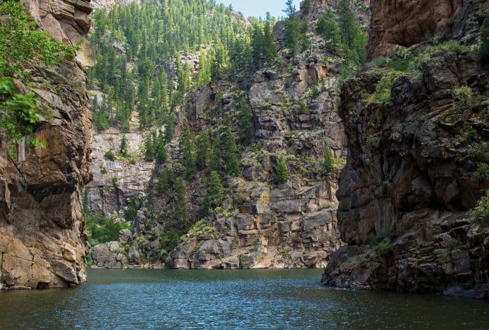
Once at the bottom, the Gunnison River awaits! It’s a calm and ideal spot for a break, a walk along the riverbank.
Gunnison River / How to Visit Blak Canyon of the Gunnison
GOOD TO KNOW: There are no services at the bottom, so pack snacks, water, and anything else you may need.
North Rim Overlooks
The North Rim of the Black Canyon of the Gunnison is a wilder and less-visited area. It offers some of the most breathtaking views of the canyon.
Accessing this side requires a longer drive, but it’s worth it.
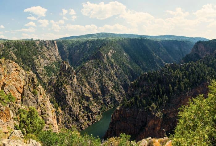
North Rim of Black Canyon of the Gunnison / How to Visit Black Canyon of the Gunnison
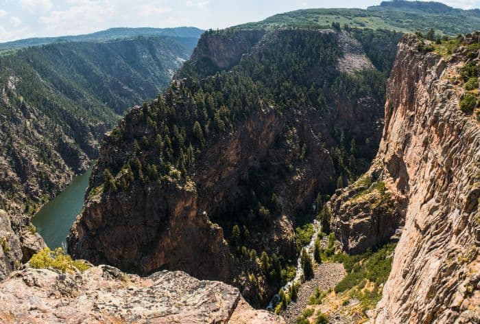
North Rim of Black Canyon of the Gunnison / How to Visit Black Canyon of the Gunnison
The North Rim has several key overlooks:
- Exclamation Point: This overlook is one of the most iconic stops on the North Rim. It’s a short hike along the North Vista Trail, approximately 1.5 miles round-trip. Once there, you’ll be rewarded with panoramic views of the Gunnison River far below, framed by towering cliffs.
- The Narrows: This viewpoint offers a close look at one of the narrowest sections of the canyon, where the walls close in tightly around the river. The steep drop and the compressed view give you a real sense of the canyon’s scale and geology.
- Balanced Rock Overlook: A standout stop with a striking view of the large boulder that appears precariously perched near the canyon’s rim.
- Big Island Overlook: This viewpoint provides a more expansive view of the Gunnison River as it snakes through the canyon. The river appears as a shimmering ribbon against the jagged cliffs, and the overlook gives you a sense of the canyon’s depth and scale.
- Island Peaks View: Located near the end of the North Rim Road, this overlook offers a quieter, less-crowded experience. The view features the Gunnison River surrounded by towering peaks and rock formations, creating a striking contrast between rugged and serene landscapes.
GOOD TO KNOW: North Rim Road is gravel and narrower than the South Rim Drive, but it is passable for most vehicles during the summer months.
Stargazing
Black Canyon of the Gunnison is an International Dark Sky Park, meaning it’s one of the best spots for stargazing in the U.S.
Thanks to its remote location and minimal light pollution, the park offers breathtaking views of the Milky Way, constellations, and even meteor showers during peak times.
Top Spots for Stargazing:
- South Rim Campground: Wide open spaces and minimal artificial light make this a favorite spot.
- Gunnison Point: A short walk from the South Rim Visitor Center with fantastic, unobstructed views.
- North Rim: Perfect for quieter stargazing, with Exclamation Point offering dramatic skies framed by the canyon walls.
PRO TIP: Visit during a new moon for the darkest skies and check for clear weather. Bring warm clothes (it gets cold at night), a blanket or chair, binoculars, and a red flashlight to preserve night vision.
Here Are Some More Ideas of Places to Visit in Colorado:
12 Amazing Places to Visit in Colorado (Your Colorado Bucket List)
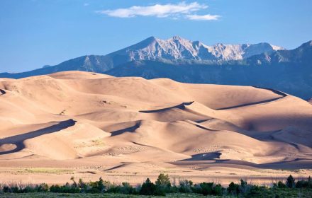
Perfect One Day in Great Sand Dunes National Park (4 Things You Can’t Miss)
9 Best Hikes in the Bear Lake Corridor, Rocky Mountain National Park (Maps and Tips)
18 Best Stops on Trail Ridge Road in Rocky Mountain National Park
12 Best Stops and Hikes on Peak to Peak Scenic Byway in Colorado (Maps+Useful Tips)
14 Things You Can’t Miss on First Visit to Glenwood Springs, Colorado
2 DAYS in MESA VERDE National Park (Perfect Itinerary for First Visit)
23 Practical Tips for FIRST VISIT to MESA VERDE National Park
Did You Find Amazing Places to Visit in Colorado Useful?
Why Not Save It to Your Pinterest Board!


Now, It Is Your Turn, I Would Like to Hear Back from You!
Are you planning your trip to Colorado?
Please let me know!
Drop me a quick comment right below!
Click on any of the images below to get inspired!
