This site uses affiliate links, meaning that if you make a purchase through our links, we may earn an affiliate commission.
Welcome to Glacier National Park, a breathtaking destination renowned for its rugged beauty and untamed wilderness.
In this guide, we have handpicked 8 fun and easy hikes in Glacier National Park that offer remarkable vistas, tranquil surroundings, and a chance to connect with the park’s natural wonders at a relaxed pace!
Whether you’re a beginner hiker, traveling with family, or simply seeking a stroll, these trails will lead you to unforgettable sights while keeping the difficulty level to a minimum. Let’s discover these effortlessly spectacular trails together!
GOOD TO KNOW: If you are looking for more challenging hikes that will test your endurance then do not miss 9 Most Scenic Hikes in Glacier National Park You Need to Explore
PRO TIP: Besides hiking the Glacier National Park’s trails, there are other things to do! Make sure to put Going-to-the-Sun Road, a breathtaking scenic mountain drive that traverses through the park on your list.
Now, with no further delay, let’s get started with fun and easy hikes in Glacier National Park!
- 1. Glacier National Park At-A-Glance
- 2. 8 Fun and Easy Hikes in Glacier National Park
-
- 2.1. Johns Lake Loop Trail
- 2.2. Trail of the Cedars
- 2.3. St. Mary Falls Trail
- 2.4. Hidden Lake Overlook Trail
- 2.5. Redrock Falls Trail
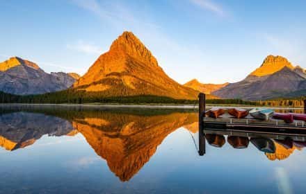
- 2.6. Swiftcurrent Lake Nature Trail
- 2.7. Lake Josephine Loop Trail
- 2.8. Running Eagle Falls Trail
- 3. Intrepid Scout's Tips for Easy Hikes in Glacier National Park
Glacier National Park At-A-Glance
Before diving in, here are a few highlights to help you plan your trip:
- What You Need to Know About Glacier National Park
1. Glacier National Park became the United States’ 8th National Park in 1910. It preserves 1 million acres of land with 792 lakes and 2,800 streams.
2. Glacier National Park is famous for its breathtaking mountain views (10,448-foot Mt. Cleveland near Goat Haunt is the highest peak), numerous waterfalls, and, of course, glaciers. Currently, there are 26 glaciers in the park (Blackfoot Glacier is the largest).
3. Glacier is home to over 70 species of mammals – grizzly and black bears, mountain goats, bighorn sheep, moose, wolverines, grey wolves, and mountain lions.
4. Glacier National Park is the 10th most visited National Park in the US with 3 million visitors annually.
- Glacier National Park Regions
Glacier National Park is divided into 5 main regions:
1. Lake McDonald Valley Region – it is situated on the western side of the park along beautiful Lake McDonald.
2. St. Mary and Logan Pass Region – St. Mary Region is located east of Lake McDonald Valley and Logan Pass is the highest point reachable by car on the Going-to-the-Sun Road.
3. Two Medicine Valley Region – it is situated on the southeastern side of Glacier National Park and can be reached by exiting the park on the east side and driving south on Highway 89 for about an hour and then re-entering the park.
4. Many Glacier Valley Region – it is located on the eastern side of the park. You will need to exit the park on the east side and then continue north on Highway 89 for about 30 minutes and then re-enter the park.
5. North Fork and Goat Haunt Region – this area is located on the northwestern side of Glacier National Park. North Fork is only accessible by unpaved roads and Goat Haunt requires backcountry hiking access.
- Best Time to Visit Glacier National Park
Hands down, summer is the best (and most popular) time to visit Glacier National Park. The weather is warm and all park facilities are open. However, my favorite time to visit is early to mid-September. The weather can be awesome in the fall and it is a great time to avoid the crowds and find some solitude on the trails.
- How to Get to Glacier National Park
Glacier National Park is located in northwestern Montana and the closest airport to Glacier National Park is Glacier Park International Airport (FCA). It is located in Kalispell which is 12 miles from the town of Whitefish and 30 miles from the West Entrance to Glacier National Park.
- How to Get Around in Glacier National Park
Driving your car or renting a car is the best option to get around Glacier National Park. This option is the most convenient and gives you the most flexibility.
Glacier National Park offers West and East Shuttle Service that operates on the Going-to-the-Sun Road. There are some pros and cons to using the shuttle. From my personal experience, the shuttle system is not very efficient.
- Where to Stay in Glacier National Park
Finding where to stay in Glacier Nationa Park can be confusing, especially if this is your first visit. Here are my favorite 14 best places to stay in Glacier National Park whether you are visiting the west or east side (or both) of this amazing national park.
- How to Reserve Entrance Pass
Starting in May through September, from hours 6 am to 3 pm MDT, you are required to have a reservation ticket to access the Going-to-the-Sun Road as well as the Many Glacier Area. Reserve your Entrance Pass here.
- Intrepid Scout’s Tip:
It costs $35 to enter the park. The entrance pass is good for 7 consecutive days. If you are visiting several national parks then make sure to get America the Beautiful National Park Pass. This $80 pass is valid for 12 months and gets you into all 400+ national park sites!
8 Fun and Easy Hikes in Glacier National Park
So here we go! Here are all the fun and easy hikes in Glacier National Park with breathtaking scenery perfect for beginners and everyone in your entire family.
- To make it more manageable these easy hikes are grouped by each region in Glacier National Park:
Lake McDonald Valley Region
St. Mary and Logan Pass Region
Two Medicine Valley Region, and
Many Glacier Valley Region
Johns Lake Loop Trail
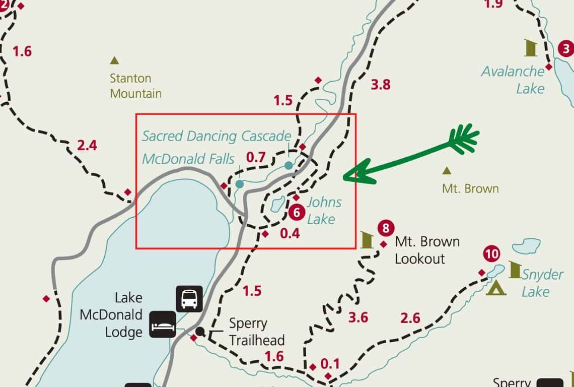
Johns Lake Loop Trail Map / Image Credit: NPS / Easy Hikes in Glacier National Park
Johns Lake Trail is a perfect hike for the entire family. It is a fun and easy loop trail with little elevation change that will take you to Johns Lake, Sacred Dancing Cascades, and McDonald Falls.
- Roundtrip Distance: 1.8 miles (loop)
- Elevation Gain: 225 feet
- Trailhead Location: Johns Lake Loop Trailhead (Lake McDonald Valley Region on the Going-to-the-Sun Road in Glacier National Park)
- Time: 1-2 Hours
- Difficulty: Easy
Johns Lake Trailhead is located 1.3 miles east of the Lake McDonald Lodge on the Going-to-the-Sun Road. If you are traveling west to east on the Going-to-the-Sun Road, then the parking lot for the Johns Lake Trailhead will be your right.
PRO TIP: The parking lot at the Johns Lake Trailhead is small and has space for only 7-8 cars. So, if the parking lot is full, then drive for just less than a mile to the Sacred Dancing Cascades parking lot and start your loop there (the parking lot will be on your left if you are heading from west to east on the Going-to-the-Sun Road.)
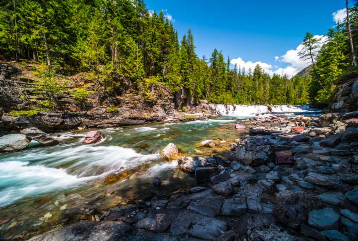
Johns Lake Loop Trail / Easy Hikes in Glacier National Park
Johns Lake Trail is a loop and you can start it in either direction. I like to do this hike counterclockwise.
Once you get started, no more than 100 yards from the trailhead, you will get to a junction with Avalanche Lake Trail. At the junction, make a slight left and continue on Johns Lake Loop Trail.
Shortly afterward, you will reach another junction with a horse trail known as the McDonald Creek Cutoff. Stay your course and continue hiking the loop.
Next, the trail will take you through the forest of old red cedars and hemlocks, and pretty soon you will catch the first view of Johns Lake. There will be many side trails that you can take to reach the shores of the lake, however, the area around the lake is surrounded by wetland grasses and access to the lake is not easy. But, it might be the perfect area to spot a moose!
Shortly, you will get to the second junction with Avalanche Lake Trail, which veers to the right and you should continue to the left. By the way, Avalanche Lake Trail is a moderate hike that will take you to a stunning Avalanche Lake. if you are up to it, then make sure to add this hike to your list.
Next, the trail will reach the Going-to-the-Sun Road; cross the road and follow the trail to the Sacred Dancing Cascades. It is a perfect spot to take some pictures!
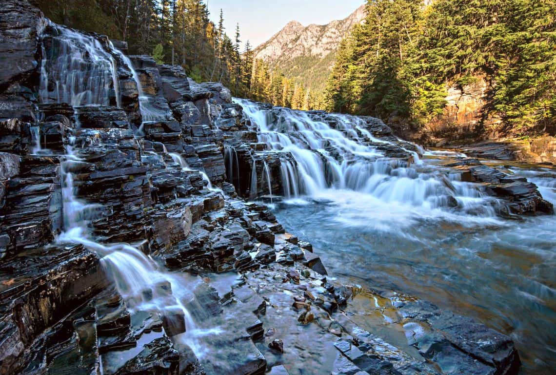
Sacred Dancing Cascades on Johns Lake Loop Trail / Easy Hikes in Glacier National Park
Once you are ready, continue hiking until you reach a footbridge over McDonald Creek; cross the bridge and continue on Johns Lake Loop Trail
At about 1.1 miles from the trailhead, you will reach McDonald Falls. This is a perfect place to snap some pictures of the waterfall.
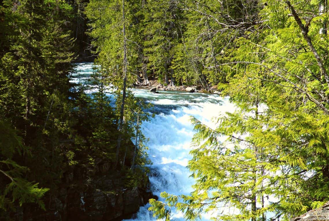
McDonald Falls on Johns Lake Loop Trail / Easy Hikes in Glacier National Park
Ahead of you is a short hike back to the trailhead. Along the way, you will get to a bridge that crosses over McDonald Creek and more opportunities for awesome pictures!
Once you cross the bridge, be on the lookout for a side trail that goes along the Going-to-the-Sun Road and will take you to where you started.
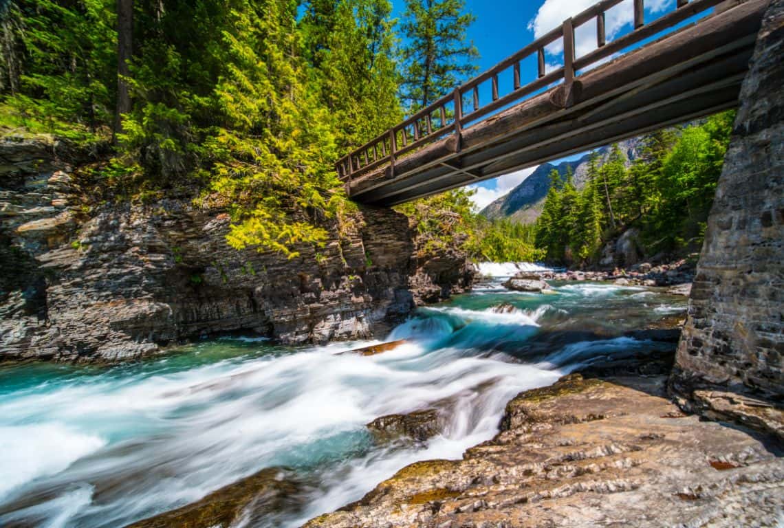
Johns Lake Loop Trail / Easy Hikes in Glacier National Park
Trail of the Cedars
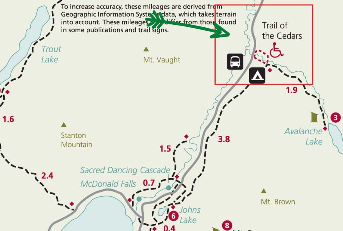
Trail of the Cedars Map / Image Credit: NPS / Easy Hikes in Glacier National Park
Trail of the Cedars is one of two wheelchair-accessible trails in Glacier National Park. The other one is Running Eagle Falls in the Two Medicine Region of Glacier National Park.
Trail of the Cedars is a beautiful hike among old western cedars that will eventually take you to a footbridge over Avalanche Creek with awesome views of the lower Avalanche Gorge.
- Roundtrip Distance: 1 mile (loop)
- Elevation Gain: 60 feet
- Trailhead Location: Avalanche Creek Trailhead (Lake McDonald Valley Region on the Going-to-the-Sun Road in Glacier National Park)
- Time: 30 min -1 Hour
- Difficulty: Easy
The parking for the Avalanche Creek Trailhead is located 5.5 miles east of Lake McDonald Lodge and getting a parking spot can be tough.
This trail is a loop and you can hike it in either direction. I like to start on the east side of the loop and do it counterclockwise.
The trail starts by going on a raised boardwalk and meandering through the forest of old western red cedars.
Huge cedars have been growing for hundreds of years in the park and some trees in the lower Avalanche Creek area are over 500 years old. The humidity in the valley, reminiscent of the humidity in the Pacific Northwest, allows cedars to grow to these incredible heights and diameters.
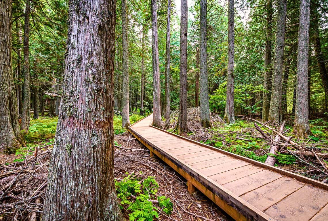
Trail of the Cedars / Easy Hikes in Glacier National Park
At about 0.5 miles from the trailhead, you will reach a footbridge over Avalanche Creek. It is a pretty good spot to take a few pictures of the lower Avalanche Gorge.
PRO TIP: Just past the footbridge, there is a junction with the Avalanche Lake Trail and if you are up to it then hike along this trail for just a bit more for much better views of Avalanche Creek cascading down this narrow gorge.
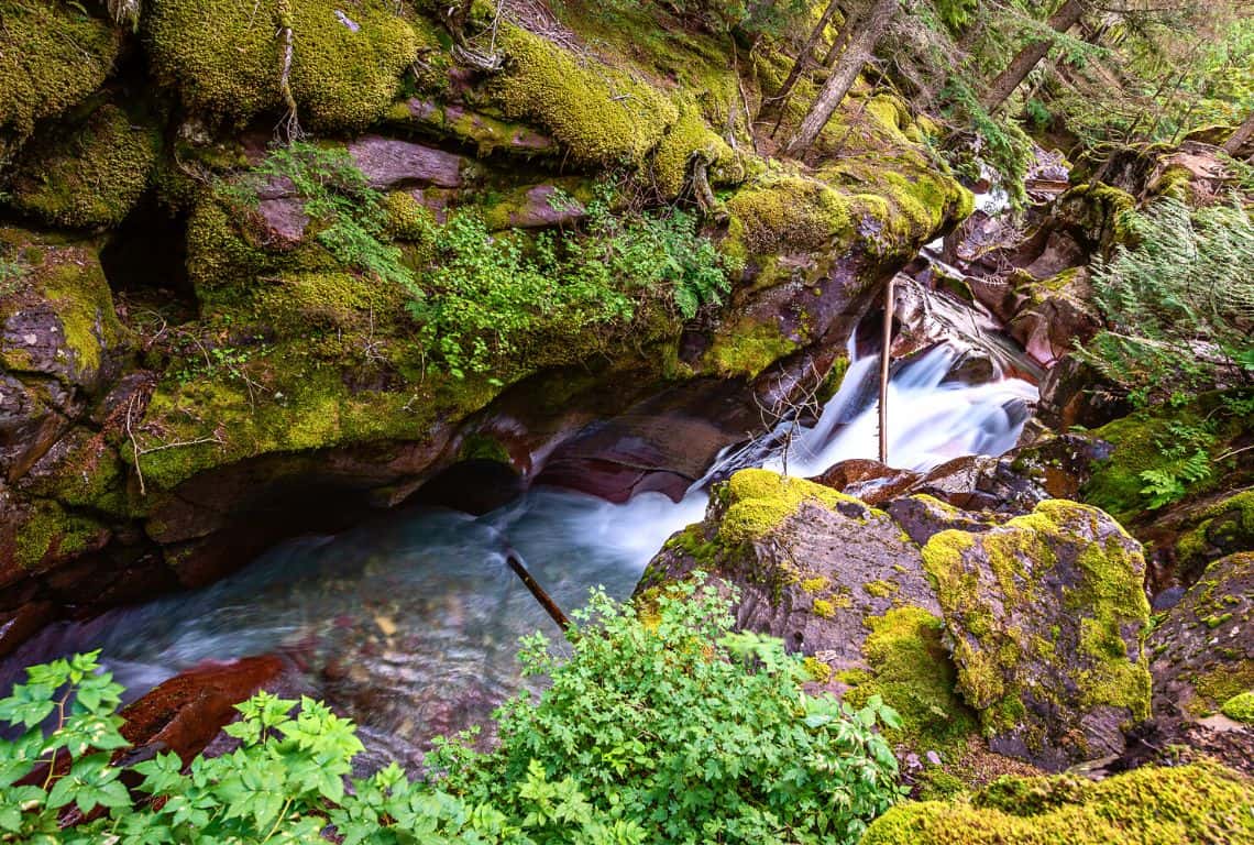
Trail of the Cedars / Easy Hikes in Glacier National Park
Next, the trail runs on the paved path and continues on the western side of the loop. Again, you will be surrounded by magnificent red cedars.
And, before you know it, you will be back at the trailhead, where you started.
St. Mary Falls Trail
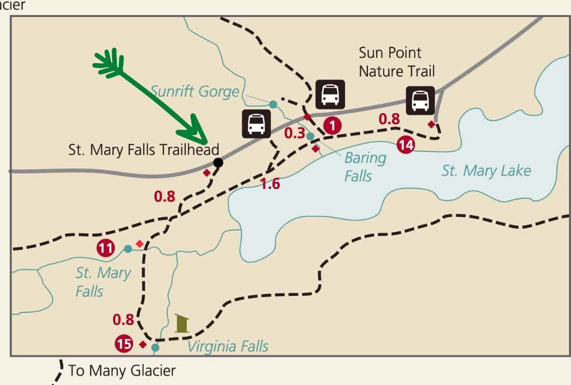
St. Mary Falls Trail Map / Image Credit: NPS / Easy Hikes in Glacier National Park
St. Mary Falls Trail is a super fun, short, and easy trail that will get you to beautiful St. Mary Falls.
- Roundtrip Distance: 1.7 miles
- Elevation Gain: 215 feet
- Trailhead Location: St. Mary Falls Trailhead (St. Mary Valley Region on the Going-to-the-Sun Road in Glacier National Park)
- Time: 1 Hour
- Difficulty: Easy
The hike to St. Mary Falls starts right at St. Mary Falls Trailhead located on the Going-to-the-Sun Road in the St. Mary Valley Region of Glacier National Park (specifically, it is located 10.6 miles west of St. Mary Entrance Station).
Just a heads up, it is a very popular hike, so expect to have plenty of company on this trail.
Right from the start, you will get to enjoy great views! As you are hiking, in front of you will be Dusty Star Mountain, and to the south, you will see Little Chief Mountain.
First, you will hike through an area that was burned during the Reynolds Creek Fire in 2015.
At 0.4 miles from the trailhead, you will reach a junction with the Piegan Pass Trail. Make sure to veer to the left and stay on St. Mary Falls Trail.
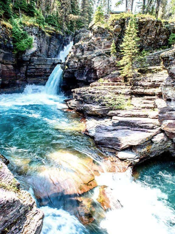
Next, at about 0.8 miles from the trailhead, you will reach St. Mary River and right after, St. Mary Falls.
St. Mary Falls Trail / Easy Hikes in Glacier National Park
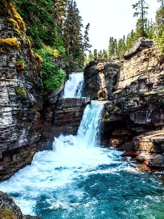
St. Mary Falls is stunning and you will be taking lots of pictures here!
It drops 35 feet in several separate tiers and forms gorgeous turquoise color pools at the bottom.
St. Mary Falls Trail / Easy Hikes in Glacier National Park
GOOD TO KNOW: If you continue on this trail, then in about 1 mile you will reach even more impressive Virginia Falls. However, make sure you are up to it since the roundtrip to Virginia Falls will add another 2 more miles to your hike. But, hands down, it is all worth it!
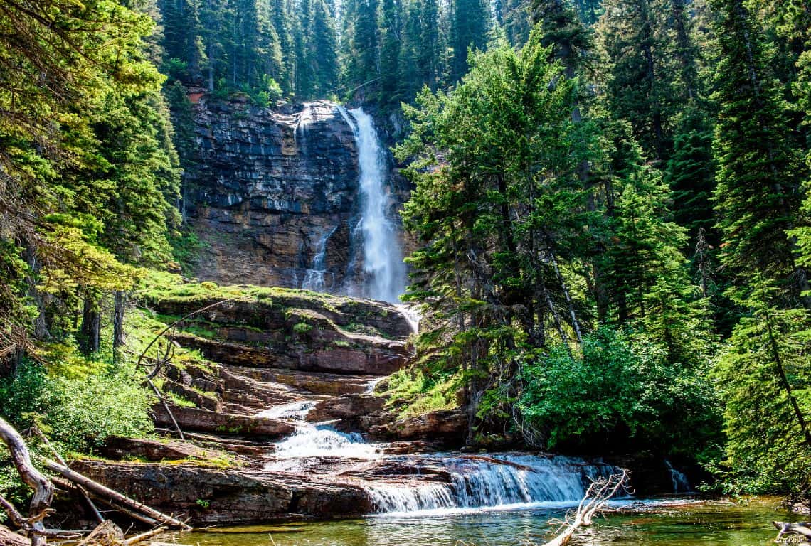
Virginia Falls in Glacier National Park / Easy Hikes in Glacier National Park
Hidden Lake Overlook Trail
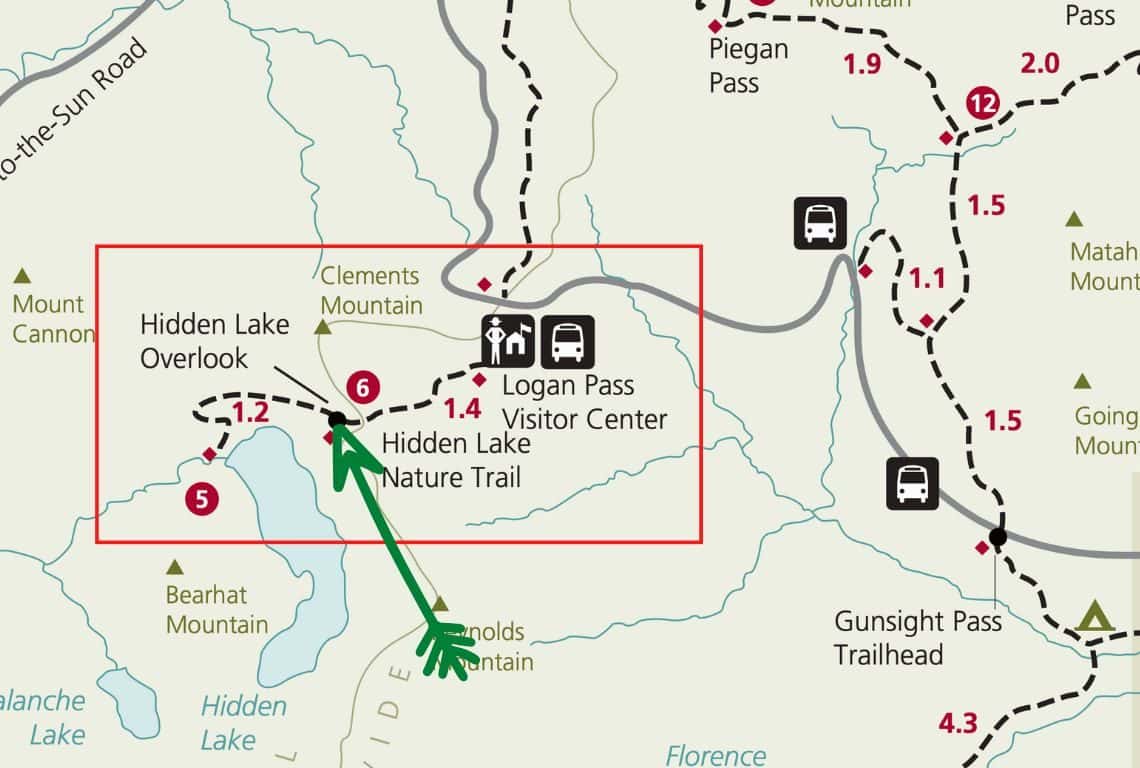
Hidden Lake Overlook Trail Map / Image Credit: NPS / Easy Hikes in Glacier National Park
Hidden Lake Overlook Trail is one of the best easy hikes in Glacier National Park. This trail will take you through beautiful alpine meadows and along the way, you will be rewarded with magnificent views of Hidden Lake surrounded by towering mountains.
Hidden Lake Overlook Trail is a slightly longer trail with a roundtrip distance of 2.8 miles and the elevation gain is about 460 feet. However, the extra distance and a bit of elevation gain are worth the extra effort!
- Roundtrip Distance: 2.8 miles
- Elevation Gain: 460 feet
- Trailhead Location: Logan Pass Visitor Center (St. Mary Valley Region on the Going-to-the-Sun Road in Glacier National Park)
- Time: 1.5-2 hours
- Difficulty: Easy/Moderate
GOOD TO KNOW: What you need to know is that Hidden Lake Overlook Trail is often referred to as the Hidden Lake Nature Trail or Hidden Lake Hanging Garden Trail. I do not want you to get confused if you see signage referring to either one along the way.
The trail starts on the back side of the Logan Pass Visitor Center. Once you get there, look for the Hanging Garden Trailhead. The name Hanging Garden Trail comes from the alpine meadows – nicknamed “hanging gardens” – that surround this trail.
First, you will be hiking on a raised boardwalk and the 8,760-foot Clements Mountain will be to your right.
At 1.2 miles from the trailhead, you will reach the Continental Divide.
The Continental Divide extends from the Bering Strait to the Strait of Magellan and separates the watersheds that drain into the Pacific Ocean from those river systems that drain into the Atlantic and (in northern North America) Arctic oceans (including those that drain into the Gulf of Mexico, the Caribbean Sea and Hudson Bay). Source: Wikipedia
Hidden Lake Overlook Trail / Easy Hikes in Glacier National Park
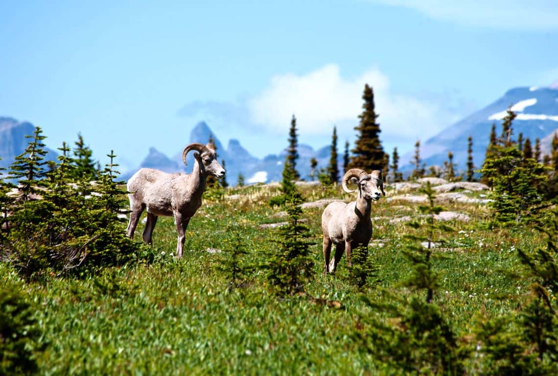
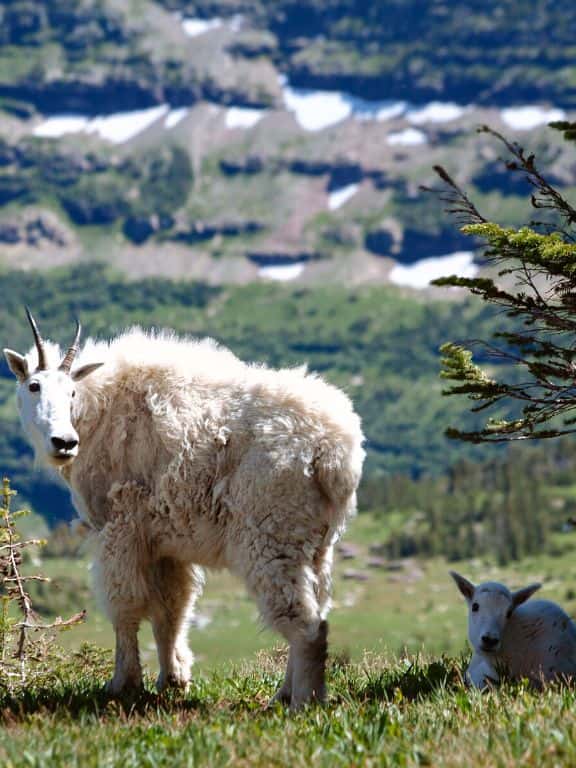
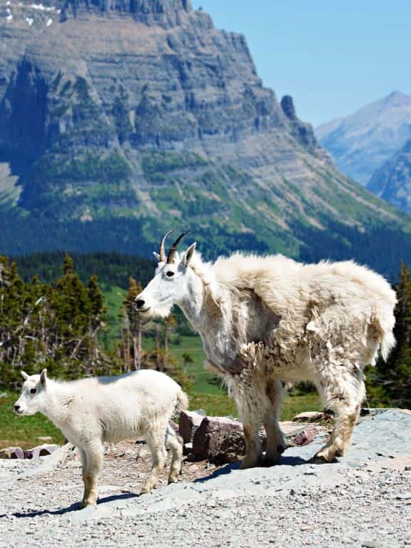
As you are hiking, be on the lookout for some wildlife. I would not be surprised if you see some mountain goats or bighorn sheep.
Be aware that grizzly bears frequent these areas as well. Make some noise as you are hiking to let them know you are in the vicinity. Also, have bear spray on you and, if possible, hike in groups.
Hidden Lake Overlook Trail / Easy Hikes in Glacier National Park
Hidden Lake Overlook Trail / Easy Hikes in Glacier National Park
At 1.4 miles from the trailhead, you will start getting glimpses of Hidden Lake in the distance, and in no time you will reach the overlook.
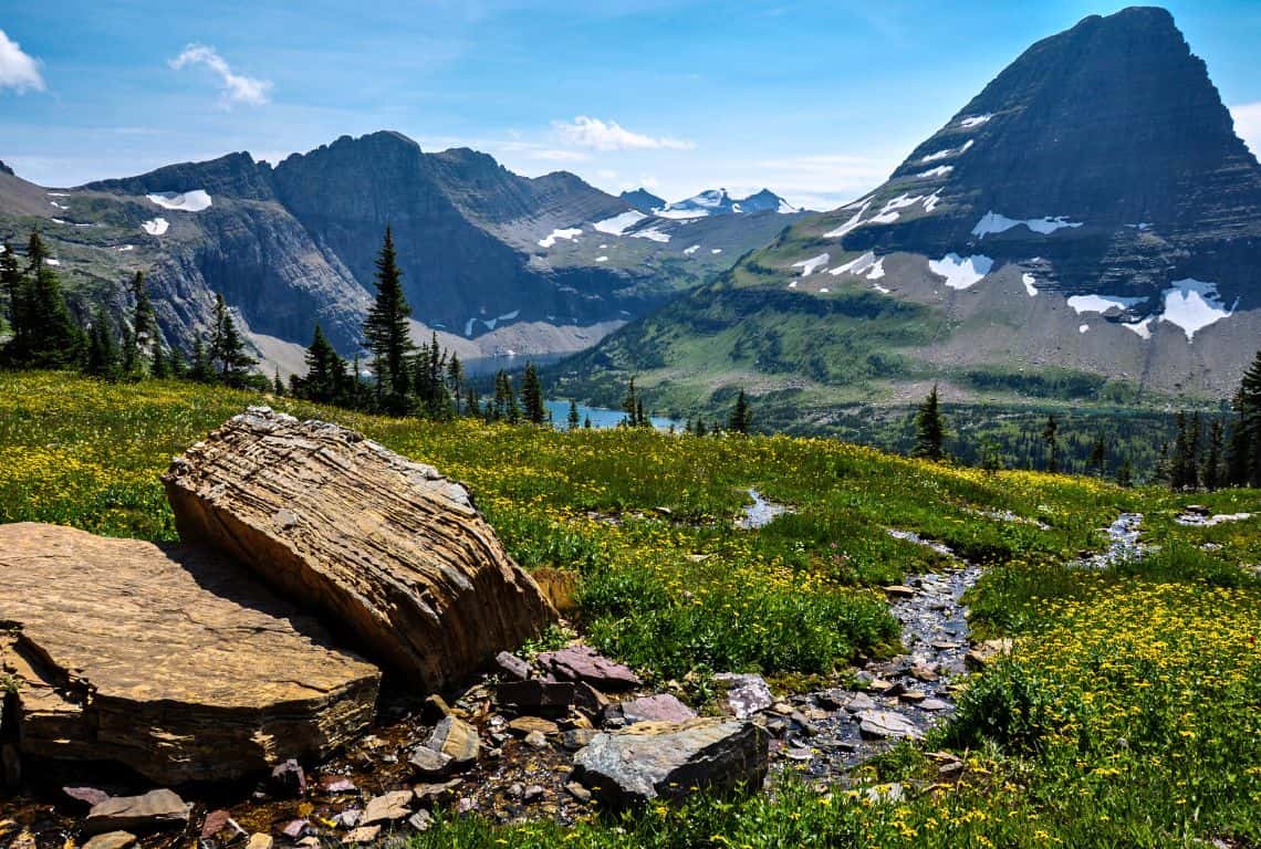
Hidden Lake Overlook Trail / Easy Hikes in Glacier National Park
The views of Hidden Lake surrounded by Clemens Mountian on the right, Reynolds Mountain on the left, and 8,684-foot Bearhat Mountian in the middle dominating the view, are off the charts!
GOOD TO KNOW: Hidden Lake is fed by snowmelt from these mountains. Large amounts of glacial silt and powdered rock sitting at the bottom causes Hidden Lake to appear in the most beautiful blue shades that remind us of emerald, sapphire, aquamarine, or opaque turquoise colors. On sunny days, when the rays of the sun reflect in the silt the colors become even more vivid.
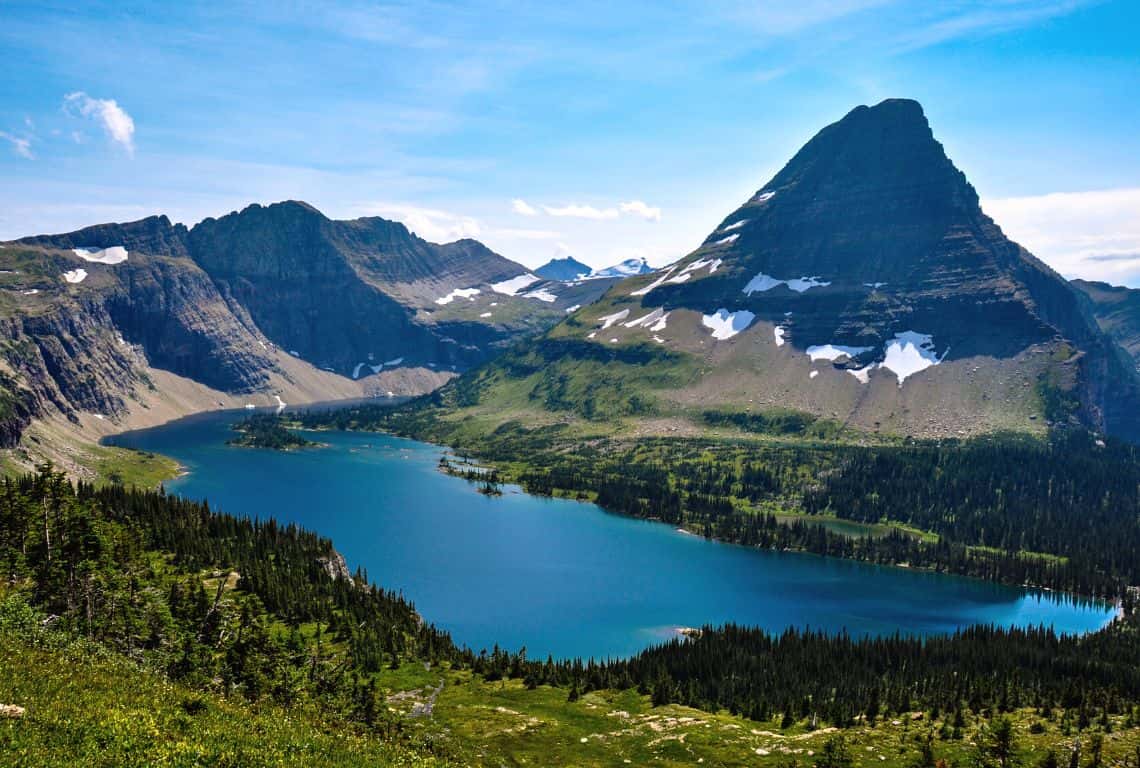
Hidden Lake Overlook Trail / Easy Hikes in Glacier National Park
PRO TIP: If you are up to doing some more hiking, then follow the trail as it descends about 770 feet along the southern slopes of Clemens Mountain down to Hidden Lake. Once you reach the lake, you will be in awe of the stunning views around you.
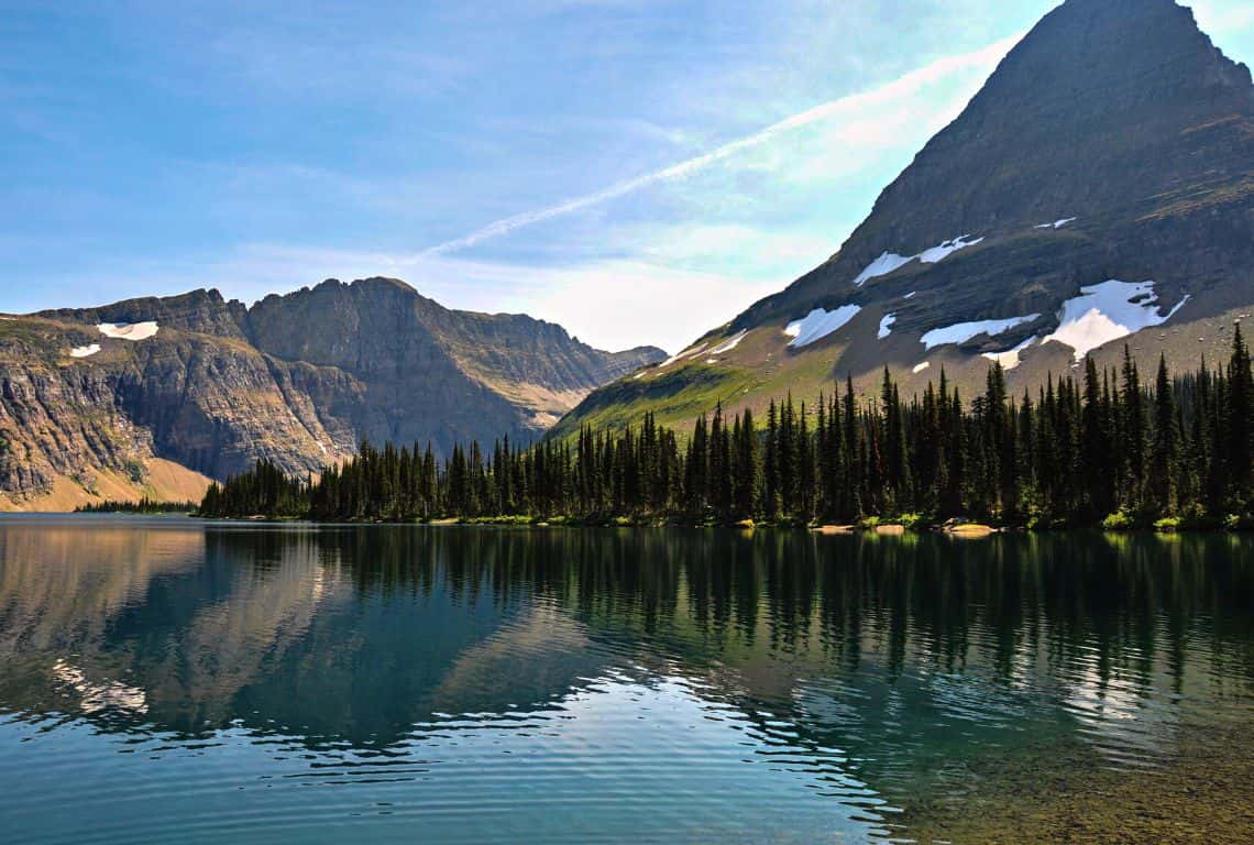
Hidden Lake Overlook Trail / Easy Hikes in Glacier National Park
Redrock Falls Trail
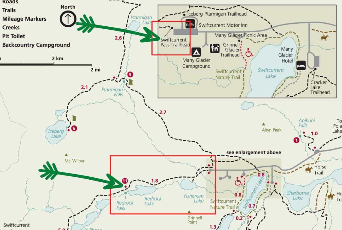
Redrock Falls Trail Map / Image Credit: NPS / Easy Hikes in Glacier National Park
Redrock Falls Trail is an awesome easy hike that will take you through stunning mountain scenery. You will see cascades and waterfalls and visit two beautiful sub-alpine lakes.
- Roundtrip Distance: 4.6 miles
- Elevation Gain: 285 feet
- Trailhead Location: Swiftcurrent Pass Trailhead (Many Glacier Valley Region in Glacier Nationa Park)
- Time: 2.5-3 hours
- Difficulty: Easy/Moderate
Redrock Falls Trail is located in the Many Glacier Valley Region of Glacier National Park.
Swiftcurrent Pass Trailhead, located at the end of Swiftcurrent Motor Inn parking lot, is the starting point for Redrock Falls Trail.
In no more than 0.3 miles from the trailhead, you will reach your first destination: Fishercap Lake. There will be a short side trail that will take you to the shore and once you reach the shore, you will be in awe of the reflections of the surrounding mountains in the pristine water of the lake.
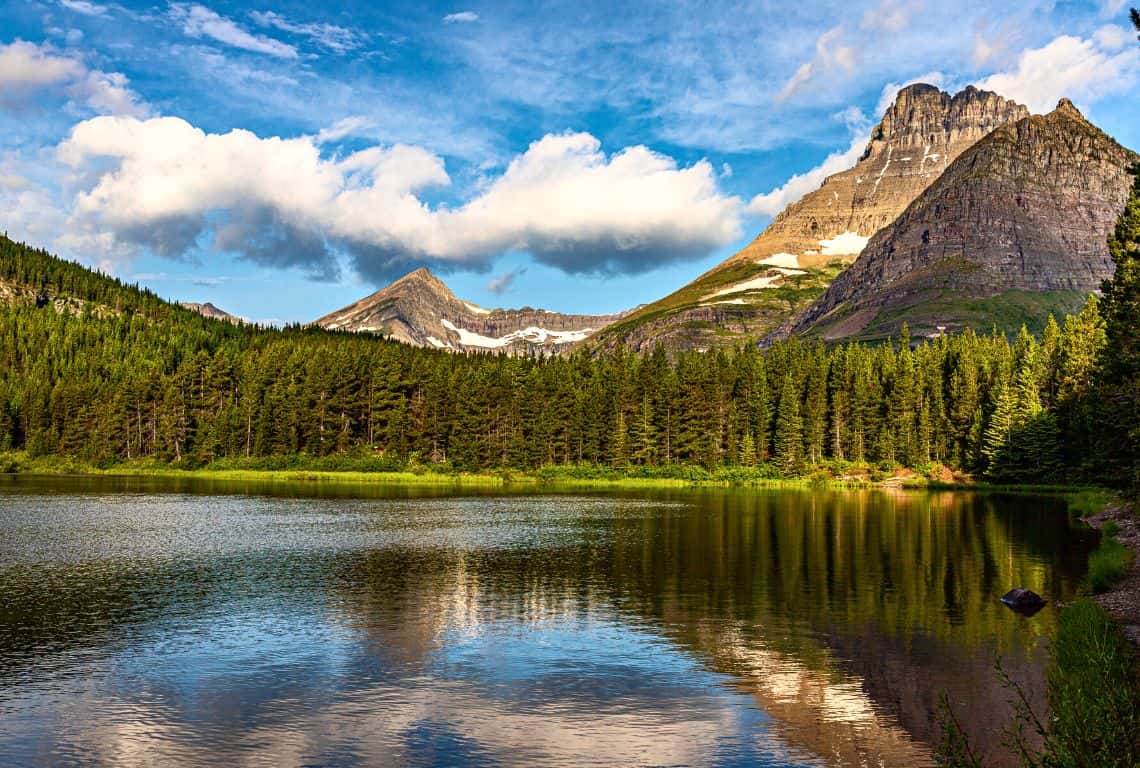
Fishercap Lake on Redrock Falls Trail / Easy Hikes in Glacier National Park
The lake’s name is a reference to George Bird Grinnell, whom the Blackfeet Indians called “Fishercap”.
George Bird Grinnell, at that time editor of the magazine “Forest and Stream,” first came to the area of the park in 1885 and again in 1887, and thereafter almost yearly as long as he was able.
To Grinnell goes the credit, and justly so, for swinging public opinion in favor of making this area into a national park, and also for promoting the legislation that made it possible.
During his visits in 1885 and 1887, he explored the St. Mary and Swiftcurrent Valleys and named many of the features within them. Source: Through the Years in Glacier National Park by Donald H. Robinson
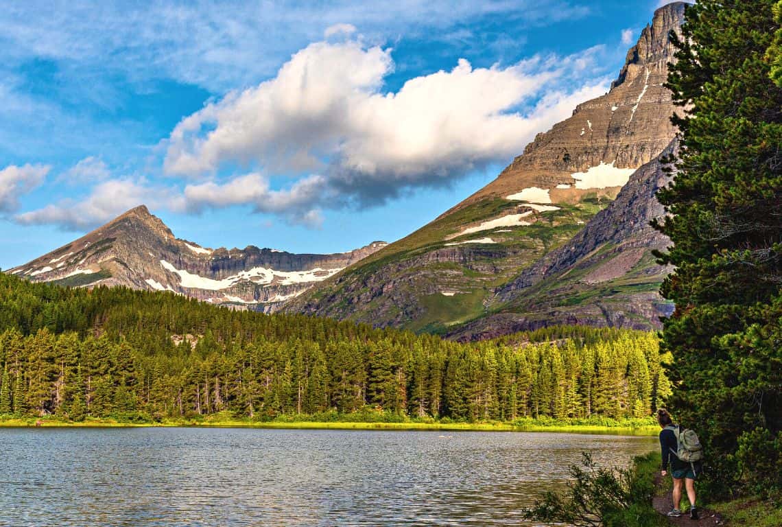
Fishercap Lake on Redrock Falls Trail / Easy Hikes in Glacier National Park
GOOD TO KNOW: The area around Fishercap Lake is an excellent spot to see moose. They will often graze for plants in shallow waters, but sometimes you can see them reaching deep into the water. Their oversized noses can block the nostrils, preventing liquid from getting in while they eat their meal entirely underwater.
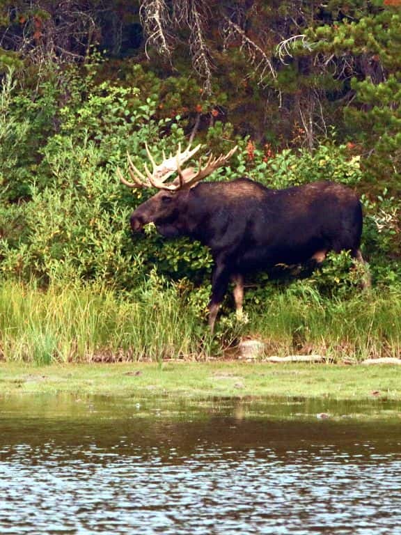
Redrock Falls Trail / Easy Hikes in Glacier National Park
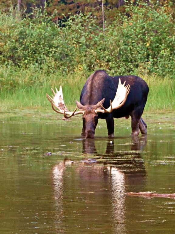
Redrock Falls Trail / Easy Hikes in Glacier National Park
At 1.7 miles from the trailhead, you will reach Redrock Lake. The views of 8,851-foot Mt. Grinnell Mountain and Swiftcurrent Glacier are spectacular here.
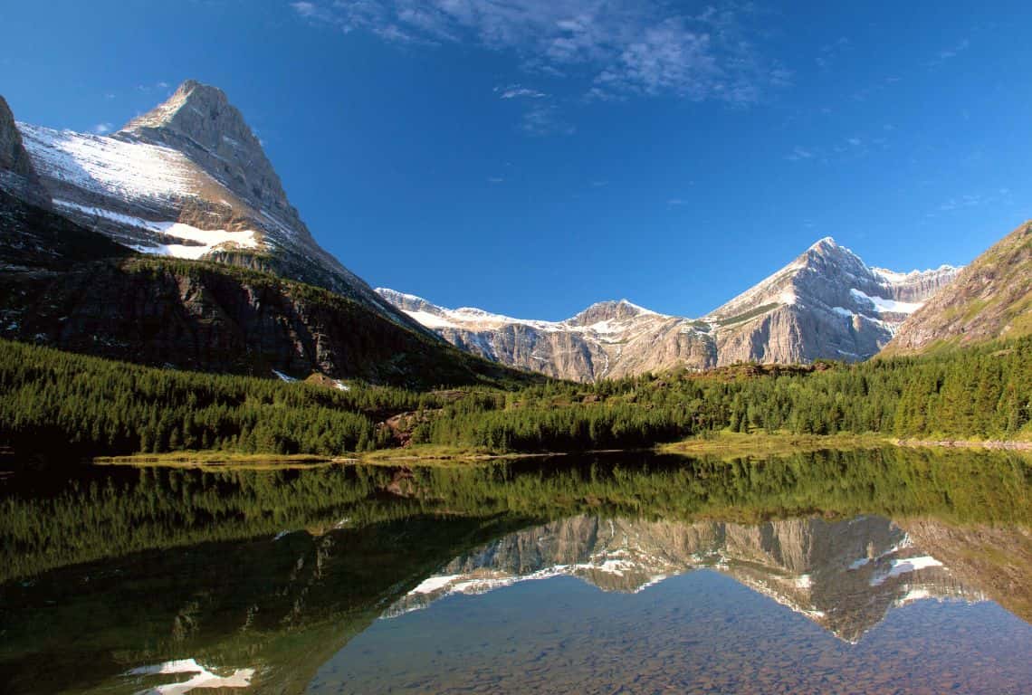
Fishercap Lake on Redrock Falls Trail / Easy Hikes in Glacier National Park
On the opposite side of Redrock Lake, right below Mount Grinnell, is Redrock Falls.
Next, follow the trail and continue along the shore of Redrock Lake. At about 2 miles from the trailhead, you will reach an unmarked junction, turn left at the junction and follow this side trail to Swiftcurrent Creek as it tumbles down in a series of cascades over some red rocks and forms beautiful Lower Redrock Falls.
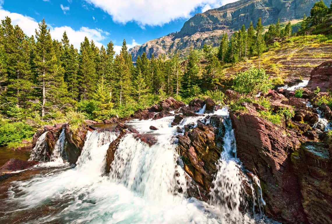
Redrock Falls Trail / Easy Hikes in Glacier National Park
There are several short side trails all around Redrock Falls that will take you to different viewing points.
Also, after you return to the main trail, you should continue your hike for just a bit to see the highest section of Redrock Falls. It is a pretty view of Swiftcurrent Mountain in the distance.
GOOD TO KNOW: The trail continues to Bullhead Lake. If you are up to hiking some more, then it is so worth it! However, it will add another 3 more miles to your hike, but only 100 feet of climbing.
After Bullhead Lake, the trail goes to Swiftcurrent Pass. It is a strenuous section, so if you decide to go on, make sure you have enough energy and time to complete this hike.
Swiftcurrent Lake Nature Trail
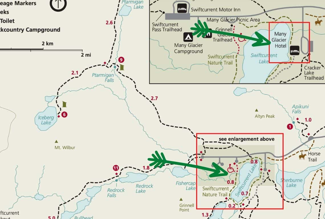
Swiftcurrent Lake Nature Trail Map / Image Credit: NPS / Easy Hikes in Glacier National Park
Swiftcurrent Lake Nature Trail is a delightful easy trail that is perfect for the entire family and the views on this trail are just drop-dead perfect!
- Roundtrip Distance: 2.7 miles (loop)
- Elevation Gain: 25 feet
- Trailhead Location: Many Glacier Hotel Boat Dock (Many Glacier Valley Region in Glacier National Park)
- Time: 1.5-2 hours
- Difficulty: Easy
Swiftcurrent Lake Nature Trail is a loop and you can do this hike in either direction. My favorite way to hike Swiftcurrent Lake Nature Trail is counterclockwise and I like to start it from the Many Glacier Hotel Boat Dock.
GOOD TO KNOW: You might see quite a few hikers here taking a boat shuttle across Swiftcurrent Lake and then another shuttle across Lake Josephine before hiking 3.6 miles to Grinnell Glacier Viewpoint or Grinnell Glacier Lake.
When you start your hike on Swiftcurrent Lake Nature Trail, right from the start, you will be in awe of the stunning views!
As you are hiking, in front of you will be impressive Grinnell Point, standing at 7,600 feet.
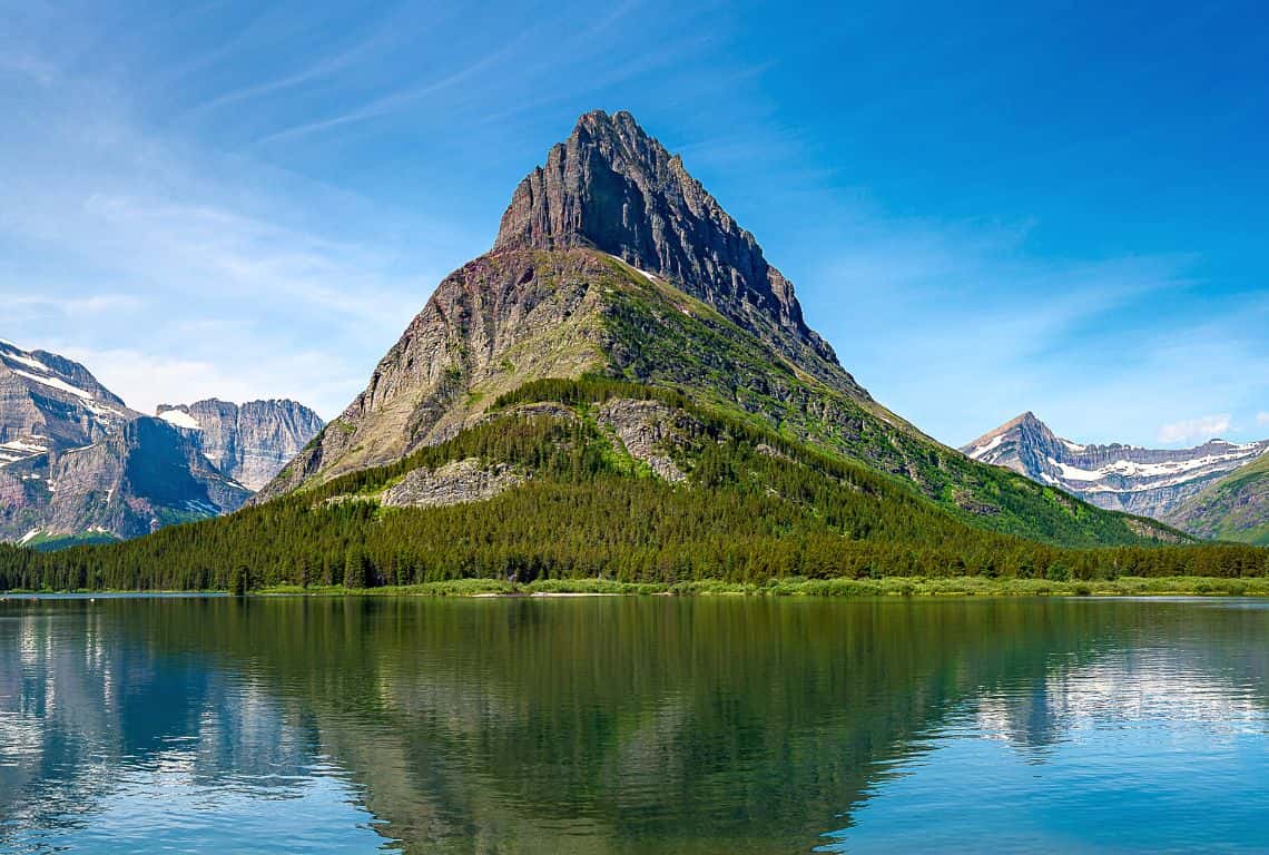
Swiftcurrent Lake Nature Trail / Easy Hikes in Glacier National Park
Next, you will reach a footbridge over Swiftcurrent Creek and the views of Mount Wilbur standing at 9,321 feet are spectacular!
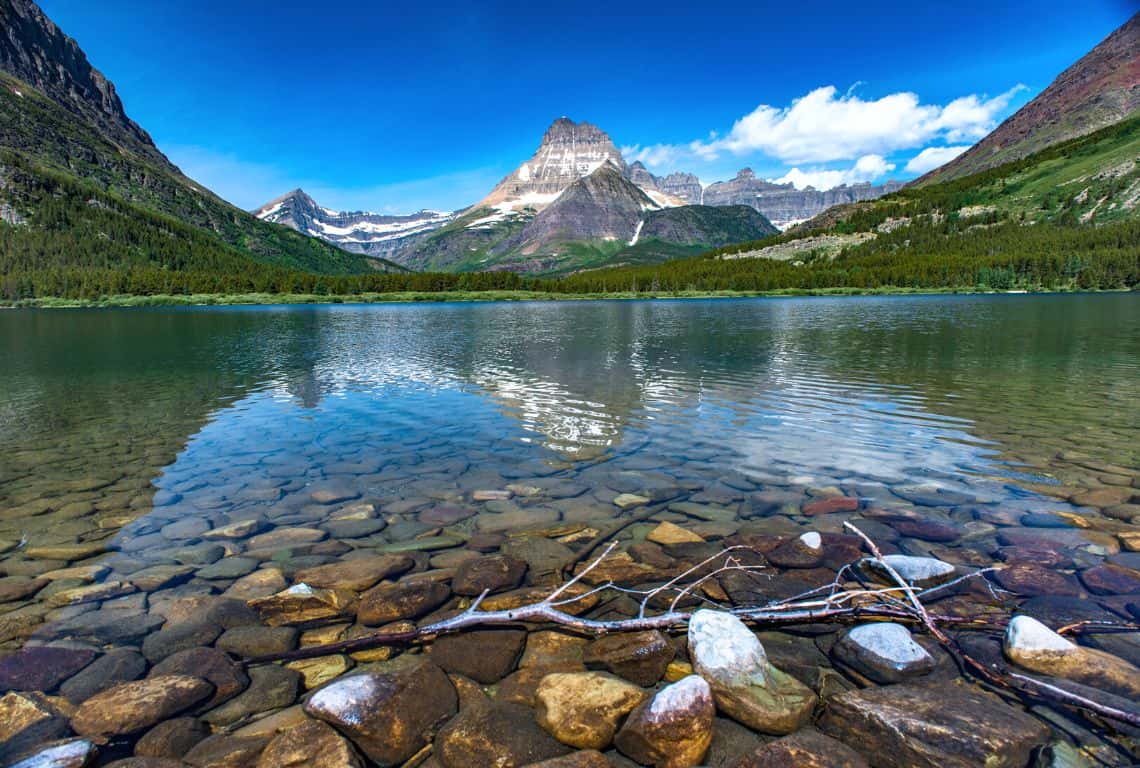
Swiftcurrent Lake Nature Trail / Easy Hikes in Glacier National Park
At 1.7 miles from the trailhead, you will reach the south boat dock where hikers take the shuttle across Lake Josephine to Grinnell Glacier Overlook Trailhead.
Then, at 1.9 miles from the trailhead, you will cross another footbridge over the channel that connects Swiftcurrent Lake and Lake Josephine. Right after, there will be a junction with Josephine Lake Loop Trail. Turn left at the junction and continue on Swiftcurrent Lake Loop Trail until you reach the trailhead where you started.
Along the way to the trailhead, there will be several side trails leading to the shore of Swiftcurrent Lake. Make sure to find a nice spot and take a snack or lunch break and just soak in the spectacular views!
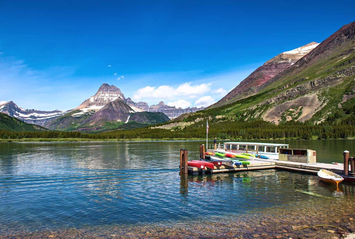
Swiftcurrent Lake Nature Trail / Easy Hikes in Glacier National Park
GOOD TO KNOW: Swiftcurrent Lake surrounded by towering peaks is a picture-perfect view. It is a great spot to photograph at sunset. If you are into sunset photography then make sure to come back here at the golden hour and stay a bit longer for the blue hour.
And, if there are any clouds in the forecast, then it’s even better news! As Paulo Coelho said: “Don’t forget: beautiful sunsets need cloudy skies.”
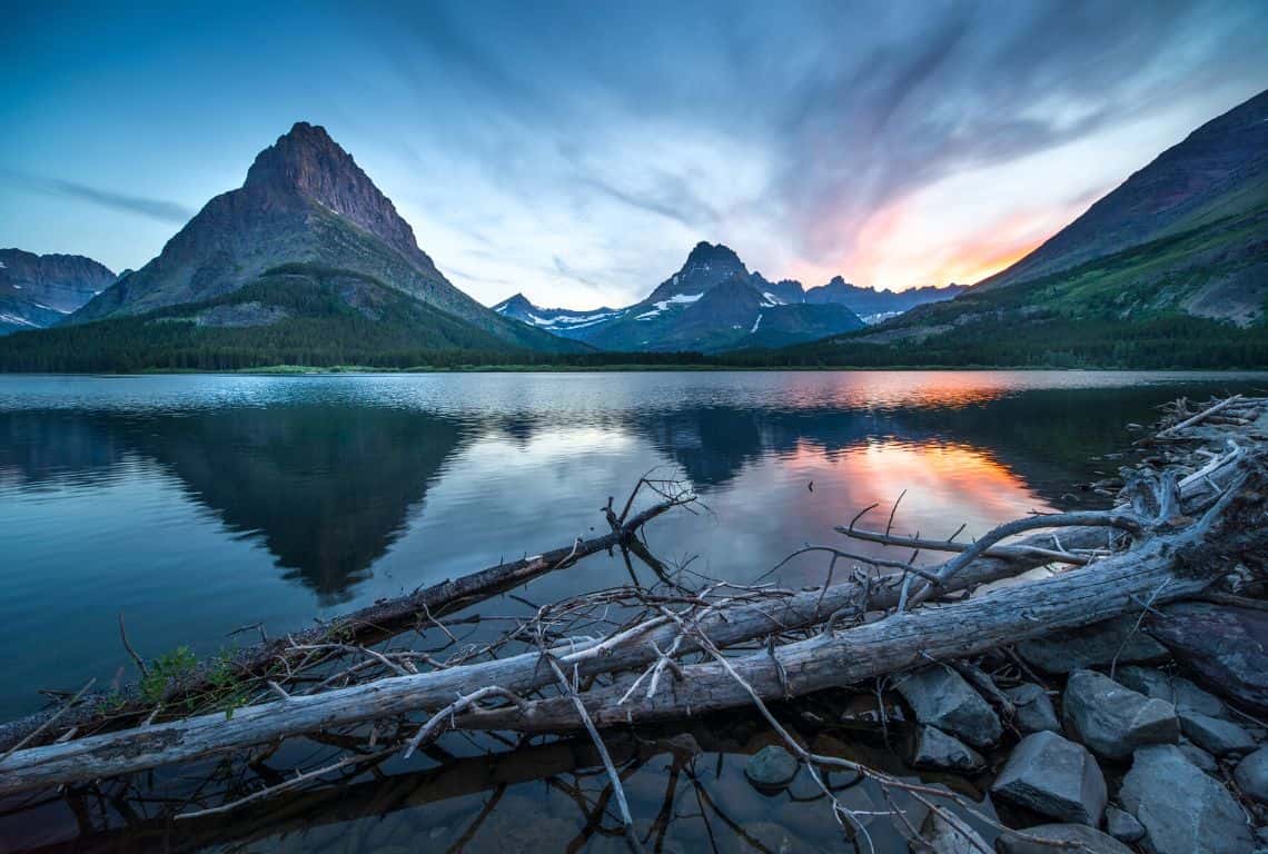
Swiftcurrent Lake Nature Trail / Easy Hikes in Glacier National Park
Lake Josephine Loop Trail
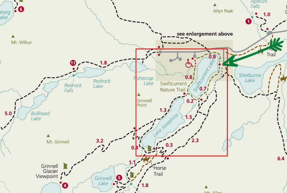
Lake Josephine Loop Trail Map / Image Credit: NPS / Easy Hikes in Glacier National Park
Lake Josephine Loop Trail is one of my favorite hikes in Glacier National Park. The views are off the charts on this hike!
It is a bit longer hike at 5.8 miles but there is not much elevation change on this hike. Plus, the stunning views will compensate you for the extra effort.
- Roundtrip Distance: 5.8 miles (loop)
- Elevation Gain: 225 feet
- Trailhead Location: Many Glacier Hotel Boat Dock (Many Glacier Valley Region in Glacier National Park)
- Time: 3-4 hours
- Difficulty: Easy/Moderate
Start your hike from the Many Glacier Hotel boat dock.
This hike is a loop and you can do it in either direction you like. I am recommending hiking it counterclockwise. The views are so much better especially if you are hiking in the morning and you will be able to see the reflections of the surrounding mountains in the calm waters of Lake Swiftcurrent and then, Lake Josephine.
At the Many Glacier Hotel south dock, you will see quite a few hikers boarding the boat shuttles that take them across Swiftcurrent Lake and then Lake Josephine as they embark on Grinnell Glacier Overlook and Grinnell Lake Trail.
The first 1.7 miles of this hike will be on Swiftcurrent Lake Nature Trail which meanders along Swiftcurrent Lake. I have to say, that the views of the lake are picture-perfect with Grinnell Point at 7,600 feet in the middle and flanked by. Angel Wing to the left and Mount Wilbur at 9,321 feet to the right.
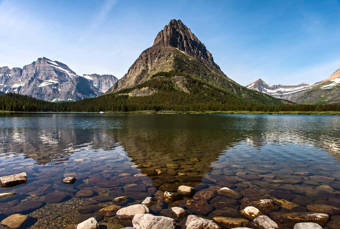
Lake Josephine Loop Trail / Easy Hikes in Glacier National Park
At 1.7 miles from the trailhead, you will reach the south boat dock. Here, you will see hikers taking a shuttle across Lake Josephine to Grinnell Glacier Trailhead.
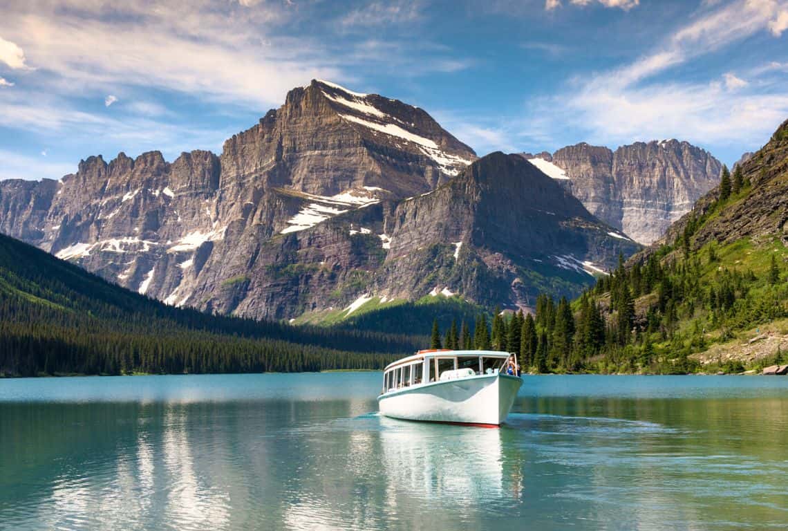
Lake Josephine Loop Trail / Easy Hikes in Glacier National Park
Next, continue the hike until you reach the north dock on Lake Josephine.
The views of Angel Wing, Mt. Gould, the Garden Wall, and Grinnell Glacier are exceptional at this point.
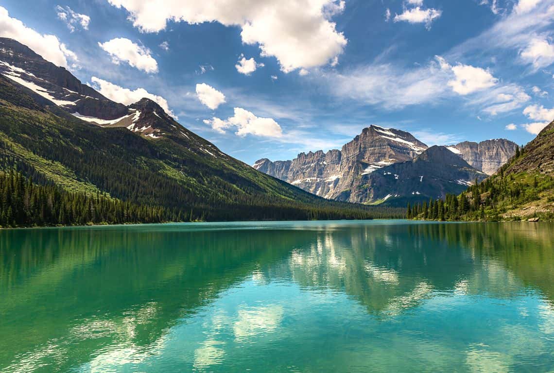
Lake Josephine Loop Trail / Easy Hikes in Glacier National Park
At 2.7 miles from the trailhead, you will reach the Grinnell Glacier Trail Junction. And, at 3.3 miles from the trailhead, you will pass a junction with a trail to Hidden Falls and Grinnell Lake.
At this point, you will be hiking on the east side of Lake Josephine going north.
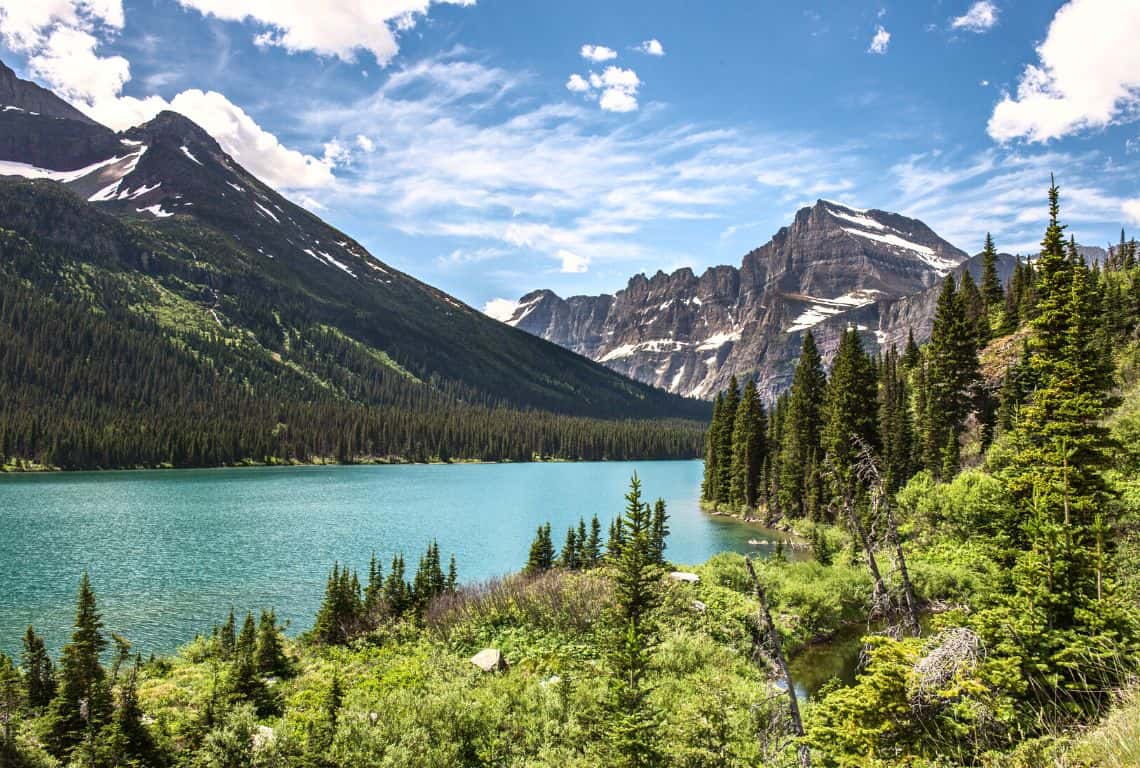
Lake Josephine Loop Trail / Easy Hikes in Glacier National Park
Along the way, you will pass by quite a few side trails that will take you to the shore of Lake Josephine. These are the perfect spots to take a break and enjoy the views.
When you are ready to continue, get back to the main trail.
At 4.8 miles from the trailhead, you will reach Swiftcurrent Lake Nature Trail which will take you back to the Many Glacier Hotel where you started.
Running Eagle Falls Trail
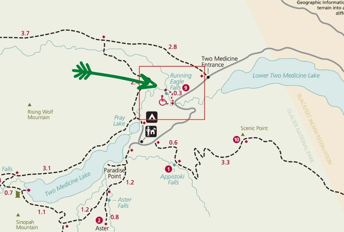
Running Eagle Falls Trail Map / Image Credit: NPS / Easy Hikes in Glacier National Park
The trail to Running Eagle Falls, also known as “Trick Falls”, is a fun and easy trail that will take you to a beautiful waterfall or waterfalls depending on when you are visiting.
This trail is perfect for everyone. It is short and with almost no elevation change. Also, it is wheelchair accessible!
- Roundtrip Distance: 0.6 miles
- Elevation Gain: 15 feet
- Trailhead Location: Running Eagle Falls Trailhead (Two Medicine Valley Region in Glacier National Park)
- Time: 30 min-1 hour
- Difficulty: Easy
Running Eagle Falls Trailhead is located 1.1 miles west of the Two Medicine entrance station.
In just 0.3 miles from the trailhead, you will reach the falls.
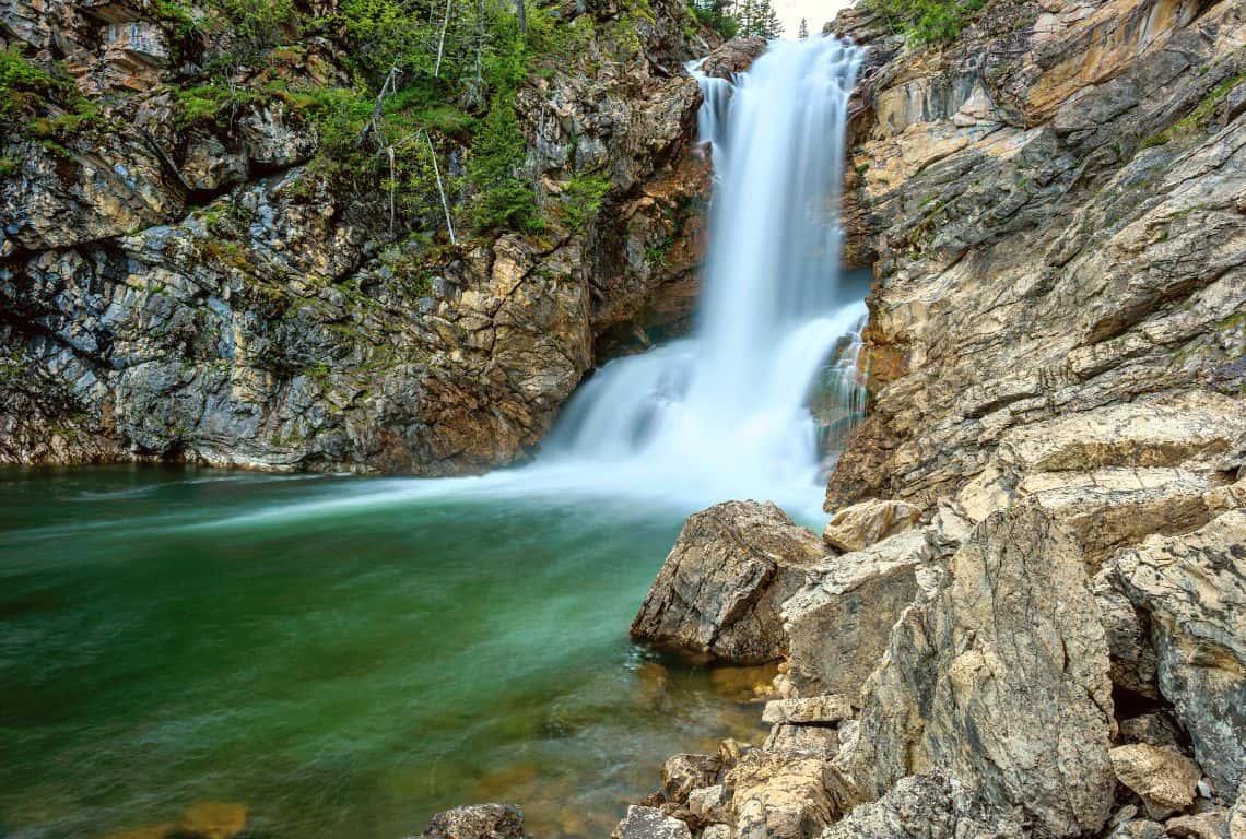
Running Eagle Falls Trail / Easy Hikes in Glacier National Park
Running Eagle Falls flow off the outlet stream between Lower Two Medicine Lake and Two Medicine Lake. They are also called “Trick Falls” since depending on the season you might see one waterfall or two waterfalls.
GOOD TO KNOW: If you are visiting during the spring months, you will see water running over the top ledge and covering another waterfall beneath it. If you are visiting during the summer months then, you will probably just see the lower waterfall.
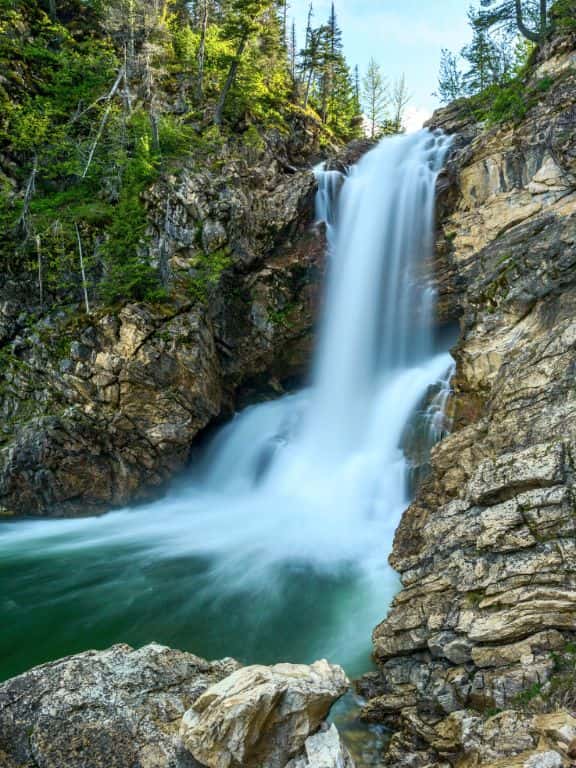
Running Eagle Falls Trail / Easy Hikes in Glacier National Park
Intrepid Scout's Tips for Easy Hikes in Glacier National Park
That is quite a list of easy hikes in Glacier National Park, right? What if you only have time to do a couple of easy hikes in Glacier? No problem!
Here are my absolute must-do 2 easy hikes in Glacier National Park:
- Hands down, the number one must-do easy hike in Glacier National Park is Lake Josephine Loop Trail. It is my favorite easy hike! The trail will take you along the shore of Swiftcurrent Lake and then around Lake Josephine. The views on this hike are picture-perfect!
- Second, do not miss St. Mary Falls Trail! This trail will take you to stunning St. Mary Falls, and if you have any bit of energy left then continue to Virginia Falls for even more spectacular views of a waterfall.
More Helpful Posts About Glacier National Park
Did You Find This Useful?
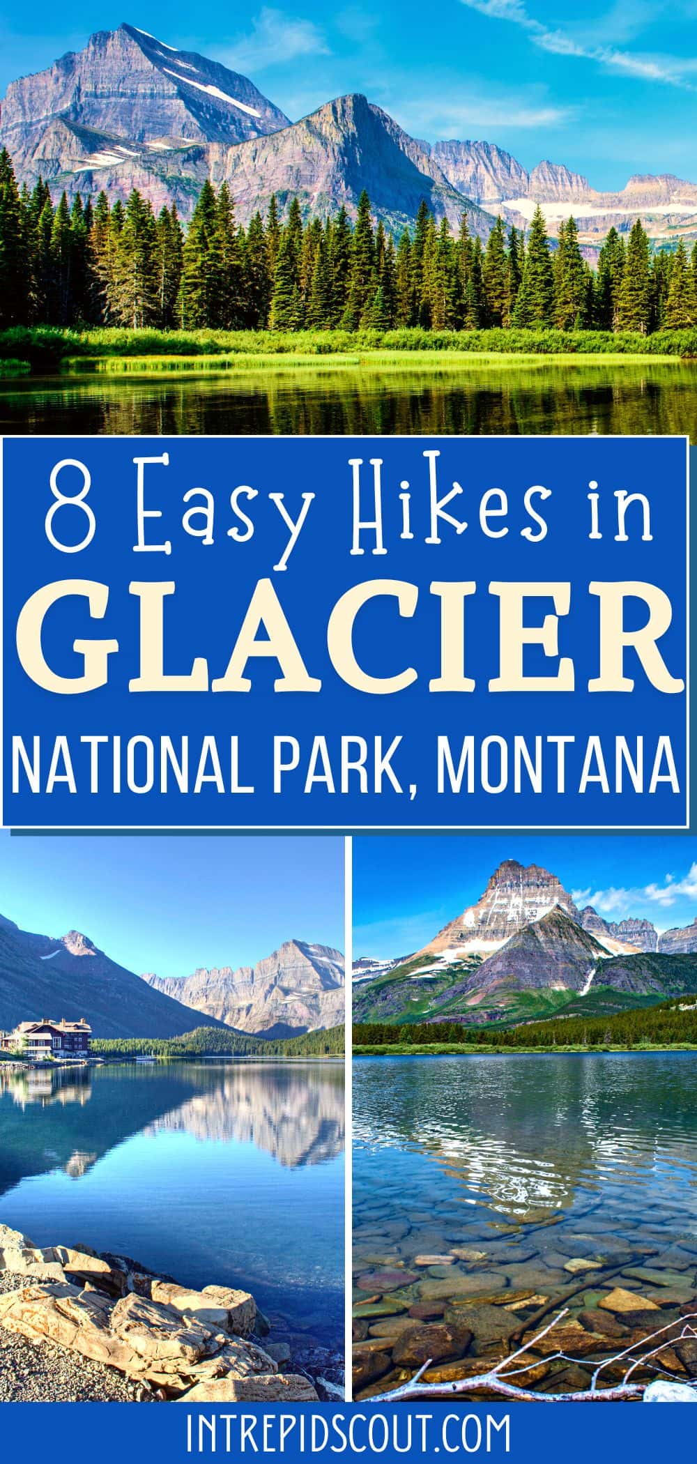
Why Not Save Easy Hikes in Glacier to Your Pinterest Board!
Now, It Is Your Turn, I Would Like to Hear Back from You!
Are you planning your trip to Glacier National Park?
Please let me know! Drop me a quick comment right below!
Click on any of the images below to get inspired and to help you with the planning process for your trip to Glacier National Park!
Comments:
4 thoughts on “8 FUN and EASY HIKES in GLACIER National Park (Maps and Useful Tips)”
Thank you! We’ll be making our first trip to Glacier NP June 25-July 1. Thank you for these hiking recommendations. We are in our 60’s and these sound perfect for us. We also hope to hike a little on the Highline, but not all of it!
Hi Denise,
Sounds great! Enjoy!
Anna
Thank you for this awesome information! Love how you break it down and offer additional tips. We’re lucky enough to visit GNP in mid-September and can’t wait to enjoy some of these hikes! 🙂
Sounds great! Enjoy your time in Glacier!