This site uses affiliate links, meaning that if you make a purchase through our links, we may earn an affiliate commission.
Trail Ridge Road is one of the most breathtaking drives you can take in the U.S., right in the heart of Rocky Mountain National Park.
Traveling along this scenic highway, you’ll reach an altitude of 12,183 feet, making it the longest continuous mountain road in the country. The road took three years to build and opened in 1932.
As you wind through some of the highest points in the Rockies, enjoy endless snowy peaks, lush valleys, and hundreds of sparkling lakes, all while keeping an eye out for wildlife. With so many incredible vistas along the way, Trail Ridge Road offers some of the best stops you won’t want to miss!
Trail Ridge Road Driving Tips
- Entrance Pass: You’ll need a valid pass to enter Rocky Mountain National Park. You can buy a day pass or an annual one if you plan to visit multiple times. Be sure to purchase your pass online ahead of time or at the park entrance.
- Timed Entry: From May through October, the park requires timed entry reservations. You’ll need to reserve your time slot in advance, especially during peak season. Without one, you won’t be able to drive through the park, so don’t forget to book ahead!
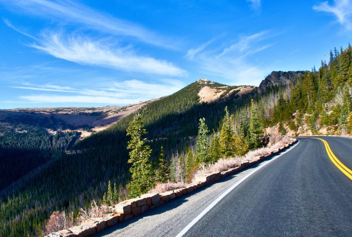
Trail Ridge Road
- Gas Up: There are no gas stations along Trail Ridge Road, so make sure to fill up your tank before starting your drive. Estes Park or Grand Lake are your best options for fueling up before you head out.
- Weather: Even in the summer, weather can change quickly in the mountains. Be prepared for cooler temperatures, rain, or even snow at higher elevations. Bring layers, and check the forecast before you go.
- Altitude: You’ll be driving at over 12,000 feet, which can take a toll if you’re not used to high elevations. Take it slow, stay hydrated, and give yourself time to adjust, especially if you’re planning on doing any hiking.
Trail Ridge Road Stats
- Start/Finish: Estes Park, CO / Grand Lake, CO (or vice versa). Driving from Estes Park, take US-34.
- Distance: 48 miles (77 km)
- Estimated Drive Time: 2-3 hours (without stops)
- Elevation: Peaks at 12,183 feet (3,713 meters)
- Seasonal Opening: Typically late May to mid-October (depending on weather)
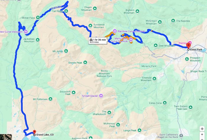
Trail Ridge Road Map
18 Must-See Stops, Panoramic Overviews and Hikes on Trail Ridge Road
Fall River Visitor Center
Your adventure on Trail Ridge Road begins at the Fall River Visitor Center, located just outside Estes Park and right before the entrance to the park.
This is a great first stop that will let you get your bearings and learn more about the park.
Inside, you’ll find interactive displays that showcase the park’s geology, wildlife, and history. It’s a fun way to learn about the area before you hit the road.
There are clean restrooms and a gift shop as well.
PRO TIP: Be sure to pick up a park map and any current trail information before you head out. The staff can also give you updates on weather conditions and any road closures.
West Horseshoe Park
After checking out the Fall River Visitor Center, hop back into your vehicle and head just two miles into the park to reach West Horseshoe Park.
It is a beautiful area with meadows, small lakes, and stunning views of the Mummy Mountain Range.
This area is a real gem for wildlife lovers! Sheep Lakes within the area is a prime spot for spotting bighorn sheep, deer, and elk, especially during the early morning or late evening hours.
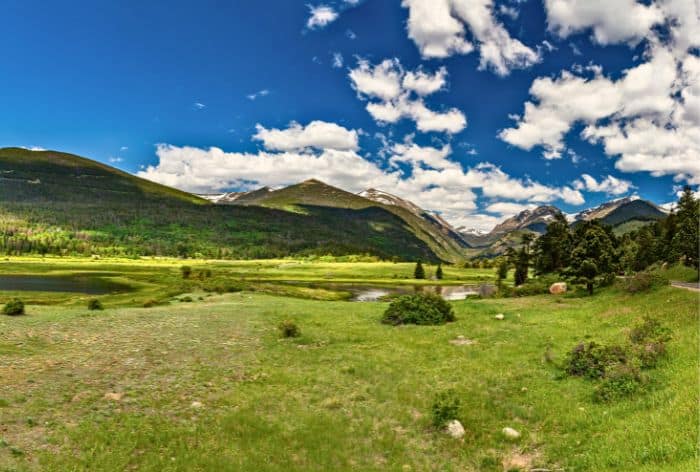
West Horseshoe Park with Sheep Lakes on Trail Ridge Road
If you’re up for a hike then, you can also access the Lawn Lake Trail from this area. It is a 4.5-mile hike leading you deeper into the park.
PRO TIP: For those looking for a bit of adventure, consider taking a detour onto Old Fall River Road. This gravel road, which starts at the next bend on your right, is the original one-way road built in 1921 that winds through Rocky Mountain National Park. It was also the first road to cross the Continental Divide!
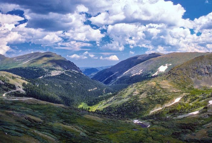
Views from Old Fall River Road
This 10.5-mile route takes you past Chasm Falls and up over Fall River Pass, giving you sweeping views of the surrounding landscape.
Keep your eyes peeled for wildlife, as this area is known for its diverse animal sightings.
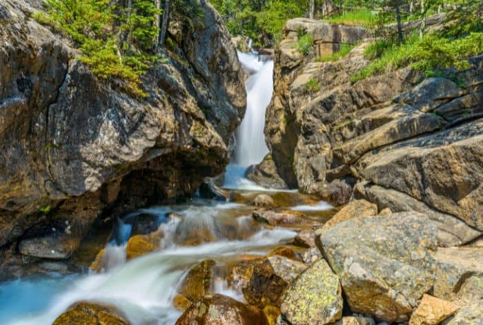
Beautiful Chasm Falls on Old Fall River Road
GOOD TO KNOW: Old Fall River Road isn’t plowed in the winter, so it’s typically only open to vehicles from July to September. At the end of the road, it rejoins US-34, making it an exciting side trip on your journey.
Horseshoe Park Overlook
Next up on your drive along Trail Ridge Road is the Horseshoe Park Overlook, a must-see spot. You will be able to see stunning panoramas of Fall River, which winds lazily through the U-shaped Horseshoe Park below, alongside Sheep Lakes.
GOOD TO KNOW: At an elevation of 8,524 feet, Horseshoe Park was carved out by glacial activity about 15,000 years ago. You’ll be treated to views of several majestic peaks, including Mount Chapin (12,454 feet), Mount Chiquita (13,069 feet), and Ypsilon Mountain (13,514 feet), which frame the picturesque valley.
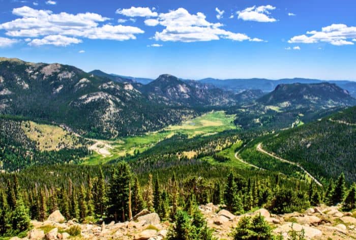
Horseshoe Park Overlook on Trail Ridge Road
PRO TIP: As you continue your journey, the road will merge with US-36. Be sure to turn right onto US-34, where the drive starts to climb with a series of exciting switchbacks, offering even more stunning views along the way.
Beaver Ponds
Two miles further up Trail Ridge Road, you’ll find the Beaver Ponds.
A short, 0.2-mile boardwalk will take you through what was once home to thriving beaver colonies.
The beavers originally built dams in the 1950s, which shifted water flow from streams to create a series of ponds. Over time, these dams decayed, and today, the area is a lush wetland full of grasses and other plant life, making it an ideal spot for observing wildlife like birds and small mammals.
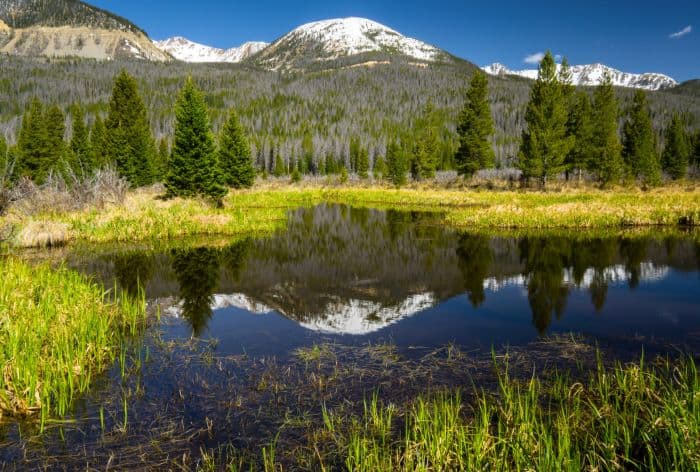
Beaver Ponds on Trail Ridge Road
The National Park Service has also introduced greenback cutthroat trout here to help restore this once-endangered species. Keep an eye out for them in the clear waters.
The boardwalk leads to an observation deck where you can take in the wetland scenery.
There’s also a picnic area nearby, perfect for a quick break on your journey.
Many Parks Curve Overlook
Next up on your drive is the Many Parks Curve Overlook, where you’re in for some spectacular panoramic views!
This overlook lives up to its name by offering vistas of several of Rocky Mountain National Park’s iconic parks, including Moraine Park, Horseshoe Park, Beaver Meadows, and even parts of Estes Park.
You’ll also see glacier-carved valleys below and towering peaks like Long’s Peak, which stands at 14,255 feet.
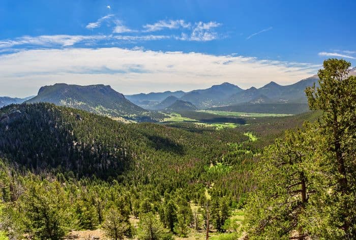
Many Parks Curve Overlook on Trail Ridge Road
GOOD TO KNOW: Parking can fill up quickly here, so be patient, especially if you’re visiting during peak season.
Rainbow Curve Overlook
Continuing up Trail Ridge Road, you’ll reach the Rainbow Curve Overlook, an absolutely stunning viewpoint at 10,875 feet above sea level.
This overlook marks the transition from subalpine forests to the alpine tundra, and it’s a great spot to witness the diverse ecosystems within Rocky Mountain National Park.
From here, you can enjoy sweeping views of the Mummy Range, Horseshoe Park, Alluvial Fan, and Hidden Valley. On a clear day, you can spot several well-known peaks, including Mount Chapin, Ypsilon Mountain, and Hagues Peak.
GOOD TO KNOW: The overlook gets its name from the rainbows often seen after summer storms.
Ute Trail East
Next up is the trailhead for Ute Trail East, an awesome stop if you’re up for a bit of hiking.
This trail follows an ancient route once used by the Ute Native Americans to cross through the alpine tundra.
Starting at 11,440 feet, the trail takes you across wide-open, high-altitude landscapes where you’ll have stunning views of mountain ridges, wildflowers (in the summer), and you might even spot some wildlife like elk or marmots.
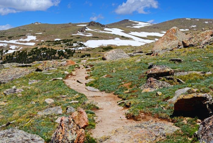
Ute Trail West
The Ute Trail is moderate and fairly gentle, so it’s a great option if you want to experience the alpine scenery without too much effort.
GOOD TO KNOW: If you hike to Tombstone Ridge, it’s about 4 miles one-way, and the views along the way are spectacular. You’ll get a full panorama of the Continental Divide and the valleys below.
PRO TIP: Weather can change fast up here, especially in the summer when afternoon thunderstorms are common. It’s a good idea to start early, bring layers, and keep an eye on the sky!
Forest Canyon Overlook
The next stop is the Forest Canyon Overlook situated at an elevation of 11,716 feet.
This viewpoint showcases the stunning U-shaped Forest Canyon, carved by glaciers over thousands of years. From here, you will be able to see towering peaks like Longs Peak, Stones Peak, and Mount Ida, as well as the Gorge Lakes.
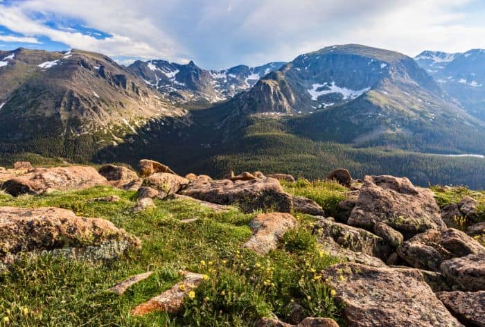
Forest Canyon Overlook on Trail Ridge Road
GOOD TO KNOW: There is a short, 0.2-mile paved trail from the parking area that leads to the overlook, and along the way, you’ll find interpretive signs explaining the area’s unique geology and fragile tundra environment.
The overlook also offers a clear view of the Continental Divide, where the water flows either west toward the Pacific or east toward the Atlantic.
Rock Cut and Tundra Communities Trail
As you continue along Trail Ridge Road, you’ll come across Rock Cut, an awesome viewpoint at 12,178 feet elevation.
GOOD TO KNOW: The drive through Rock Cut was made possible in 1932 when workers blasted through the area while carefully preserving the giant rock formations on the sides of the road.
PRO TIP: Make sure to hike the Tundra Communities Trail, a 1-mile out-and-back trail.
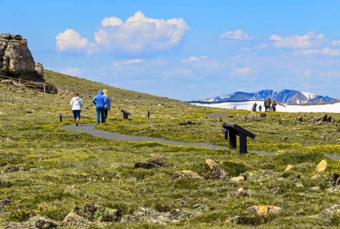
Tundra Communities Trail on Trail Ridge Road
Along the way, you’ll pass unique rock formations like Mushroom Rocks, with their dark caps and light stems, created by magma rising through ancient seabeds.
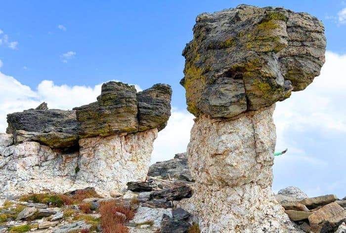
Mushroom Rocks on Tundra Communities Trail
There are interpretive signs on the trail teach you about the tundra ecosystem and how plants survive in such an extreme environment.
Keep an eye out for marmots and elk, which are common in the area. The trail culminates at a plaque dedicated to Roger Wolcott Toll, a former park superintendent.
Gore Range Overlook
The next stop on Trail Ridge Road is Gore Range Overlook, located at an elevation of 12,048 feet.
From this overlook, you’ll be treated to sweeping views of the Gore Range, the Never Summer Mountains, and some of the tallest peaks in Rocky Mountain National Park.
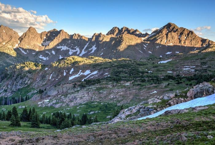
Gore Range Overlook
The Never Summer Mountains are particularly unique, formed by volcanic activity around 25 to 28 million years ago. The Arapaho people named them because snow tends to linger on their high slopes well into summer.
The overlook also offers a glimpse of Longs Peak, the highest mountain in the park at 14,259 feet.
GOOD TO KNOW: It’s a cold, often windy stop, as the temperature here can be 20-30 degrees cooler than at lower elevations, so be prepared for brisk weather! Altitude sickness is also a concern, so take it slow, and stay hydrated.
PRO TIP: After enjoying the view, continue past this overlook as the road reaches its highest point on Trail Ridge Road—12,183 feet—just beyond Gore Range Overlook
The Alpine Visitor Center
Next up is the Alpine Visitor Center, located at 11,796 feet above sea level, which is the highest visitor center in the entire National Park System!
Perched atop Fall River Pass, it provides some of the most stunning views in Rocky Mountain National Park.
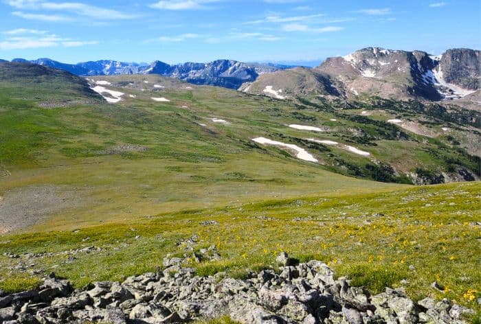
Fall River Pass
The center itself offers informative exhibits on the unique tundra ecosystem, along with a gift shop, snack bar, and restroom facilities. You can also find rangers on hand to answer questions and guide you through the area’s trails and viewpoints.
Medicine Bow Curve
Medicine Bow Curve is the next awesome viewpoint along Trail Ridge Road, known for its sweeping panoramas of the Medicine Bow Mountains and the Cache la Poudre River.
From this vantage point, you will be able to see two distinct tree lines: the upper one marks the transition from subalpine forests to alpine tundra, while the lower one, near the valley, shows where it’s too wet for trees to grow.
PRO TIP: The road descends sharply from this point, so take it slow and enjoy the breathtaking surroundings as you head toward the next stop.
Poudre Lake
Next up is Poudre Lake a serene alpine lake located at Milner Pass, where Trail Ridge Road crosses the Continental Divide.
Sitting at about 10,758 feet in elevation, this scenic lake is the headwater for the Poudre River, which flows eastward toward Fort Collins before eventually joining the Mississippi River.
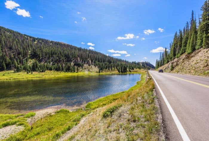
Poudre Lake on Trail Ridge Road
GOOD TO KNOW: The nearby Milner Pass Trailhead provides access to the Ute Trail. The trail offers a moderately easy hike, beginning at 10,759 feet and climbing steadily through alpine meadows and tundra ecosystems. The trail runs for approximately 4 miles to the Alpine Visitor Center.
Fairview Curve Overlook
The next stop is the Fairview Curve Overlook offers a great view of the glacier-carved Kawuneeche Valley and the rugged Never Summer Mountains.
The Kawuneeche Valley holds cultural significance, having been home to Native American communities for thousands of years. Early settlers used the valley for homesteading in the late 1800s, but it’s now a protected part of the national park.
The Never Summer Range is unique in the park as its only volcanic mountain range, and you can spot the Grand Ditch, a man-made canal across the mountains that still provides water to eastern Colorado farmers.
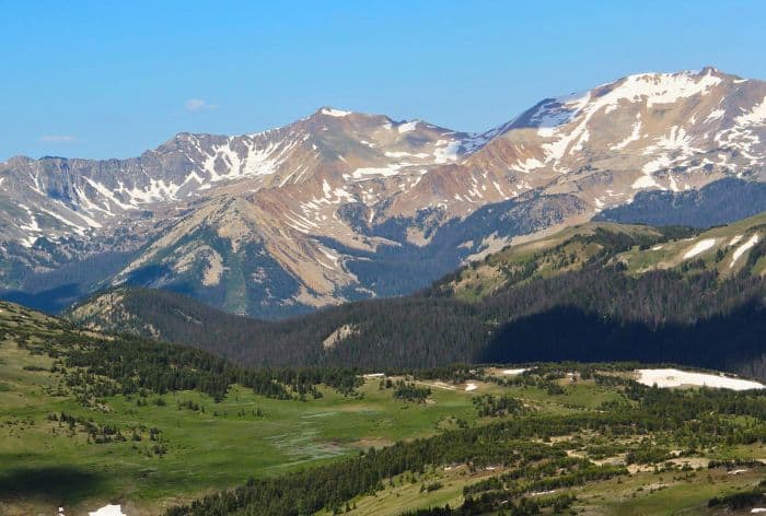
Never Summer Mountains
Colorado River and Timber Lake Trailheads
Next, the road continues to descend through the forest with many crazy wild curves. After about 2 miles you will reach a couple of trailheads for Colorado River Trail and Timber Lake Trail.
Colorado River Trail is a hike that offers stunning views of the surrounding landscapes as it follows the Colorado River upstream.
- Distance: 7.1 miles round trip
- Elevation Gain: Approximately 944 feet
- Difficulty: Moderate
- Location: Trailhead located off Trail Ridge Road
About a mile in, you’ll first encounter the Colorado River, which may look modest here but travels another 1,400 miles to the Gulf of California.
One highlight is the remains of a small, historic mining operation along the trail, with an old mining car and cabin remnants from the late 1800s, remnants of an earlier time when this area was a bustling mining hub.
The trail culminates at Lulu City, an old silver mining town founded in 1879.
Just a short drive from the Colorado River Trailhead, you’ll find the Timber Lake Trailhead. This trail offers a 4.8-mile one-way hike that leads to the stunning Timber Lake. Here are some key details:
- Distance: 4.8 miles one way
- Elevation Gain: Approximately 2,050 feet
- Difficulty: Moderate to strenuous
- Estimated Hiking Time: 3.5 to 6 hours round trip, depending on your pace
- Trail Type: Out and back
Holzwarth Historic Site
The next stop is the Holzwarth Historic Site located in the beautiful Kawuneeche Valley. This site offers a glimpse into early 20th-century life in the Rockies.
The site began as a homestead and cattle ranch established in 1917 by John Holzwarth, who moved here after Prohibition. The ranch became popular with visitors to Rocky Mountain National Park and eventually transformed into the Holzwarth Trout Lodge.
Several cabins, including the main lodge and guest accommodations, still stand today.
Rocky Mountain National Park Visitor Center at Kawuneeche
Ahead of you is the Rocky Mountain National Park Visitor Center at Kawaumeeche. It is a good stop to check out all the exhibits and take a break before continuing on your journey.
From here continue to Grand Lake.
Grand Lake
The last stop is Grand Lake a stunning alpine gem, known as the largest and deepest natural body of water in Colorado, covering over 500 surface acres and plunging nearly 400 feet deep.
It was formed by glaciers less than 12,000 years ago and is surrounded by Rocky Mountain National Park on three sides, making it a breathtaking spot for outdoor enthusiasts!
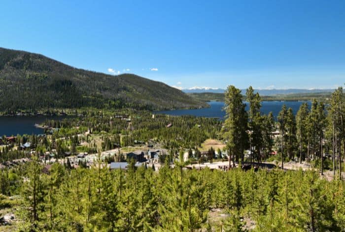
Grand Lake on Trail Ridge Road
In the summer, the lake is a hub for swimming, boating, kayaking, paddleboarding, and fishing. You can rent various watercraft from local marinas.
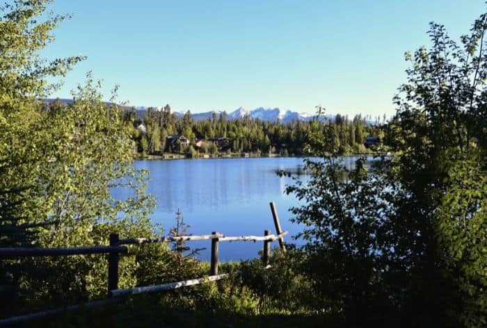
Grand Lake
Intrepid Scout's Tips for Best Stops on Peak to Peak Scenic Byway
- Dress for the Weather: Even in summer, temperatures at high elevations can drop significantly. Bring layers, including a jacket, as weather at the summit (over 12,000 feet) can be windy, cold, and unpredictable. Snow can fall even in July!
- Hydration and Altitude Awareness: The high altitude can cause dehydration and altitude sickness. Bring plenty of water, take it slow, and be aware of symptoms like headaches or dizziness. Consider limiting your physical exertion, especially if you’re not used to high altitudes.
Here Are Some More Ideas of Places to Visit in Colorado:
8 Best Scenic Drives in Colorado (Maps, Tips, Best Stops and Hikes)
4 Best Stops on Mount Blue Sky Scenic Byway (Best Hikes, Tips and Maps)
9 Best Hikes in the Bear Lake Corridor, Rocky Mountain National Park (Maps and Tips)
18 Best Stops on Trail Ridge Road in Rocky Mountain National Park
12 Best Stops and Hikes on Peak to Peak Scenic Byway in Colorado (Maps+Useful Tips)
14 Things You Can’t Miss on First Visit to Glenwood Springs, Colorado
2 DAYS in MESA VERDE National Park (Perfect Itinerary for First Visit)
23 Practical Tips for FIRST VISIT to MESA VERDE National Park
Did You Find Best Stops on Trail Ridge Road Useful?
Why Not Save It to Your Pinterest Board!


Now, It Is Your Turn, I Would Like to Hear Back from You!
Are you planning your trip to Colorado?
Please let me know!
Drop me a quick comment right below!
Click on any of the images below to get inspired!
