This site uses affiliate links, meaning that if you make a purchase through our links, we may earn an affiliate commission.
Mount Blue Sky Scenic Byway, formerly Mount Evans Scenic Byway, is Colorado’s ultimate mountain drive. This route lets you start in the lush forests around Echo Lake, climb up past wildflower fields and alpine lakes, and eventually reach stunning views at over 14,000 feet.
In this guide, you’ll find the best stops on Mount Blue Sky Scenic Byway, tips on navigating this mountain road, and the key things to know before you go.
- 1. Mount Blue Sky Scenic Byway Overview and History
- 2. Mount Blue Sky Scenic Byway Stats
- 3. Mount Blue Sky Scenic Byway Timed Entry Reservation Requirements
- 4. Reservation Fees for Mount Blue Sky Scenic Byway
- 5. Map of Mount Blue Sky Scenic Byway Timed Entry Reservation Requirements
- 6. Best Stops on Mount Blue Sky Scenic Byway
-
- 6.1. Echo Lake
- 6.2. Mount Goliath Research Natural Area
- 6.3. Summit Lake Park
- 6.4. Summit Interpretive Area
Mount Blue Sky Scenic Byway Overview and History
The Mount Blue Sky Scenic Byway, once called Mount Evans Scenic Byway, is Colorado’s highest paved road and stretches up to the summit of Mount Blue Sky at over 14,000 feet.
The road starts near Echo Lake and winds its way up, passing through alpine forests, rocky tundra, and some incredible viewpoints.
The byway was built in the 1920s to make these high places more accessible, and today it’s one of the most popular drives for both locals and tourists.
Along the way, you’ll get a chance to see Colorado’s unique landscapes change as you go higher, and there’s a good chance of spotting wildlife like mountain goats and bighorn sheep.
The route itself is short but steep, so it’s perfect for a day trip with several stops along the way.
Mount Blue Sky Scenic Byway Stats
- Starting Point: The entrance to the Mount Blue Sky Scenic Byway is located at Echo Lake Park.
- Ending Point: The byway culminates at the summit of Mount Blue Sky, which stands at 14,265 feet. Be prepared for a short hike to reach the true summit, which takes about 20 minutes.
- Elevation: The road reaches a height of 14,130 feet at the summit, making it the highest paved road in North America.
- Length: The byway spans 28 miles round-trip.
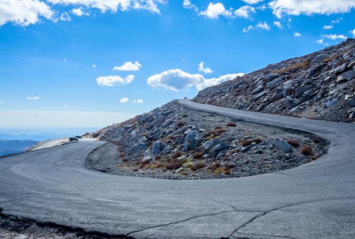
Sharp Turns on Mount Blue Sky Scenic Byway / Best Stops on Mount Blue Sky Scenic Byway
- Travel Time: While the drive itself is around 45 minutes each way, you’ll want to account for extra time to stop and enjoy the stunning views. Depending on how long you linger at each stop, your total time on the byway could easily exceed 3 hours.
- Temperature Drop: For every 1,000 feet in elevation gain, the temperature drops roughly 3-5°F, meaning it can be 20-30°F cooler at the summit than in town.
- Visitors Per Year: Approximately 200,000 visitors make the drive each season, making it one of Colorado’s top scenic attractions.
- Wildlife Viewing: The area is home to mountain goats, bighorn sheep, and marmots, with the best chances for sightings around Summit Lake and near the summit.
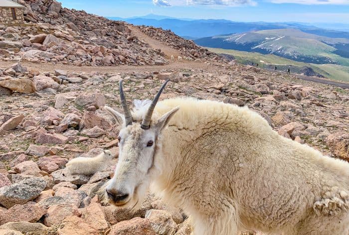
Mountain Goats Near the Summit / Best Stops on Mount Blue Sky Scenic Byway
- Seasonal Access: This route is open seasonally, typically from Memorial Day through Labor Day, depending on weather conditions.
- Pets: Pets must be kept on a handheld leash at all times, and they cannot be kept in an unattended vehicle.
- Road Conditions and Safety: With narrow lanes, steep drops, and no guardrails in some sections, drive cautiously, especially near the summit.
- Vehicle Guidelines: Due to altitude and road conditions, it’s recommended to use a well-maintained vehicle; larger vehicles may struggle in some areas.
Mount Blue Sky Scenic Byway Timed Entry Reservation Requirements
When planning a visit to the Mount Blue Sky Scenic Byway, it’s essential to secure a timed-entry reservation in advance:
- Reservations are mandatory and cannot be purchased at the park entrance. They need to be made online through Recreation.gov
- Passes are available on a 30-day rolling basis with 25% of the time slots opening 48 hours in advance.
- You’ll need to download or print your reservation before arriving, as there is no cell service at the entrance.
- When you reach the entrance, have your photo ID ready to present along with your reservation.
There are a few ticket options available:
- All Recreation Sites Vehicle Ticket:
This ticket provides access for one private vehicle and motorcycles to access Mount Blue Sky and all developed recreation sites: Mount Goliath, Summit Lake Park, and the Summit Interpretive Area.
- Mt. Goliath Nature Center and Summit Interpretive Area Ticket:
This ticket provides access for one private vehicle and motorcycles to access Mount Goliath and the Summit Interpretive Area only.
- Summit Lake Park Only Vehicle Ticket:
This ticket provides access for one private vehicle or motorcycle to access Summit Lake Park only.
GOOD TO KNOW: Timed entry starts at 8 am, but if you want to access the road prior, you’ll still need an 8 am reservation slot.
Reservation Fees for Mount Blue Sky Scenic Byway
When visiting the Mount Blue Sky Scenic Byway, be prepared to pay the following rates for vehicle entry and reservations:
- Personal Vehicle: $15.00
- 2-Person Motorcycle (ages 16+): $6.00
- 1-Person Motorcycle (ages 16+): $3.00
- Reservation Fee: $2.00 per ticket (nonrefundable)
- Late Cancellation Fee: No refunds within 24 hours of the tour
GOOD TO KNOW: If you are an America the Beautiful pass holder, the only charge is the nonrefundable reservation fee, so make sure to add your pass during checkout.
Map of Mount Blue Sky Scenic Byway Timed Entry Reservation Requirements
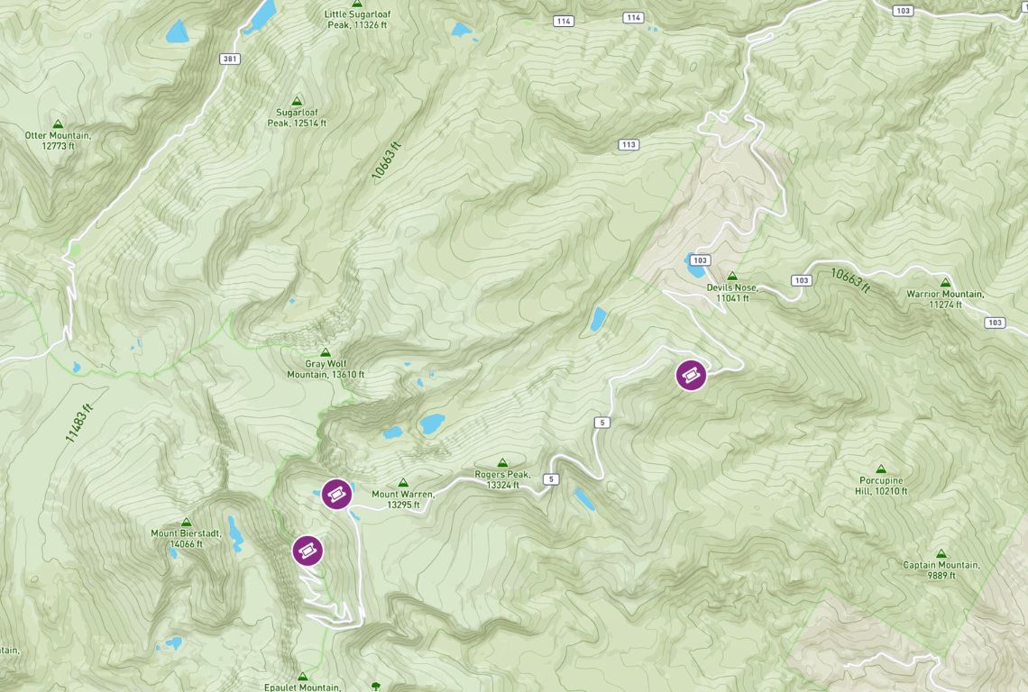
Map of Mount Blue Sky Scenic Byway Timed Entry Reservation Requirements / Credit: Recreation.gov
Best Stops on Mount Blue Sky Scenic Byway
Echo Lake
The first stop before you reach the entrance station is Echo Lake. You don’t need a parking permit or reservation to visit the area.
The lake sits at an elevation of 10,600 feet and is surrounded by towering mountains and lush forests.
The views are especially breathtaking in the early morning or late afternoon when the sunlight casts a warm glow on the surrounding peaks.
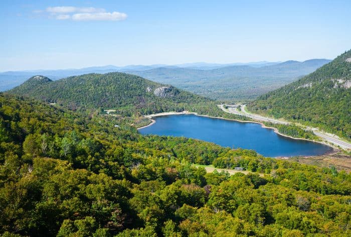
View of Echo Lake / Best Stops on Mount Blue Sky Scenic Byway
There are several hiking options here:
- The Echo Lake Loop is an easy, 1-mile trail that winds around the lake, providing excellent views.
- If you are looking for a bit more of a challenge, you can connect to the Chicago Lakes Trail, which leads to two stunning glacial lakes higher up.
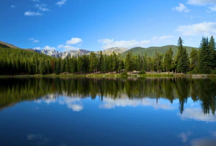
Echo Lake Loop / Best Stops on Mount Blue Sky Scenic Byway
GOOD TO KNOW: There are picnic areas with tables and benches. Bring a packed lunch and enjoy a peaceful meal surrounded by nature.
PRO TIP: Nearby, you’ll find the historic Echo Lake Lodge, a great place to stop for lunch or dinner after your scenic drive. It’s a cozy spot to relax and refuel before heading out, making it a perfect addition to your visit.
Mount Goliath Research Natural Area
Your next stop is Mount Goliath Research Natural Area, a protected 160-acre section dedicated to the conservation, study, and appreciation of Rocky Mountain bristlecone pines.
This area is one of the few accessible places where you can see the ancient bristlecone pines, some of which have survived over 1,000 years, adapting to extreme conditions with their dense, twisted forms.
Here are a few things that you can do at this stop:
- Hike the Bristlecone Pine Trail
The Bristlecone Pine Trail at Mount Goliath is a short and easy 1-mile round-trip with an elevation gain of roughly 200 feet that provides an up-close look at some of the oldest trees in the world and the stunning alpine landscape surrounding Mount Blue Sky. This hike should not take you more than 30-45 minutes.
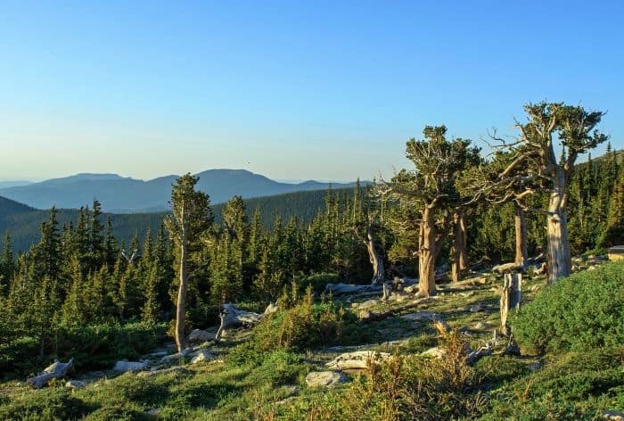
Bristlecone Pine Trail / Best Stops on Mount Blue Sky Scenic Byway
The twisted, gnarled forms of the bristlecone pines are adaptations to the harsh, windy conditions of high-altitude life, and some trees here are over 1,000 years old. The pines often show signs of weathering, which gives them their distinctive, almost sculptural appearance.
Along the trail, interpretive signs provide details about the ecology, botany, and geology of the area. You’ll learn about how bristlecone pines adapt to survive high winds, extreme temperatures, and a short growing season.
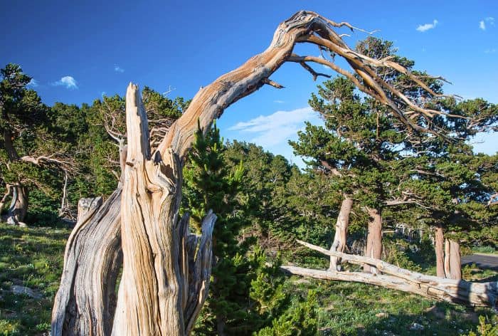
Bristlecone Pine Trail / Best Stops on Mount Blue Sky Scenic Byway
- Dos Chappell Nature Center
Make sure to visit the Dos Chappell Nature Center. Located at 11,540 feet, this interpretive center provides insights into the high-altitude ecosystems of Mount Goliath.
You will find informative exhibits that explain the lifecycle and resilience of bristlecone pines, local flora, and fauna, and the area’s geology.
The center was established in partnership with the Denver Botanic Gardens, Volunteers for Outdoor Colorado, and the U.S. Forest Service.
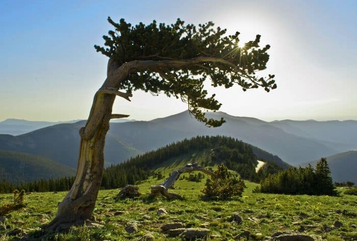
Bristlecone Pines on Mount Goliath / Best Stops on Mount Blue Sky Scenic Byway
- Explore the Alpine Gardens
Next, explore the Alpine Gardens at Mount Goliath showcasing a stunning array of native alpine plants and wildflowers. The gardens are accessible from the Dos Chappell Nature Center and connect seamlessly with the Bristlecone Pine Trail.
Located at around 11,500 feet, these gardens highlight species adapted to the extreme conditions of high altitudes, such as cold temperatures, strong UV rays, and short growing seasons.
There are interpretive signage along the paths that provides insights into each species’ survival strategies, making a walk through the Alpine Gardens both visually and educationally enriching.
Summit Lake Park
Summit Lake Park is one of the most beautiful stops on the Mount Blue Sky Scenic Byway. Sitting at 12,830 feet, the lake and surrounding trails offer a mix of easy and more challenging hikes, with incredible mountain views.
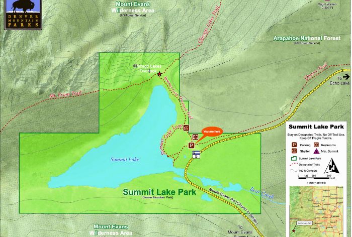
Map of Summit Lake Park / Image Credit: Denver Mountain Parks
Here’s what you can do while you’re here:
Chicago Lakes Overlook Trail
This trail is a short, scenic hike that’s just about 2 miles round-trip. It takes you from Summit Lake to an overlook with jaw-dropping views of the Chicago Lakes basin and surrounding peaks.
- Length: ~2 miles round trip from Summit Lake
- Elevation Gain: ~400 feet
- Difficulty: Easy to moderate
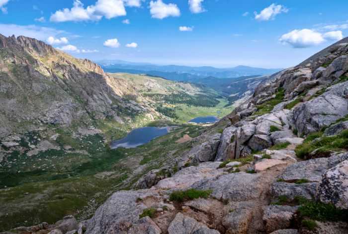
Chicago Lakes Overlook Trail / Best Stops on Mount Blue Sky Scenic Byway
Once you reach the overlook, you’ll be able to see all the way down the valley, with mountain lakes and rocky peaks on the horizon—perfect for some panoramic photos.
It’s an easy-to-moderate trail, so it’s a good option for most people looking to enjoy the views without a lot of climbing!
Summit Lake Loop Trail
The Summit Lake Loop Trail is a simple, half-mile walk around the lake itself. It’s flat and easy, making it ideal if you just want a quick stroll to take in the views or snap a few photos.
- Length: ~0.5 miles
- Elevation Gain: Minimal
- Difficulty: Easy
Along the way, you can spot alpine wildflowers and might even see mountain goats lounging around.
This loop is a quick way to get a taste of the alpine landscape up close, all within a stone’s throw of your car.
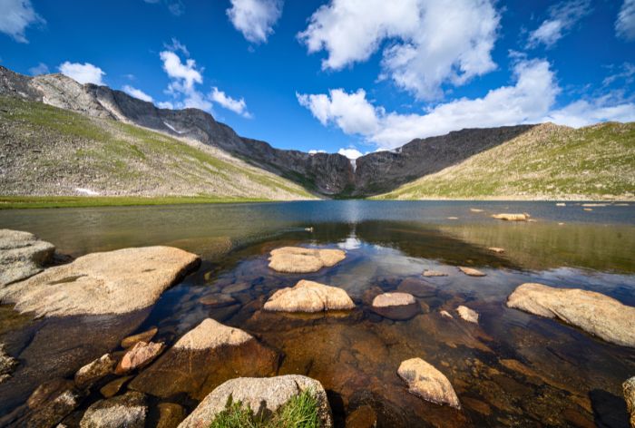
Summit Lake Loop Trail / Best Stops on Mount Blue Sky Scenic Byway
Mount Blue Sky Summit Trailhead
If you’re up for a challenge, Summit Lake is also the starting point for the trail to the Mount Blue Sky summit.
- Trail Type: Out-and-back trail to the summit
- Distance to Summit: ~3.5 miles one way
- Elevation Gain: ~1,400 feet from Summit Lake to the summit
- Difficulty: Strenuous
The trail is about 3.5 miles one way, and it’s a pretty steep climb, gaining around 1,400 feet in elevation.
This hike can be tough, but the reward is huge—breathtaking, 360-degree views from the summit.
You’ll need to be prepared with plenty of water, layers for changing weather, and a solid plan for the altitude, but if you’re up for it, this trail is unforgettable.
Summit Interpretive Area
The Summit Interpretive Area is the grand finale of the Mount Blue Sky Scenic Byway, perched at the highest accessible point along the drive.
This area stands out for its sweeping views, opportunities to spot mountain wildlife, and unique historic features.
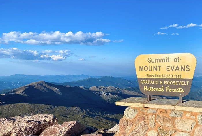
Summit Interpretative Area / Best Stops on Mount Blue Sky Scenic Byway
Here are a few things to do at this stop:
The Mount Blue Sky Summit Trail
You can’t miss this short but rewarding 0.25-mile trail to the Mount Blue Sky summit. Although brief, this trail has an elevation gain that challenges even experienced hikers due to the high altitude.
- Trail Type: Out-and-back trail to Mount Blue Sky summit.
- Distance to Summit: Approximately 0.25 miles one way.
- Elevation Gain: Roughly 138 feet from the Summit Interpretive Area parking lot.
- Difficulty: Strenuous, despite the short distance.
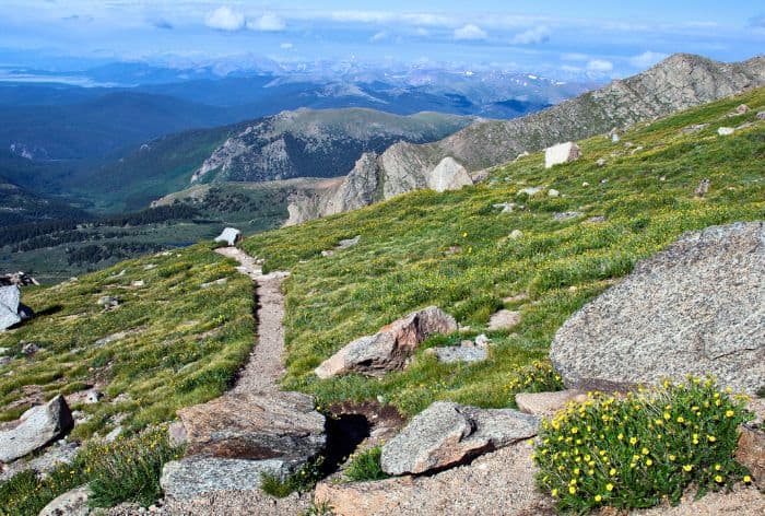
Mount Blue Sky Summit Trail / Best Stops on Mount Blue Sky Scenic Byway
This trail offers some of the most stunning panoramic views of the Rockies, with sights that stretch across the Continental Divide and as far south as the Sangre de Cristo Mountains in New Mexico.
To top it off, you will have the unique experience of “bagging” a fourteener, or 14,000-foot peak, with relative ease!
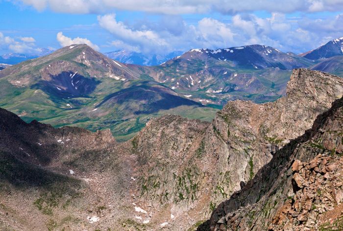
Views from Mount Blue Sky / Best Stops on Mount Blue Sky Scenic Byway
Crest House Ruins:
Make sure to check out Crest Houese ruins. It was once a bustling restaurant and tourist stop in the 1940s. It was destroyed by a fire in the 1970s.
Today, the ruins serve as an observation platform where visitors can get an up-close view of historic architecture and enjoy the surrounding scenery.
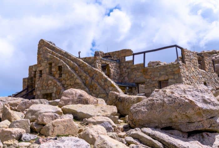
Crest House Ruins / Best Stops on Mount Blue Sky Scenic Byway
Meyer-Womble Observatory:
As one of the highest observatories in North America, Meyer-Womble Observatory does high-altitude scientific research.
The observatory is managed by the University of Denver, although public tours aren’t typically available.
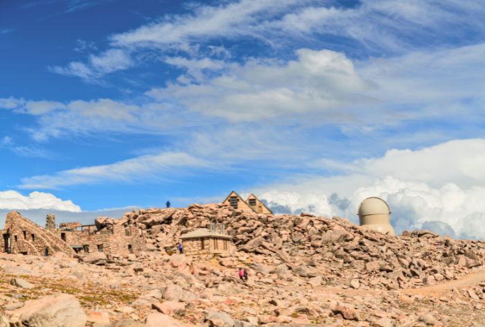
Crest House Ruins and Meyer-Womble Observatory / Best Stops on Mount Blue Sky Scenic Byway
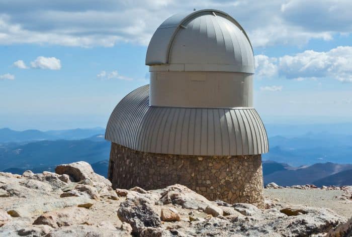
Meyer-Womble Observatory / Best Stops on Mount Blue Sky Scenic Byway
Here Are Some More Ideas of Places to Visit in Colorado:
Perfect 5 Days in Rocky Mountain National Park (Hikes, Scenic Drives, Hidden Gems)
13 Tips for First-Time Visit to Rocky Mountain National Park
12 Short and Easy Hikes in Rocky Mountain National Park (Perfect for Beginners)
8 Best Scenic Drives in Colorado (Maps, Tips, Best Stops and Hikes)
9 Best Hikes in the Bear Lake Corridor, Rocky Mountain National Park (Maps and Tips)
18 Best Stops on Trail Ridge Road in Rocky Mountain National Park
12 Best Stops and Hikes on Peak to Peak Scenic Byway in Colorado (Maps+Useful Tips)
14 Things You Can’t Miss on First Visit to Glenwood Springs, Colorado
2 DAYS in MESA VERDE National Park (Perfect Itinerary for First Visit)
23 Practical Tips for FIRST VISIT to MESA VERDE National Park
Did You Find Best Hikes in Bear Lake Corridor in Rocky Mountain Useful?
Why Not Save It to Your Pinterest Board!


Now, It Is Your Turn, I Would Like to Hear Back from You!
Are you planning your trip to Colorado?
Please let me know!
Drop me a quick comment right below!
Click on any of the images below to get inspired!
