This site uses affiliate links, meaning that if you make a purchase through our links, we may earn an affiliate commission.
Colorado is home to some of the most beautiful scenic drives in the country, from high-altitude mountain passes to red rock canyons and historic mining towns.
Each of these routes offers a unique experience, whether you’re exploring for a few hours or a full day.
Here’s a guide to the best scenic drives in Colorado, complete with key stops, insider tips, and details on hiking trails and viewpoints.
Peak to Peak Scenic Byway
The Peak to Peak Scenic Byway, Colorado’s oldest scenic byway established in 1918, stretches from Estes Park to Black Hawk, winding through dense forests, alpine meadows, and historic mining towns.
This 55-mile route offers endless mountain views. It is especially stunning during fall when endless aspen trees turn gold!
Along the way, you’ll pass quaint mountain towns, ghost towns, and landmarks like the Chapel on the Rock, a beautiful stone chapel backed by Mount Meeker.
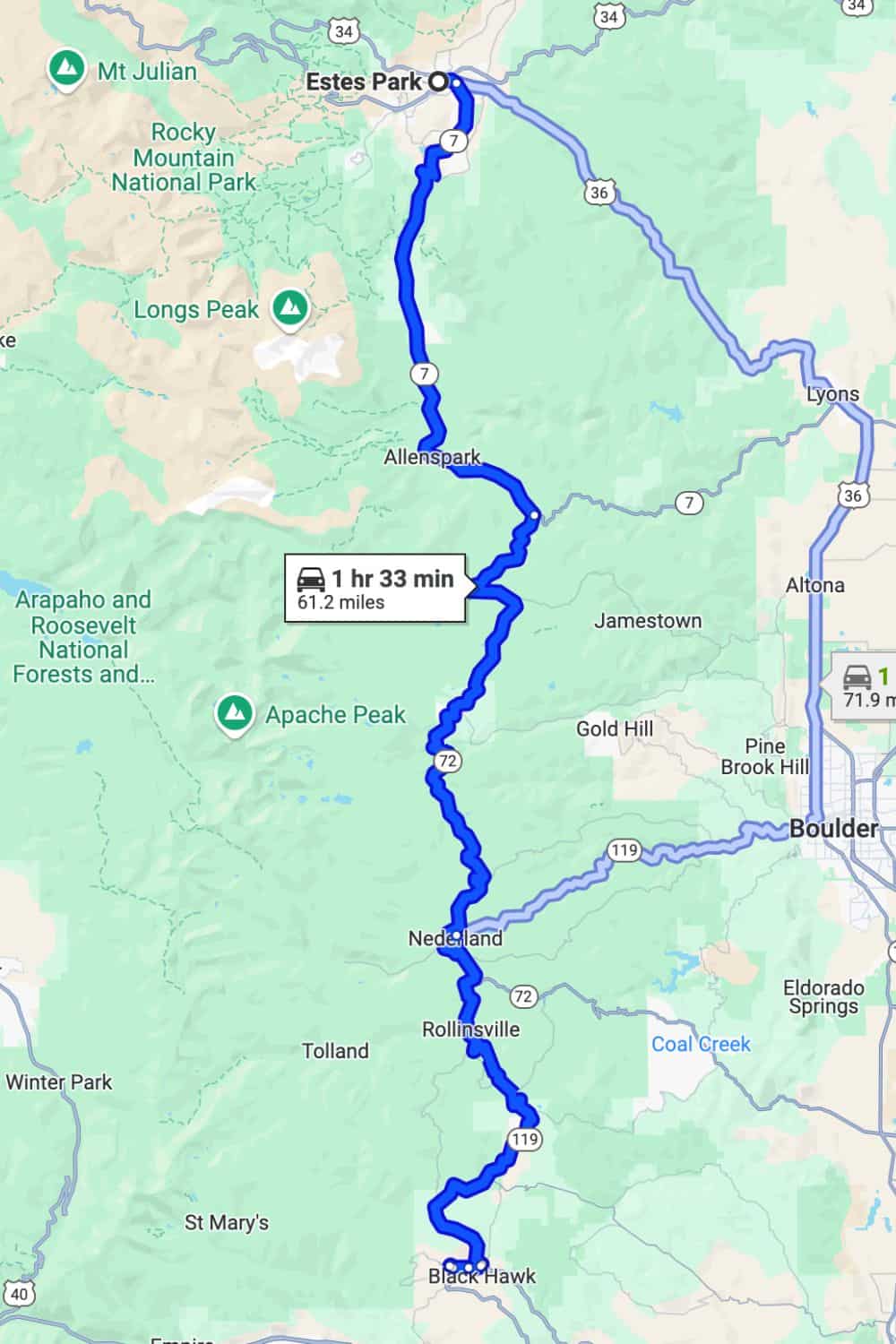
Map of Peak to Peak Scenic Byway
- Location: Northern Colorado
- Start/End Points: Estes Park to Central City
- Seasonal Accessibility: Open year-round, though winter weather may impact conditions.
- Distance: 60 miles
- Estimated Drive Time: Around 2 hours (without stops)
Must-See Stops Along Peak to Peak Scenic Byway:
- Just south of Estes Park, you will find Lily Lake. It offers a peaceful setting with an easy, flat 0.8-mile loop trail around the lake. Enjoy scenic views of Longs Peak and vibrant wildflowers in summer.
GOOD TO KNOW: The trail is wheelchair accessible, making it perfect for families and all fitness levels.
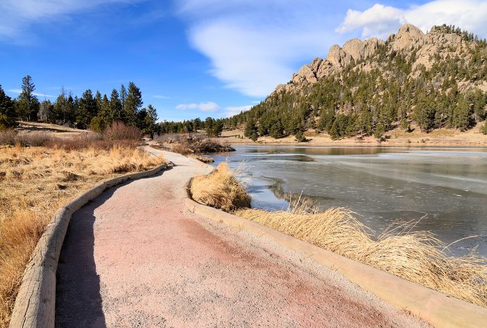
Lilly Lake / Best Scenic Drives in Colorado
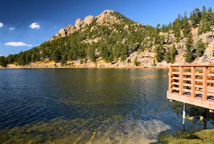
Lilly Lake / Best Scenic Drives in Colorado
- Next up, near Allenspark you will find Chapel on the Rock. This iconic stone chapel is one of Colorado’s most photographed landmarks. It’s a lovely spot to stop, take photos, and enjoy the tranquil surroundings.
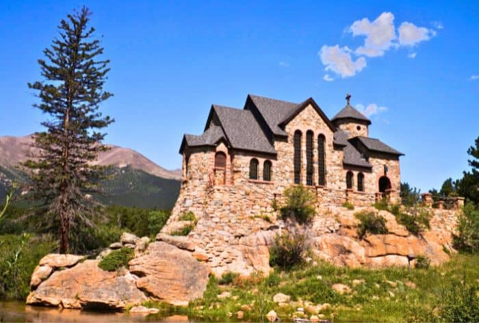
Chapel on the Rock / Best Scenic Drives in Colorado
- Continuing on is Nederland. It is a historic mountain town, set beside Barker Meadow Reservoir. It was originally a trading post for miners in the late 1800s and grew during Colorado’s silver and tungsten booms.
PRO TIP: Nederland is a perfect stop to relax and refuel. There are lots of unique shops and cafes.
- Just south of Nederland, you will find Rollinsville. This place is rich in Colorado railroad history!
GOOD TO KNOW: Rollinsville was established by John Rollins, who built a wagon road over the Continental Divide in 1873, it later became a part of John Moffat’s ambitious railroad project, completed in 1903 with 33 tunnels.
PRO TIP: Follow Rollins Pass Road, a rugged trail along the old railway route that offers stunning Continental Divide views and remnants of the historic railroad, including bridges and tunnels.
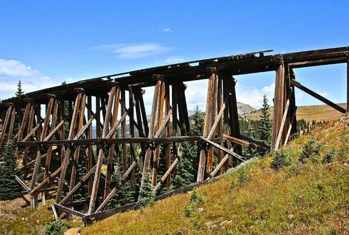
Rollinsville / Best Scenic Drives in Colorado
Trail Ridge Road
Known as the “Highway to the Sky,” Trail Ridge Road reaches heights of 12,183 feet as it crosses Rocky Mountain National Park from Estes Park to Grand Lake.
This high-altitude road is the highest continuous paved road in North America, delivering sweeping views of alpine tundra and the Rockies.
Wildlife like elk, bighorn sheep, and marmots are frequently seen along the way, and there are numerous pull-offs to take in the sights.
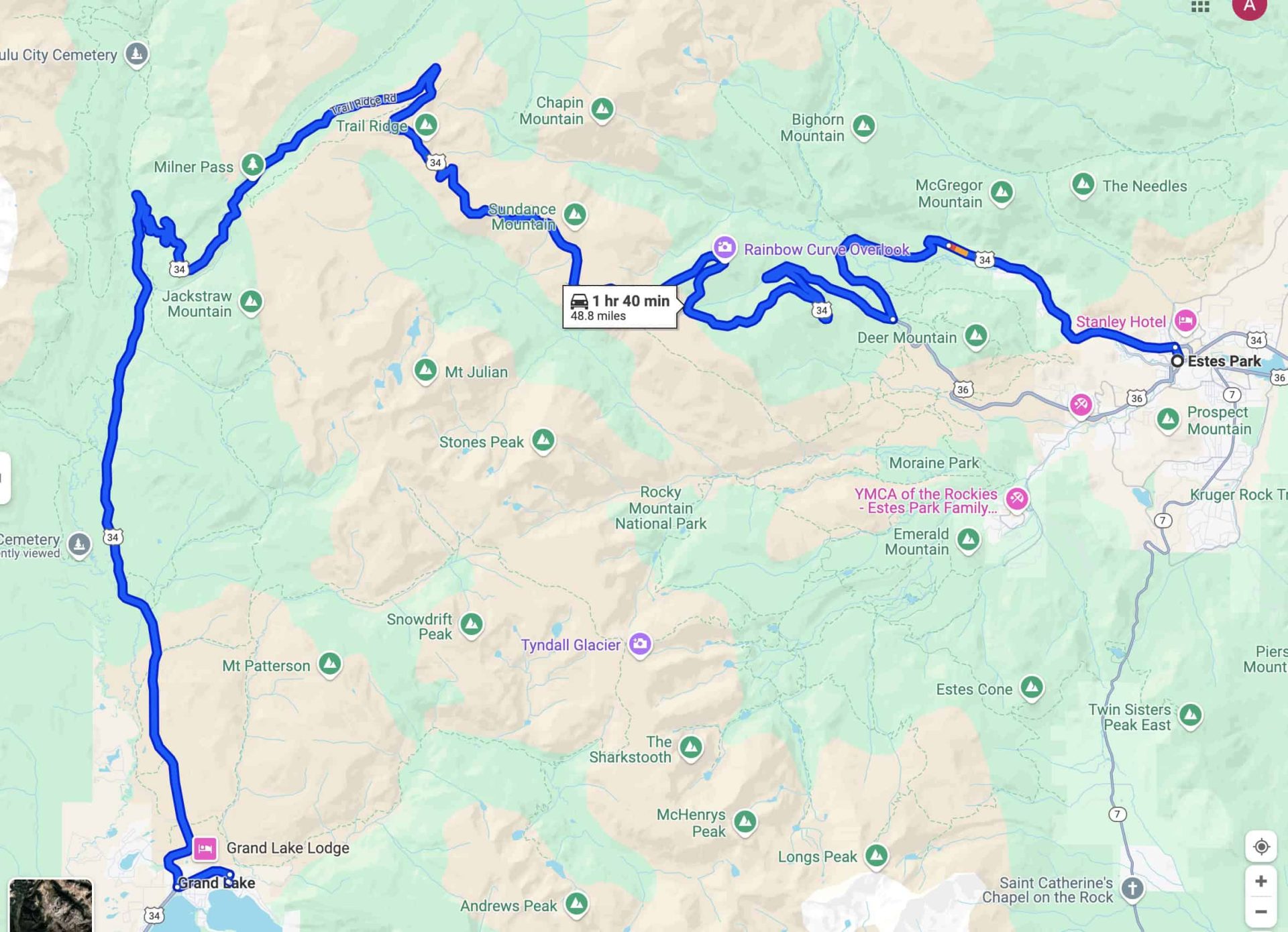
Trail Ridge Road Map / Best Scenic Drives in Colorado
- Location: Rocky Mountain National Park
- Start/End Points: Estes Park to Grand Lake
- Seasonal Accessibility: Open late May to mid-October (weather permitting)
- Distance: 48 miles
- Estimated Drive Time: 2 hours (allow extra time for stops)
GOOD TO KNOW: Trail Ridge Road requires an entrance fee to Rocky Mountain National Park and a timed entry reservation during peak season.
Must-See Stops Along Trail Ridge Road:
- The first stop that is absolutely breathtaking is Horseshoe Park Overlook!
Carved by glaciers about 15,000 years ago, this overlook provides stunning views of the U-shaped Horseshoe Park, with towering peaks like Mount Chapin (12,454 feet), Mount Chiquita (13,069 feet), and Ypsilon Mountain (13,514 feet) framing the scene.
GOOD TO KNOW: Sheep Lakes, nestled in the valley, are also visible and often host grazing elk.
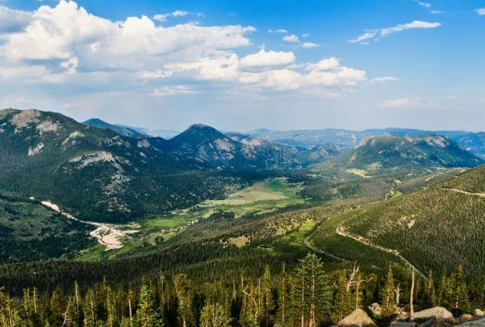
Horseshoe Park Overlook / Best Scenic Drives in Colorado
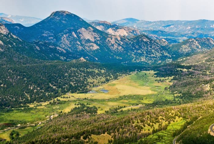
Horseshoe Park Overlook / Best Scenic Drives in Colorado
- The next stop you can’t miss is Forest Canyon Overlook. This pull-off offers sweeping views into Forest Canyon and across to the Never Summer Mountains. It’s a great spot for photos and a good chance to spot wildlife in the canyon below.
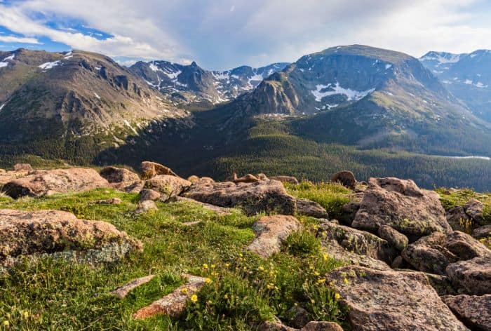
Forest Canyon Overlook / Best Scenic Drives in Colorado
- Next up is Tundra Communities Trail. This 0.5-mile round-trip trail starts at Rock Cut and provides an introduction to the unique, delicate tundra ecosystem.
There are Interpretive signs along the way that explain the hardy plants and animals that thrive at this extreme altitude.
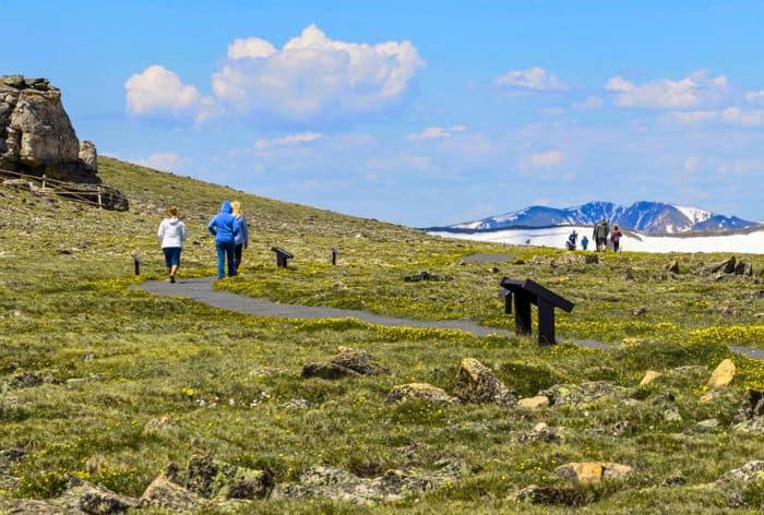
Tundra Communities Trail / Best Scenic Drives in Colorado
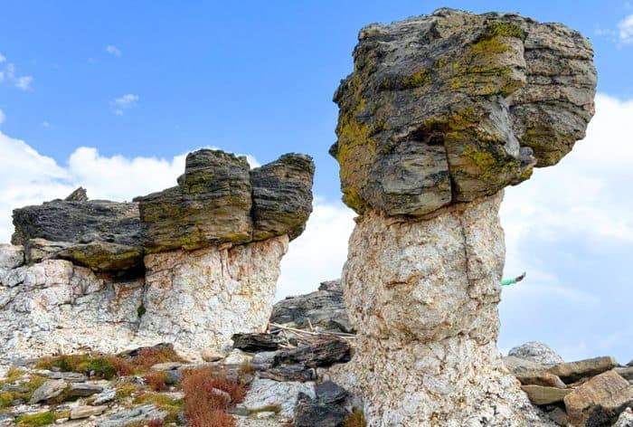
Tundra Communities Trail / Best Scenic Drives in Colorado
Mount Blue Sky Scenic Byway (Mount Evans Scenic Byway)
The Mount Evans Scenic Byway, now renamed Mount Blue Sky, is one of Colorado’s most thrilling drives, climbing to a dizzying 14,265 feet at the summit of Mount Blue Sky.
It’s the highest paved road in North America, with switchbacks that offer views of the Continental Divide, alpine lakes, and forests of ancient bristlecone pine trees. Reaching the summit feels like being on top of the world, with 360-degree views of surrounding peaks and valleys.
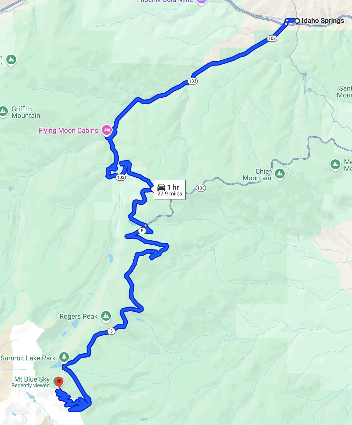
Mount Blue Sky Scenic Byway Map / Best Scenic Drives in Colorado
- Location: Near Denver
- Start/End Points: Idaho Springs to Mount Blue Sky summit
- Seasonal Accessibility: Late May to early October, weather permitting
- Distance: 28 miles
- Estimated Drive Time: 1.5 hours (without stops)
GOOD TO KNOW: When planning a visit to the Mount Blue Sky Scenic Byway, it’s essential to secure a timed-entry reservation in advance. Reservations need to be made online through Recreation.gov
Must-See Stops on Mount Blue Sky Scenic Byway:
- Mount Goliath Natural Area should be your stop. This unique area is home to ancient bristlecone pines, some of the oldest trees in North America.
There is a short interpretive trail that offers insight into the resilience and beauty of these twisted, weathered trees, along with stunning views of the surrounding mountains.
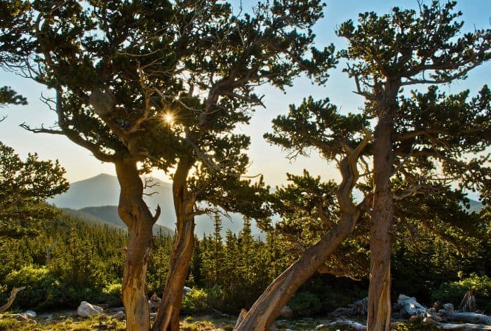
Bristlecone Pines in Mount Goliath Area / Best Scenic Drives in Colorado
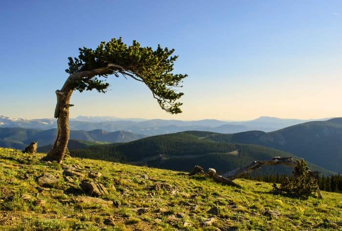
Bristlecone Pines in Mount Goliath Area / Best Scenic Drives in Colorado
- Next up is Summit Lake Park. The star here is obviously Summit Lake, situated at 12,840 feet, this glacial lake is surrounded by rugged cliffs and alpine tundra dotted with wildflowers.
There is a short trail that let you explore the area, and it’s an excellent spot for spotting mountain goats and enjoying breathtaking high-altitude scenery.
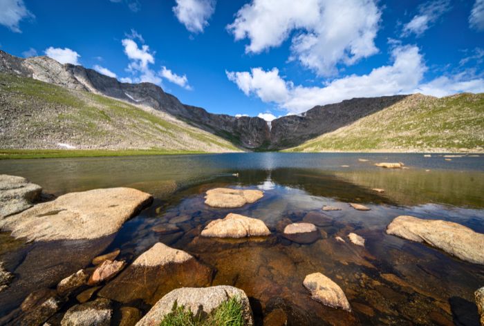
Summit Lake Park / Best Scenic Drives in Colorado
- The final stop is Mount Blue Sky Summit. There is a short, rocky trail (0.15 miles) that leads to incredible panoramic views of Colorado’s Front Range.
On clear days, you’ll feel on top of the world as you take in the sweeping landscapes that stretch across the state.
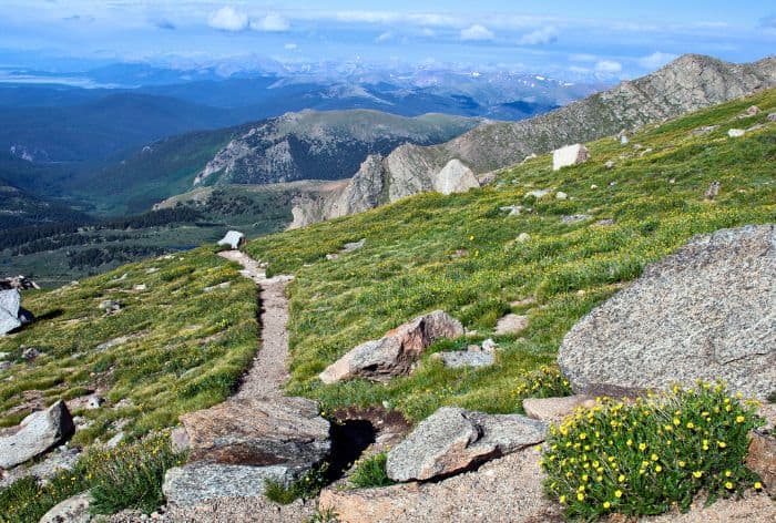
Mount Blue Sky Summit / Best Scenic Drives in Colorado
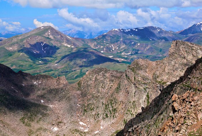
Mount Blue Sky Summitt / Best Scenic Drives in Colorado
Top of the Rockies Scenic Byway
The Top of the Rockies Scenic Byway runs through central Colorado, connecting Aspen, Leadville, and Minturn while passing some of Colorado’s tallest peaks, including Mount Elbert and Mount Massive.
This route is steeped in mining history, with remnants from the state’s silver boom and historic towns tucked into the landscape. Its high-altitude passes offer breathtaking views of the Rockies.
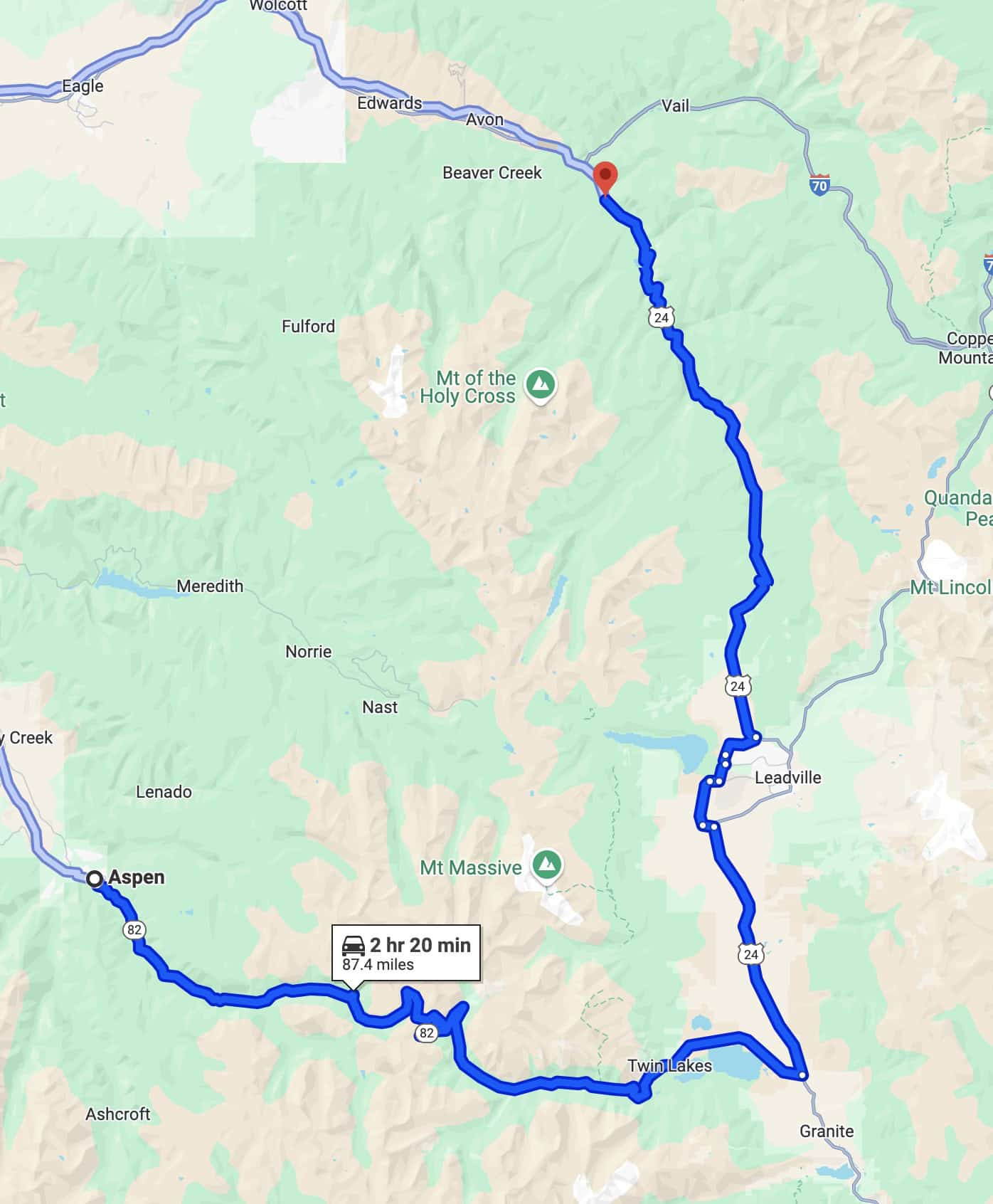
Top of the Rockies Scenic Byway Map
- Location: Central Colorado
- Start/End Points: Aspen to Minturn
- Seasonal Accessibility: Open year-round, but winter driving can be challenging
- Distance: 88 miles
- Estimated Drive Time: around 2 hours
Must-See Stops Along Top of the Rockies Scenic Byway:
- Just outside Aspen, you will find Independence Ghost Town. This historic mining town offers a fascinating glimpse into Colorado’s 1880s silver boom.
This is a perfect spot to wander through preserved cabins and structures and learn about the lives of miners who once sought fortune here.
- Next at 12,095 feet, will be Independence Pass Summit. This high-altitude overlook offers panoramic views of the Continental Divide.
There are short trails around the summit that allow for even better vantage points and great photo opportunities of the expansive alpine landscape.
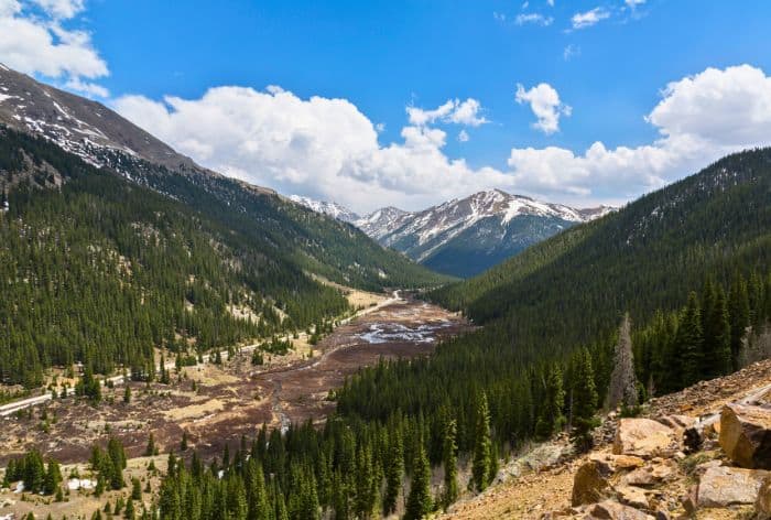
Independence Pass on Top of the Rockies Scenic Byway / Best Scenic Drives in Colorado
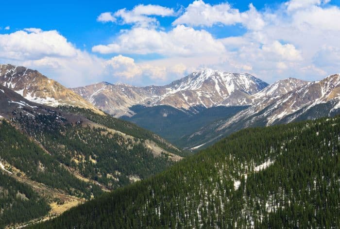
Independence Pass on Top of the Rockies Scenic Byway / Best Scenic Drives in Colorado
- Located just beyond Independence Pass, you will find Twin Lakes. This area is stunning with lake views framed by mountain peaks.
Stop at the Twin Lakes village for a snack or paddle on the lake, or hike the Interlaken Trail to see historic resort ruins along the water’s edge.
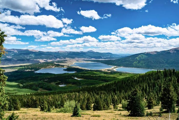
Twin Lakes / Best Scenic Drives in Colorado
- Next, you will get to Leadville. It is known as Colorado’s highest incorporated city.
Leadville is rich in history, Victorian architecture, and unique sites. Highlights include the Tabor Opera House, Leadville Mining Museum, and a variety of local shops and cafes to explore.
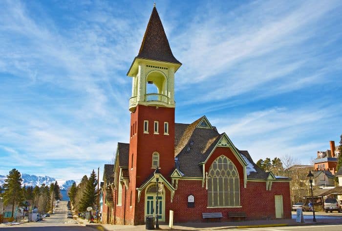
Leadville / Best Scenic Drives in Colorado
- Finally, you will reach Tennessee Pass. This scenic pass offers beautiful mountain views and access to Camp Hale, a historic WWII training site for the 10th Mountain Division.
Pikes Peak Highway
Winding 19 miles up to the summit of Pikes Peak, Pikes Peak Highway is one of the most famous drives in Colorado.
The drive offers dramatic mountain views, and at 14,115 feet, the summit offers a panoramic view that inspired the song “America the Beautiful.”
The route is known for its hairpin turns and serves as the site of the Pikes Peak International Hill Climb, one of the world’s oldest car races.
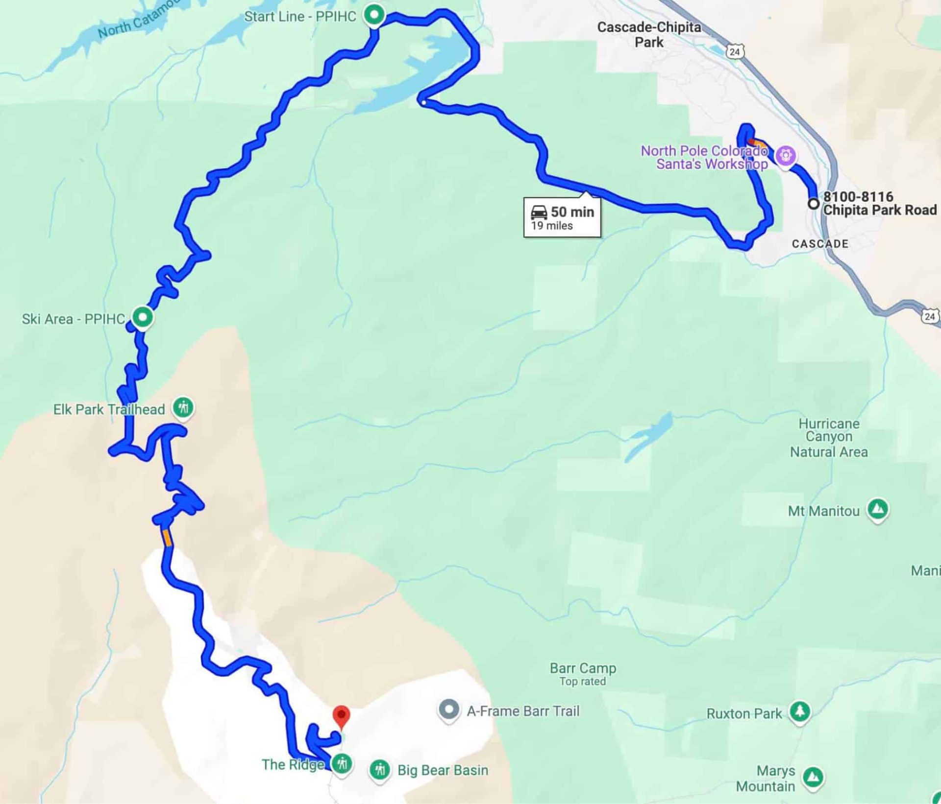
Pikes Peak Highway / Best Scenic Drives in Colorado
- Location: Near Colorado Springs
- Start/End Points: Cascade to Pikes Peak Summit
- Seasonal Accessibility: Open year-round, weather permitting
- Distance: 19 miles
- Estimated Drive Time: 1-2 hours
GOOD TO KNOW: For peak season visits to Pikes Peak Highway, from late May through September, a timed-entry reservation is required to manage traffic and enhance the visitor experience. Reservations can be made online through the official City of Colorado Springs Pikes Peak website.
Must-See Stops Along Pikes Peak Highway:
- Located at mile seven, Crystal Reservoir is a scenic lake perfect for photos, picnics, and fishing.
GOOD TO KNOW: There is the Crystal Reservoir Visitor Center that provides information about the area, along with restrooms and a gift shop.
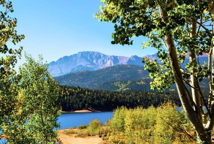
Crystal Reservoir / Best Scenic Drives in Colorado
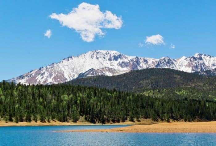
Crystal Reservoir / Best Scenic Drives in Colorado
- Around halfway up, you will find Glen Cove Inn. It is a cozy stop with restrooms, snacks, and an observation deck.
- Next up is Devil’s Playground. It is named for its frequent lightning strikes.
Devil’s Playground offers sweeping views of the valley below and unique rock formations created by powerful winds.
There are hiking paths for short walks and a chance to see wildlife like mountain goats or marmots in the open terrain.
- The grand finale is the top of Pikes Peak. There is the newly constructed Summit Visitor Center. It provides a cozy place to warm up!
PRO TIP: Make sure to try the famous high-altitude donuts.
The panoramic views from the summit, especially on clear days, allow you to see up to five states and give an unmatched perspective over the Rocky Mountains.
San Juan Skyway / Million Dollar Highway
Running through the heart of the San Juan Mountains, the San Juan Skyway includes the famous Million Dollar Highway stretch between Silverton and Ouray, known for its narrow lanes, steep cliffs, and jaw-dropping views.
The entire 233-mile loop winds through historic mining towns, alpine valleys, and stunning peaks, making it a favorite drive in Colorado, especially for fall foliage.
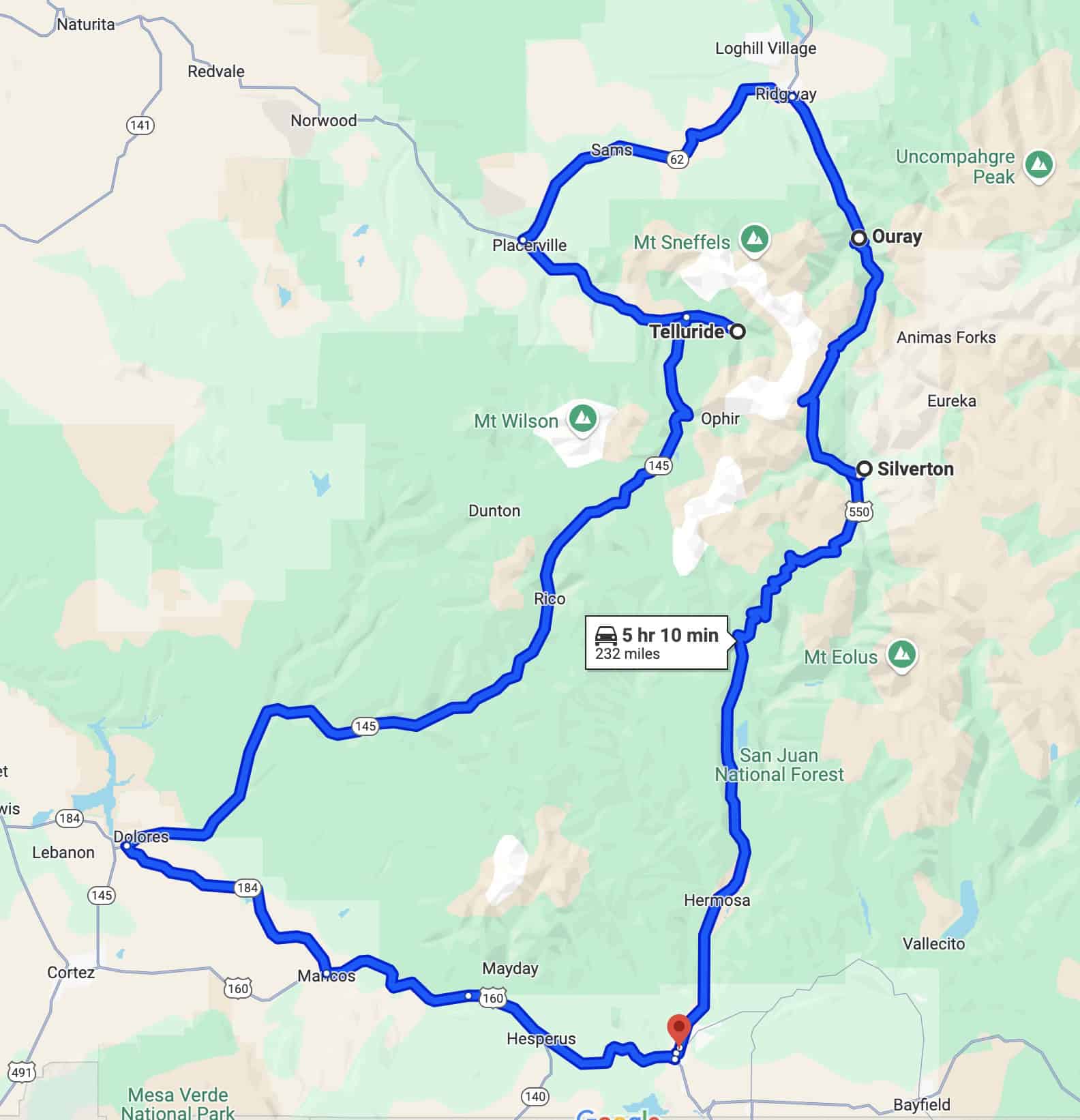
San Juan Scenic Skyway / Million Dollar Highway Map
- Location: Southwestern Colorado
- Start/End Points: Durango loop through Silverton, Ouray, Telluride
- Seasonal Accessibility: Open year-round, though winter conditions can be severe
- Distance: 233 miles
- Estimated Drive Time: 7-8 hours
Must-See Stops on San Juan Skyway / Million Dollar Highway:
- The first stop you absolutely can’t miss is Ouray. It is known as the “Switzerland of America.” Ouray is surrounded by rugged peaks and features natural hot springs.
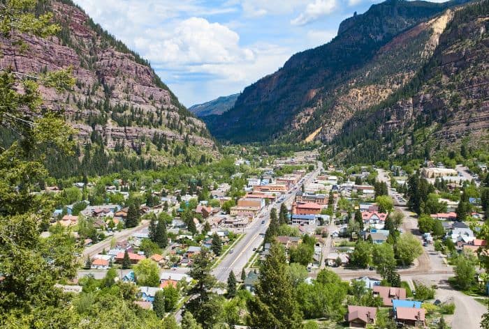
Ouray / Best Scenic Drives in Colorado
Ouray Hot Springs Pool offers mineral pools with mountain views, and the Perimeter Trail is a 6-mile loop with waterfalls and scenic valley vistas.
Don’t miss Cascade Falls located above the town of Ouray which can be accessed via a short hike from the Cascade Falls Trail.
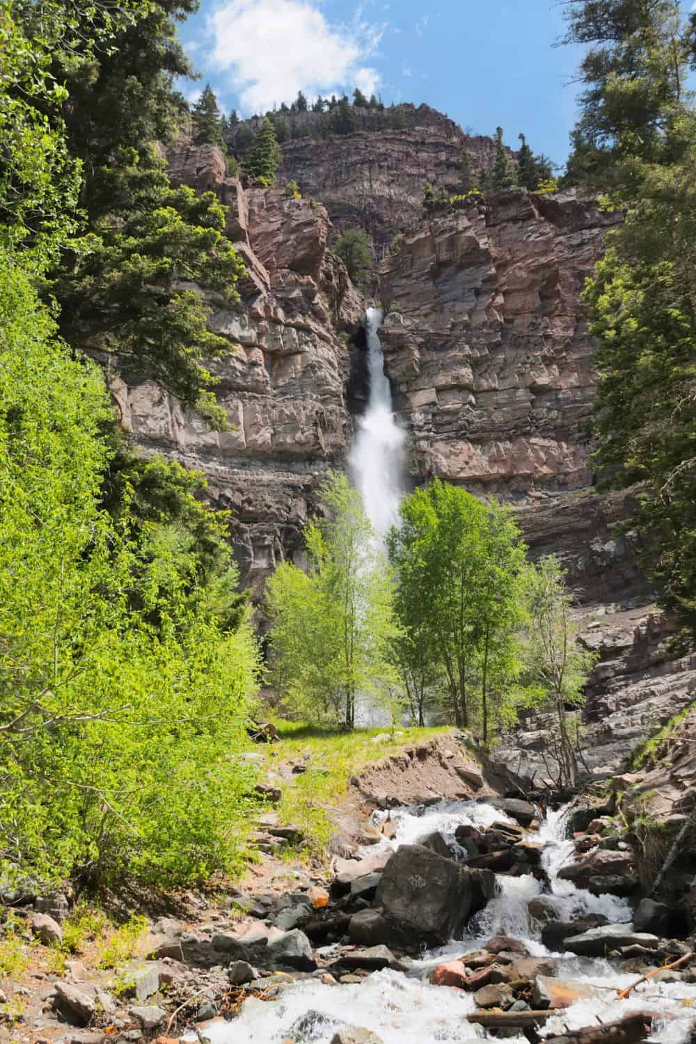
Cascade Falls / Best Scenic Drives in Colorado
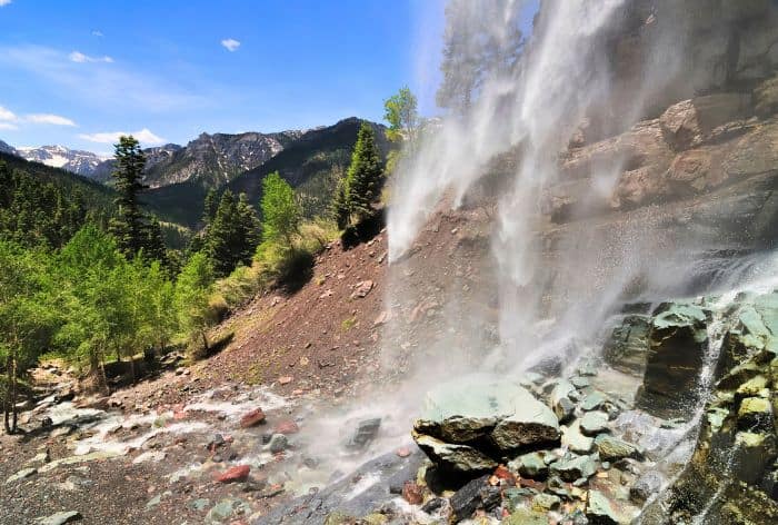
Cascade Falls / Best Scenic Drives in Colorado
- South of Ouray, you will find Red Mountian Pass. This thrilling road features tight curves and sweeping views of iron-rich, red-hued mountains.
Stop at Red Mountain Overlook for panoramic views, and see remnants of mining history at Yankee Girl Mine.
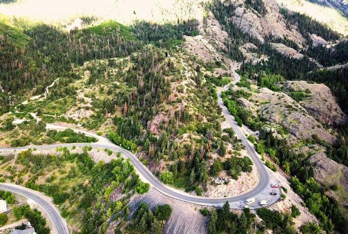
Red Mountain Pass / Best Scenic Drives in Colorado
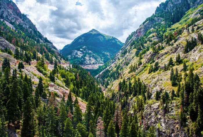
Red Mountain Pass / Best Scenic Drives in Colorado
- Next up is Silverton, a well-preserved 19th-century mining town with Victorian architecture and an Old West feel.
PRO TIP: Catch the Durango & Silverton Narrow Gauge Railroad for a scenic train ride, and explore Silverton Museum or Blair Street, a historic red-light district.
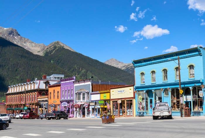
Silvertone / Best Scenic Drives in Colorado
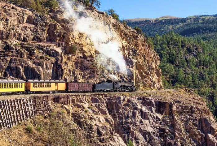
Durango & Silverton Narrow Gauge Railroad / Best Scenic Drives in Colorado
- Next is Telluride, a lively mountain town famous for festivals, skiing, and stunning views.
Take the free Telluride-Mountain Village Gondola, hike the family-friendly Bear Creek Trail to waterfalls, or tackle the Bridal Veil Falls Trail for views of Colorado’s tallest free-falling waterfall.
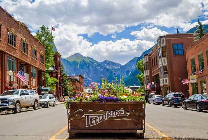
Telluride / Best Scenic Drives in Colorado
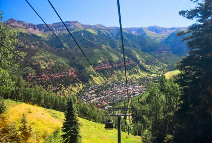
Telluride-Mountain Village Gondola / Best scenic Drives in Colorado
- South of Telluride is Lizard Head Pass. This pass offers panoramic views of Lizard Head Peak and nearby wildflower-filled trails like Lizard Head Trail.
- Finally, nestled by the Dolores River, you will find Dolores, a small town that provides access to McPhee Reservoir for fishing and boating.
PRO TIP: Make sure to visit the Anasazi Heritage Center to explore the artifacts and history of the ancient Puebloan people.
Rim Rock Drive
Rim Rock Drive winds through the heart of Colorado National Monument, offering stunning red rock canyon views and unique rock formations.
The 23-mile drive is known for dramatic cliff edges and winding turns that showcase the Monument’s towering spires and mesas.
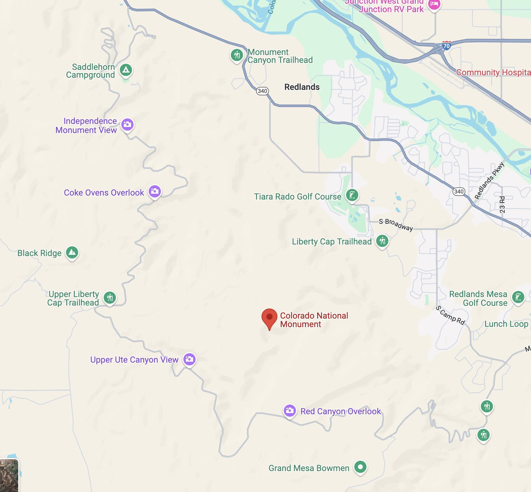
Rim Rock Drive in Colorado National Monument Map
- Location: Western Colorado, Colorado National Monument
- Start/End Points: Grand Junction loop within Colorado National Monument
- Seasonal Accessibility: Open year-round
- Distance: 23 miles
- Estimated Drive Time: 1-2 hours
GOOD TO KNOW: The entrance fee for the Colorado National Monument is $25 per vehicle, valid for seven consecutive days. If you have the America the Beautiful Pass, this fee is covered.
Not-to-Miss Stops on Rim Rock Drive in Colorado National Monument:
- You can’t miss Balanced Rock. This impressive rock formation appears to defy gravity as it sits atop a narrow pedestal, making it an ideal spot for photography and a short hike.
- Next, the Independence Monument. This iconic rock formation stands at 450 feet and it is the park’s centerpiece.
GOOD TO KNOW: You can enjoy breathtaking views from the Rim Rock Overlook or opt for a hike on the Monument Canyon Trail, which is a 5.5-mile round trip that provides a closer look at the monument and the surrounding landscape.
- Finally, Cold Shivers Point delivers some of the most dramatic vistas in the park, overlooking a steep canyon and towering red cliffs.
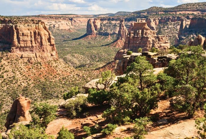
Rim Rock Drive in Colorado National Monument
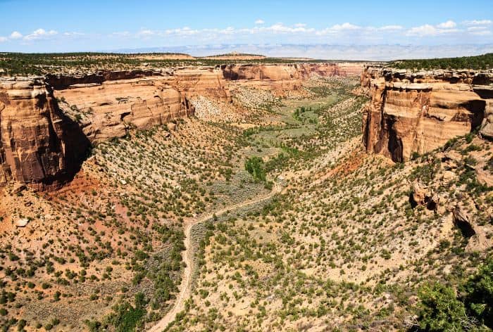
Rim Rock Drive in Colorado National Monument
Collegiate Peaks Scenic Byway
The Collegiate Peaks Scenic Byway winds through the Arkansas River Valley, surrounded by some of Colorado’s tallest mountains, named after Ivy League universities.
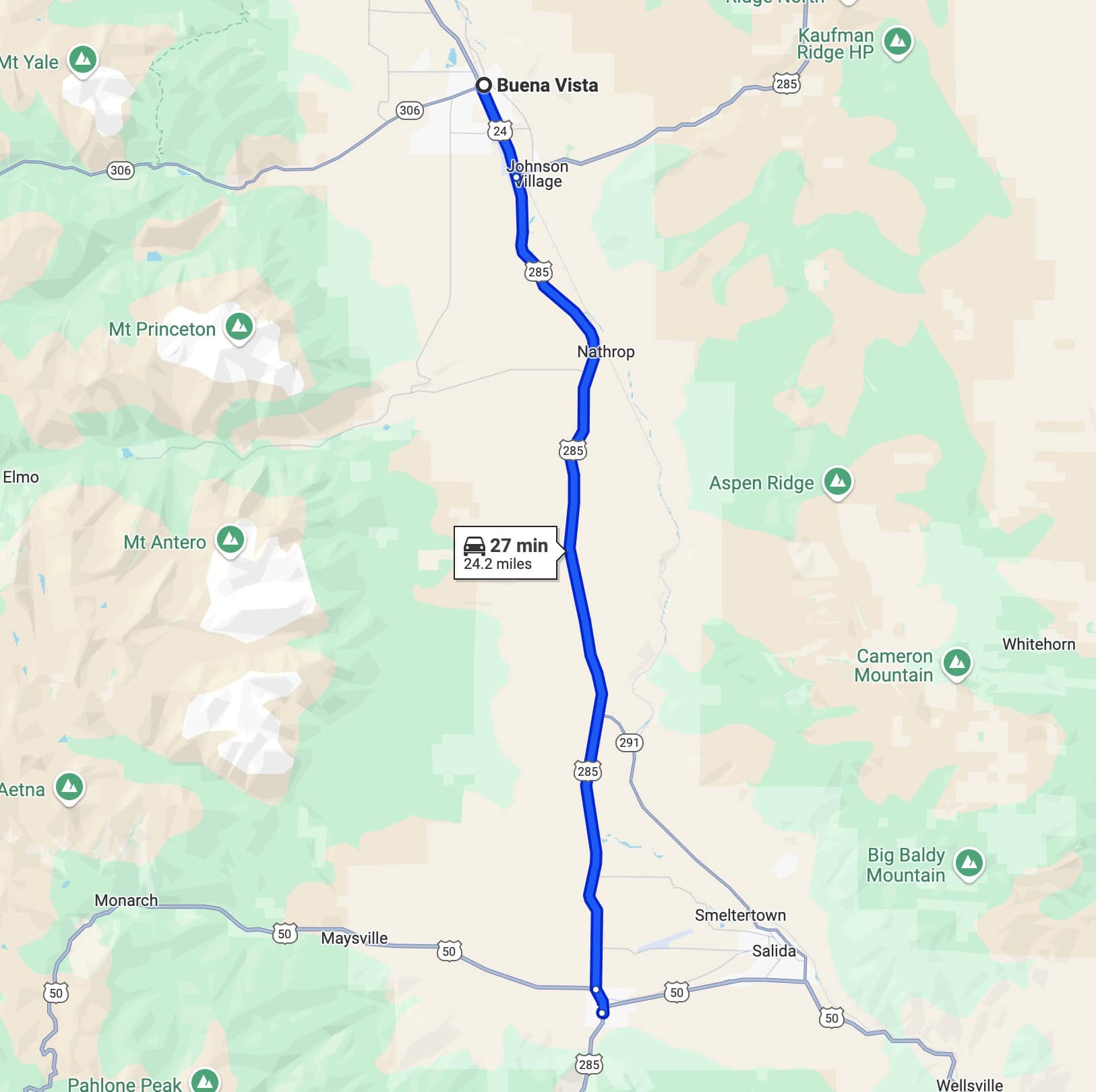
Collegiate Peaks Scenic Byway Map
- Location: Central Colorado, through the Arkansas River Valley
- Start/End Points: Buena Vista to Poncha Springs
- Seasonal Accessibility: Open year-round, though snow may affect road conditions in winter
- Distance: 57 miles
- Estimated Drive Time: 1.5 hours
Must-see Stops on Collegiate Peaks Scenic Byway:
- One of the best stops on the Collegiate Peaks Scenic Byway is Cottonwood Pass. This stunning high-mountain pass offers breathtaking views of the Collegiate Peaks and access to numerous hiking trails.
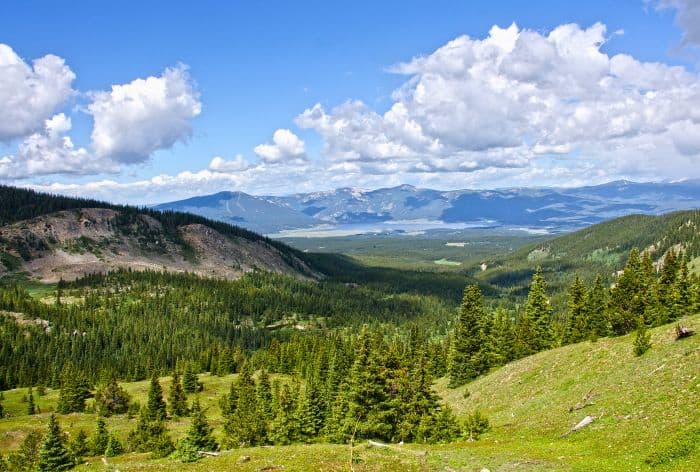
Cottonwood Pass / Best Scenic Drives in Colorado
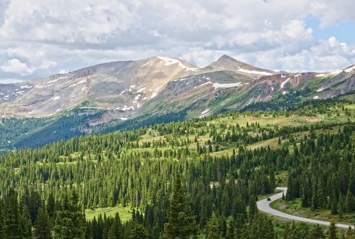
Cottonwood Pass / Best Scenic Drives in Colorado
- Next up is Mount Princeton Hot Springs Resort. It is located near the base of Mount Princeton and offers natural hot springs, spa services, and beautiful mountain views. It’s an ideal stop to unwind and enjoy the soothing waters after a day of exploring.
- Further up you will find Twin Lakes, a picturesque area featuring two stunning lakes surrounded by towering peaks.
The views of Mount Elbert, Colorado’s highest peak, are particularly impressive from here!
- Next, you will reach the historic mining town of Leadville with well-preserved 19th-century architecture and several museums. Explore the local shops, grab a bite to eat, and learn about Leadville’s fascinating past, including its role in the mining boom.
- Just outside Leadville, you will find Turquoise Lake. This beautiful glacial lake is surrounded by hiking trails and picnic areas. It’s a perfect spot for fishing, boating, or simply enjoying the stunning mountain scenery.
The lake gets its name from its vibrant turquoise color, which is particularly striking on sunny days.
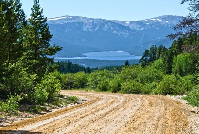
Turquoise Lake / Best Scenic Drives in Colorado
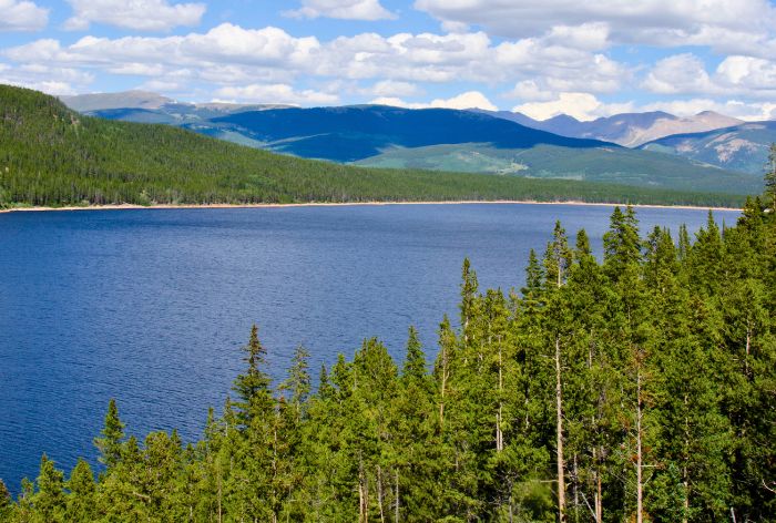
Turquoise Lake / Best Scenic Drives in Colorado
Here Are Some More Ideas of Places to Visit in Colorado:
How to Visit the Maroon Bells near Aspen, Colorado (+Hike to Crater Lake)
Perfect 5 Days in Rocky Mountain National Park (Hikes, Scenic Drives, Hidden Gems)
13 Tips for First-Time Visit to Rocky Mountain National Park
12 Short and Easy Hikes in Rocky Mountain National Park (Perfect for Beginners)
9 Best Hikes in the Bear Lake Corridor, Rocky Mountain National Park (Maps and Tips)
18 Best Stops on Trail Ridge Road in Rocky Mountain National Park
12 Best Stops and Hikes on Peak to Peak Scenic Byway in Colorado (Maps+Useful Tips)
14 Things You Can’t Miss on First Visit to Glenwood Springs, Colorado
2 DAYS in MESA VERDE National Park (Perfect Itinerary for First Visit)
23 Practical Tips for FIRST VISIT to MESA VERDE National Park
Did You Find Best Scenic Drives in Colorado Useful?
Why Not Save It to Your Pinterest Board!


Now, It Is Your Turn, I Would Like to Hear Back from You!
Are you planning your trip to Colorado?
Please let me know!
Drop me a quick comment right below!
Click on any of the images below to get inspired!
